The Haute route {part two} - my Ten Days from Chamonix to Zermatt
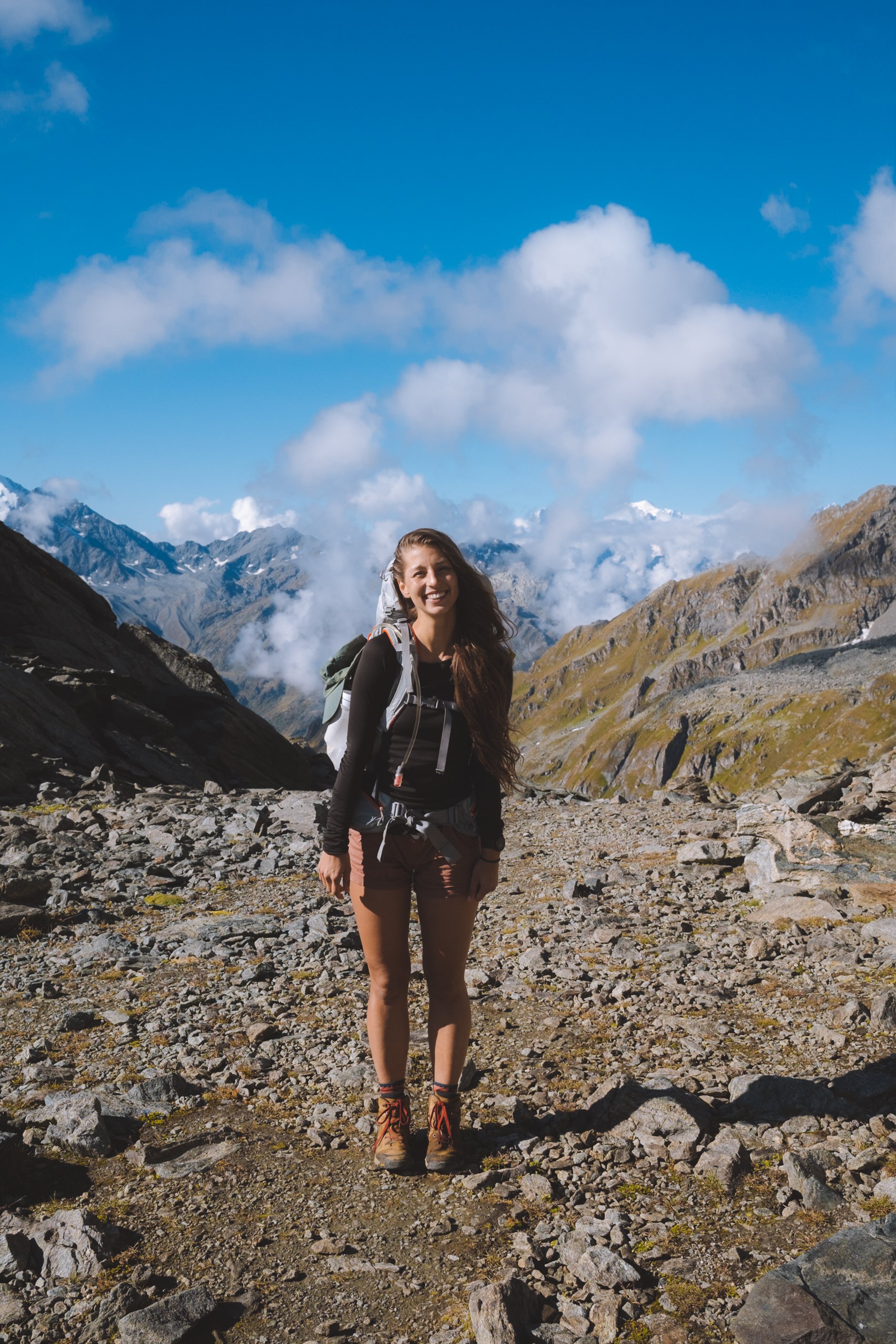
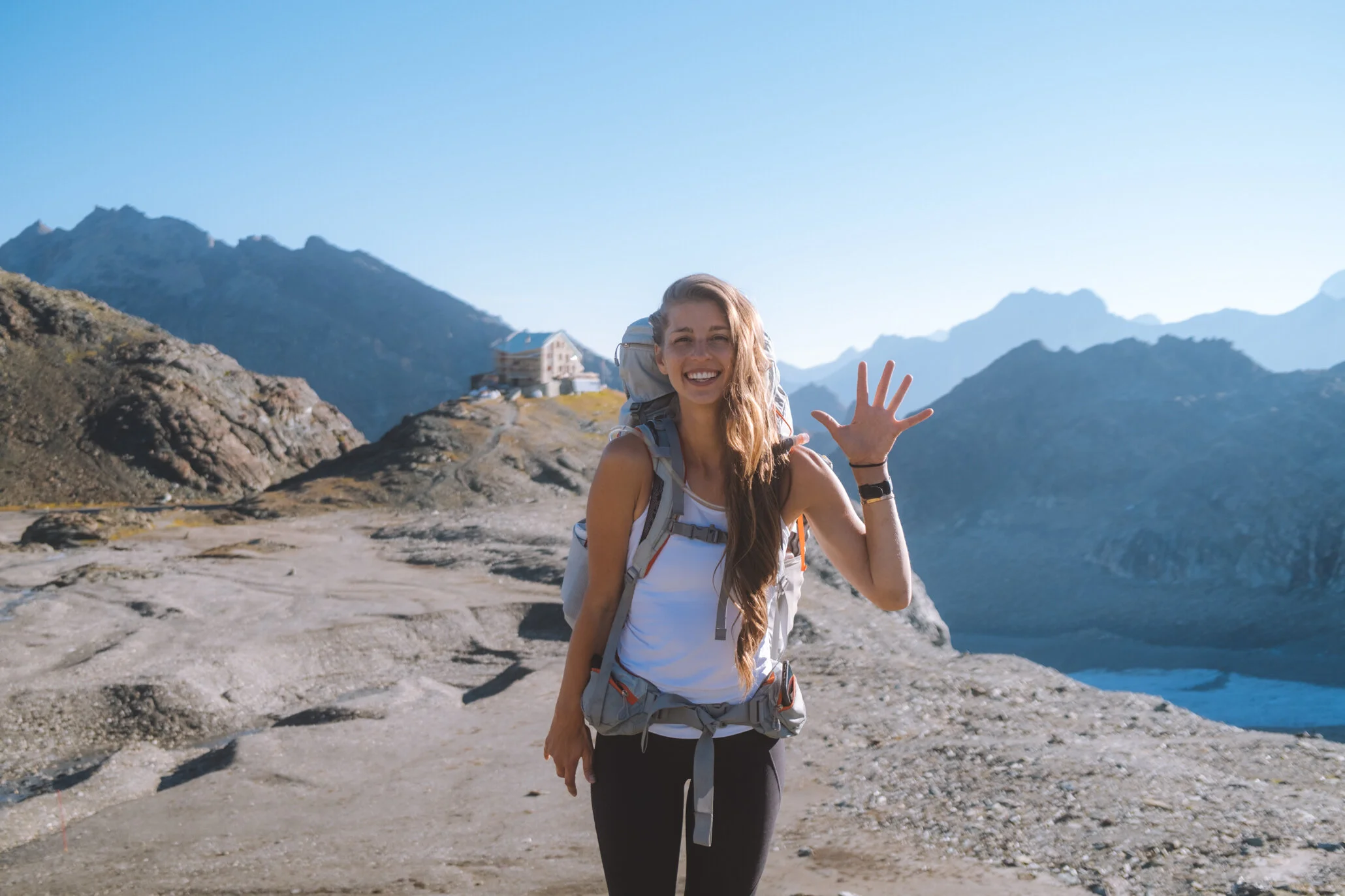
We (my friend Mike and I) set out on the Walker’s Haute Route on somewhat of a whim. We had not trained, prepared for or researched the trail enough to truly understand what an undertaking this classic hike is. We enlisted the help of The Hiking Club both in terms of helping us plan a hike that hit our timeline, objectives and budget as well as helping with the actual booking of some of harder to book huts. Below is the overview of the hike that we built together - as you will see as you read this blog, we did veer from the plan a few times and put our egos aside and hopped on an extra bus (four or five), took a rest day and skipped one of the hotels altogether. But ten days after we left Chamonix we arrived in Zermatt, as planned, and walked off the trial a few lbs lighter with some new bumps and bruises and many stories to tell.
For everything you should know before hiking the Walker’s Haute Route check out my intro to the Haute Route guide below.
And for my full overview of what to pack (and also what not to pack) when setting out on the Walker’s Haute Route check out my packing guide.

Overview:
Difficulty: Quite Difficult
Distance: 215.7km / 134 mi
Duration: 10 days
Highest point: 2,964 meters – 9,724 feet
Total elevation gain: 14,315 meters – 46,965 feet
Average day: 21.6 km / 13.4mi with an elevation gain of 1,432 meters / 4,697 feet

it all began in Chamonix…
We took the train(s) from Zurich to Chamonix and spent two nights in the town. I could spend a year here and it would not be enough. We rented a small airbnb and used our time to prepare, acclimate and do our best to beat jet lag.
Some highlights of Chamonix:
Best coffee : Moody Coffee Roasters
Great outdoor lunch : La Fabrica
Best burgers : Poco Loco (you have to, its amazing)
Best pizza : JOIA by Pizzeria Des Moulins (be prepared to wait)
Where to get trail supplies : Snell Sports - this is where we found fuel for the JetBoil. There are many sports stores in Chamonix and all major outdoor brands have stand alone stores. if you forgot anything you will be covered.
Where to get groceries : We liked “Le Petit Casino” but Spar has a much larger selection.


Day one
starting point : Chamonix (French)
distance : 21 km/ mi
elevation gain : 1,764m/5,787ft
elevation loss : 94m/308ft
transport : n/a
daily trail time : 5h 26
ending point : Albert Premier Hut (French)
thoughts
This was the hardest day for me. We opt’ed out of taking the train from Chamonix to Argentière or Montroc le Planet, nor did we take the ski lift up. Any of these would have helped tremendously. Being so late season the Refuge du Col de Balme was closed for the year so we stayed in Refuge Albert 1er. It was one of my favourite huts of the tour. However, it was the only hut that did not offer bedding (Col de Balme would have) - and we made the executive decision to suffer without it using down jackets instead. We were fine and would have likely been given blankets had we asked - we also could have purchased inexpensive sleeping bags in Chamonix but the extra cost and weight for one night didn’t make sense… or for as great of a story. The food was great and location could not be beat. It was a bit of added distance on days 1 and 2 and the lack of bedding may be deterrent to most.
Refuge Albert 1er is cash only.

Day two
starting point : Albert Premier Hut (French)
distance : 23.2km / 14.4mi
elevation gain : 1,280 / 4,199
elevation loss : 2,521 / 8,271
transport : n/a
total hiking time : 7h 50
ending point : Champex Lac (French)
thoughts
This was Mike’s hardest day. It was a lot of elevation gain and loss and the first true day on the hike. In retrospect we would have packed food for lunch - we stopped at Buvette du Glacier du Trient for lunch and purchased very small and expensive sandwiches and instant coffee (I also had soup). The hike to Fenêtre d'Arpette was an unrelenting incline and the descent on the other side was hardly any quicker. With the shorter days this was hard to complete between breakfast and dinner at the Refuges (set times). In Champex Lac we booked a private room in the Pension en Plein Air online - do this, the dorm style rooms are very open and exposed with very little cost difference. It was more of a mix between a hostel and a B&B.

Day three
starting point : Champex Lac (French)
distance : 25.8 km/ 16mi
elevation gain : 739m / 2,425ft
elevation loss : 1,349m / 4,426ft
transport : gondola x 2
daily trail time : 5h 52
ending point : Cabane de Louvie (French)
thoughts
Day three we used our first transportation. There are (I would say mandatory) Gondolas from Le Châble into the alpine. If you could provide proof of accommodations booked in Bagnes Valley: Le Chable, Verbier, Cabane du Mont Fort, Cabane de Louvie these were free of cost - I am unsure if this was a 2021 promotion or a normal thing. But we ran into hikers that did not know about this and paid nearly 100CHF for these without need - just check at the small information booth at the base of the gondola in Le Châble. This day was hard and we were in clouds with intermittent rain all day - not the most enjoyable day on the trail but with a few good podcasts to listen to and great rain layers we made it to the Cabane de Louvie.
Cabane de Louvie has zero cell phone reception/wifi. Also, they have the best coffee on the trail - a Nespresso pod machine that was 5 CHF per cup and was so worth it.

Day four
starting point : Cabane de Louvie (French)
distance : 24.6km / 15.3mi
elevation gain : 1,779m / 5,837ft
elevation loss : 1,076m / 3,530ft
transport : n/a
total hiking time : 8h 14
ending point : Cabane Des Dix (French)
thoughts
The host at Cabane de Louvie told us that there was a 0% chance we would make our objective this day - she even offered to book us into a mid point stop and proposed an alternative route. This simply fuelled my fire to do the d*mn thing. We woke up early and ate breakfast early (a rare accommodation made) and headed out before sunrise. An almost immediate climb gave us our last views of Mont Blanc from our first of three passes for the day. With little time to spare this was one of the days we were thankful to have brought dehydrated meals and my JetBoil. Some Backpackers Pantry Pad Thai at the high point of our second pass and half way point was our only true break. We made it to Lac des Dix and the hut keeper at Cabane de la Barmaz offered us a beer along the way (I asked for a ride to the end of the lake in his truck - which was a no go), we politely declined the beer and carried on our way. This was a long and challenging day but Cabane Des Dix did not disappoint. We met some amazing Swiss climbers who shared their wine and welcomed us warmly. This was also the only hut that offered an apéritif with dinner and had an espresso machine… and a puppy.
Cabane Des Dix has no cell phone service and no running/potable water. You can purchase bottled water (5-7CHF per large bottle). But it was by far the most fun.
Day five
starting point : Cabane Des Dix (French)
distance : 12.7km / 7.9mi
elevation gain : 317 m/ 1,040ft
elevation loss : 1,401m / 4,596ft
transport : n/a
daily trail time : 3h 59
ending point : La Gouille (French)
thoughts
Our shortest hiking day. We checked with the hut keeper at Cabane Des Dix regarding the glacial route and he told us that it was fine - so we took the short cut across the glacier (apparently this changes often but they can give you updates at the hut) the alternate isn’t a terrible detour around the toe of the glacier. And then up the Pas de Chèvres - a steep set of vertical ladders that made me very uncomfortable. The most direct route. From there it was a casual drop into the valley below. We made it to Arolla in time for lunch (wildly expensive) and as it was a holiday and a weekend we ended up not going to Lac Bleu (which looks incredible but there were three overflowing parking lots which was not what we were looking for). We booked into the Pension du Lac Bleu in La Gouille online and although it did not offer half board, we ate at their restaurant. It was amazing. They also had the best shower of the entire trip. This was the most comfortable/North American stop on our trip.

Day six
starting point : La Gouille (French)
distance : 18.1km / 11.2mi
elevation gain : 1,920m / 6,299ft
elevation loss : 939 m/ 3,081ft
transport : n/a
daily trail time : 5h 23
ending point : Cabane de Moiry (French)
thoughts
This was our earliest start of the trip as the Pension du Lac Bleu did not include breakfast and thus we were not waiting on that. You can purchase their breakfast, and I imagine it would be incredible, but in the sake of time we hiked out by headlamp fuelled by a cup of coffee generously set up for us by the owner of Pension du Lac Bleu (seriously, stop there, it’s amazing). We made it to Les Haudères and stopped in a bakery to get breakfast (we were very used to butter and bread for breakfast at this point). We cheated and took a 5 minute bus ride up to La Sage and began leg two of our hike - to the Cabane de Moiry. This was the most aesthetically pleasing of the huts along the trip and what Mike was most excited for.
There is extremely limited cell phone service and no potable water at Cabane de Moiry - I opted to fill up from glacial streams outside.

Day seven- rest day
Cabane de Moiry
thoughts
This was an unplanned rest day. But morale was low and this was the hut Mike was most excited to photograph, so we made our stop here. It was incredibly beautiful and the glacier is within a few minutes walk. We spent the day flipping through books and wandering around the hut. The staff at the Cabane de Moiry were the rudest on the entirety of the trail. They made it very clear that they had no interest in being there and would actively avoid questions and often lied about benign things, such as availability of the hut and answers to basic questions. I speak French so this was not a language/communication error. In all fairness we went late season in the middle of a pandemic and perhaps they were burnt out. But it was one of the most expensive huts and the staff were wildly unpleasant. Do not necessarily recommend.

Day eight
starting point : Cabane de Moiry (French)
distance : 26.6km/16.5mi
elevation gain : 1,920m/6,299ft
elevation loss : 1,597m/5,240ft
transport : two busses and one funiculaire
daily trail time : 8h 05
ending point : Turtmannhutte (German)
thoughts
In order to accommodate our rest day - this is two days jammed into one. And a long one at that. We left Cabane de Moiry after the first seating of breakfast and hiked to the end of the dam to catch a bus and then, after stopping at the grocery store in St Luc we hopped on a funicular. I thought this would feel like cheating but it was pouring rain and we just barely made it to the Turtmannhutte in time for dinner. This was the first hut that was in Swiss German - a sign that the end of the trip was approaching. The hut was older and therefore super interesting - the food was heavier, more German and breakfast finally included meat and cheese. We shared a room with a German climbing couple who spoke no English but I put my 10 phrases I learned for my great-nephews to good use. It was a fun time, but by and large the least amount of English.
Turtmannhutte has no running water no cell phone service and the wet gear room is located in the basement so our wet layers became cold wet layers over night. Not ideal but such a cool location.

Day nine
starting point : Turtmannhutte (German)
distance : 28.2km / 17.5mi
elevation gain : 1,893m / 6,211ft
elevation loss : 1,025m / 3,363ft
transport : gondola down to valley
daily trail time : 8h 26
ending point : Europahutte (German)
thoughts
Another big day. After breakfast we headed out. Unfortunately, due to weather and timing, we never truly got to enjoy the Turtmannhutte and surrounding glaciers. But this was the final stretch. We hiked along the valley edge listening to podcasts - up a pass and then down the other side (with help from a gondola down - apparently there is a trail but it is extremely steep and hard on knees). It was tempting - and there was a conversation about it - to simply take the train from St Niklaus to Zermatt and end the trip a day early. And this was actually what we had originally booked. but Brendan from The Hiking Club insisted on a night at the Europahutte and the views from Hohberge. So we began our final ascent of the trip. A painful climb to Europahutte. Unfortunately the weather did not quite cooperate. However, Europahutte is amazing in its self.

Day ten
starting point : Europahutte (German)
distance : 21km / 13mi
elevation gain : 853m / 2,799ft
elevation loss : 1,511m / 4,957ft
transport : n/a
daily trail time : 5h 05
ending point : Zermatt (German)
thoughts
We woke up in the clouds on our final morning and I won’t say that spirits were high. We were exhausted and ready to just be finished. Mildly regretting our decision to hike up to Europahutte (honestly) and took a slow morning, ate a big breakfast, packed up our bags one final time and made our way along the trail. The highlight of day ten (aside from finishing the trek) was the 494 m long suspension bridge just past the hut. We ended up hanging out here for a while and waiting for the clouds to roll in and out. It was worth the break and it’s actually a pretty cool suspension bridge. But then, our final push. Mostly loss in elevation which, knowing that, made the 853m of gain painful. We almost took a gondola down into Zermatt but decided to finish our trip strong. There were new covid measures in place when we arrived in Zermatt that unfortunately meant we were not able to eat in restaurants and opt’ed for a very generous McDonalds dinner to finish out our hike. It is funny in retrospect and honestly was funny in the moment - fitting of my friendship with Mike and this trip as a whole.

…and ended in zermatt
This was my second time visiting Zermatt, and in comparison to Chamonix, I find Zermatt to feel more akin to a tourist town. It is a world class ski town and home to one of the most famous mountains in the world - and the prices definitely are indicative of it. We were generously hosted by the Zermatt Tourism board and below outlines how we spent our four recovery days in Zermatt.
What to do in Zermatt:
Splurge on Fondue : Du Pont is the oldest fondue restaurant in Zermatt which was unfortunately closed while we were there so we opt’d to go to Whymper-Stube and as a cheese connesour, I would happily pay the $140CDN many times over for the experience Mike and I had there.
Get a good cup of coffee : Petit Royal was the best coffee we found since leaving Chamonix. And we looked hard. They also have a plethora of sweets and chocolates available.
Snack on pretzels and local pastries : I could not pass by Fuchs bakery without stopping for a pretzel (and a giggle at their near profanity sounding name). But it turns out they exclusively carry a delicious bread local to Zermatt.
Relax at : Hotel Christina and Spa - with by far the best breakfast we had had in weeks included in our stay as well as an incredible swimming pool and spa this hotel is the perfect place to indulge after a week or two on the trail.
Take the train to Gornergrat : Europe’s highest open-air cog railway brings passengers direct from Zermatt station (1,620 m) to the summit of the Gornergrat (3,098 m). It is just shy of 10km and takes 33 minutes. But you can hop on and off of the train as many times as you like. I recommend stopping at Riffelsee Lake for an iconic view of the Matterhorn as well as use the Sheep Tracker to meet the famous, black-nosed sheep from Zermatt. The train costs Anywhere from 55-110 CHF per person depending on the day (but is eligible for the Swiss Half Fare card I mention in my Haute Route overview blog).
Take a once in a lifetime helicopter ride : Okay so the tourism board didn’t let us do this one this year. But when I was in Zermatt in 2019 I was able to see the Matterhorn up close and personal at sunrise and it was one of the most incredible experiences of my life. It can be booked through Air Zermatt and starts at 220 CHF per person. I did include one photo of this below.
Do [or don’t] eat at McDonalds : half a joke but when we finished the trail we did not have the proper proof of vaccinations required for most restaurants and spent the first few days over paying for McDonald’s Toblerone Blizzards.


*Please note that some of the links above are affiliate links, and I may earn a small commission on any purchase made - at no additional cost to you. As always, all ideas and opinions expressed in this post are entirely my own. Thank you for your support!


