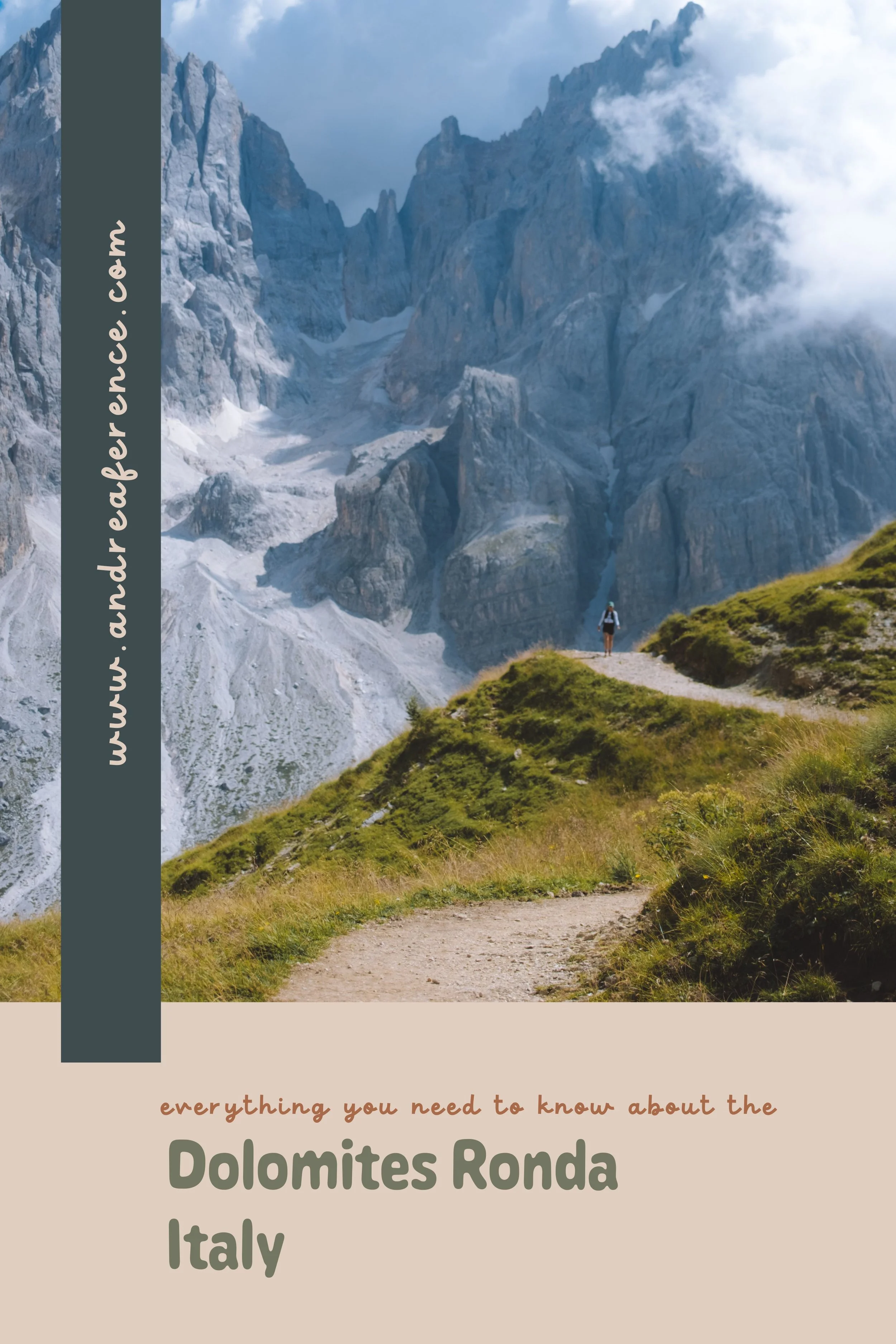
My Dolomites Ronda (Two)
In my usual last minute fashion, I booked a trip to Europe (non-refundable because I will never learn my lesson) and had two weeks with no real plans before I needed to be in Chamonix, France to run the opening race at the 2025 UTMB trail running festival.
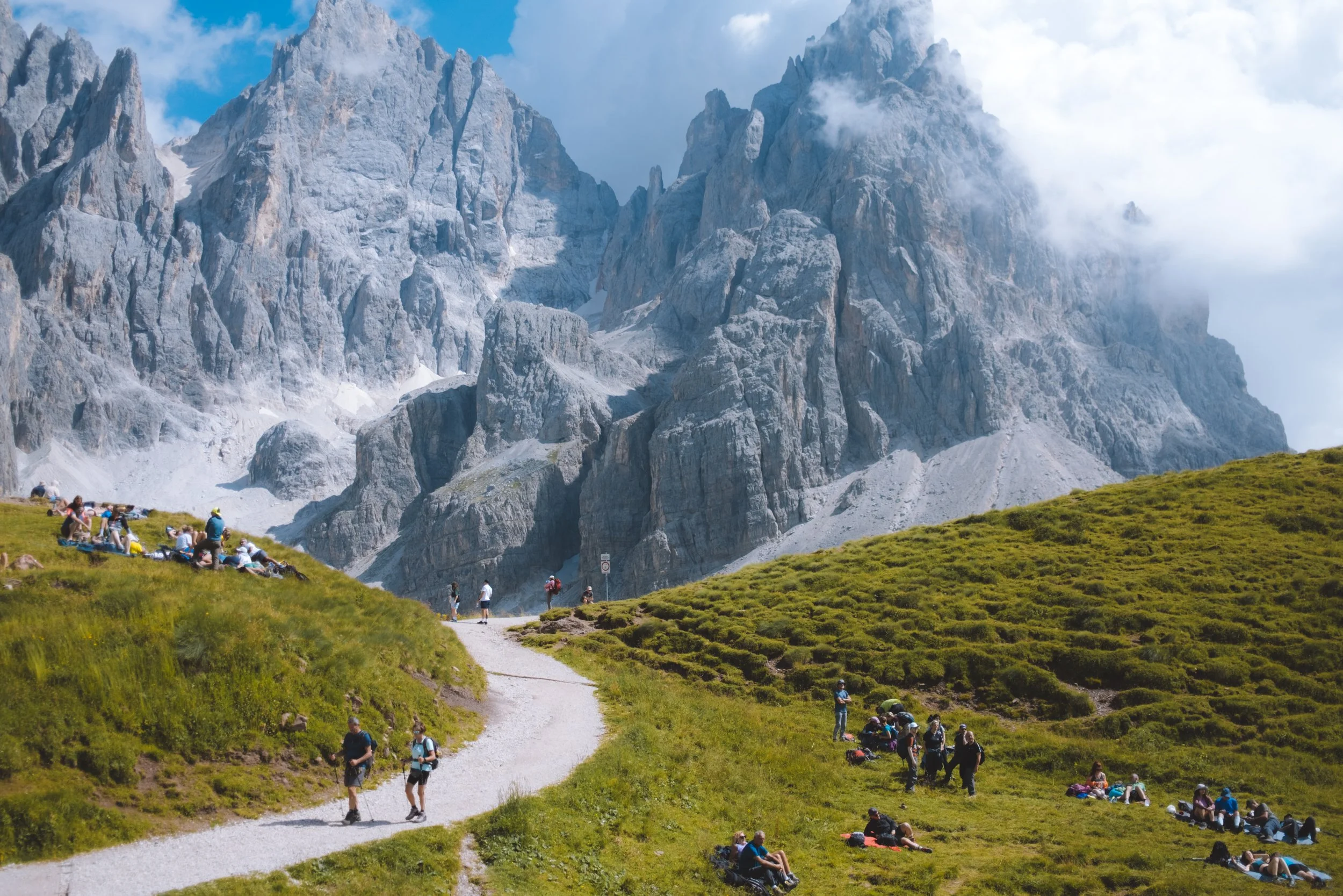
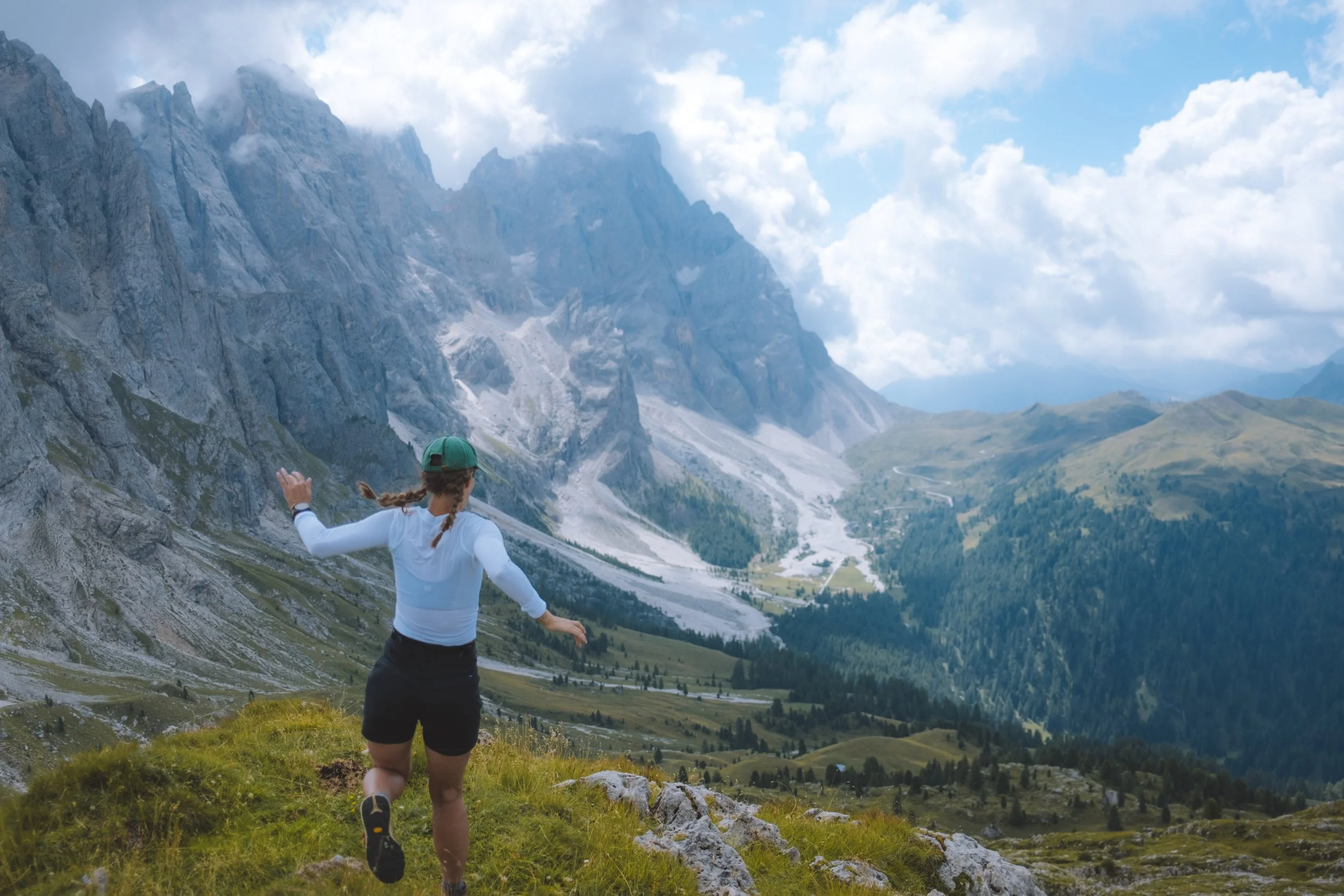
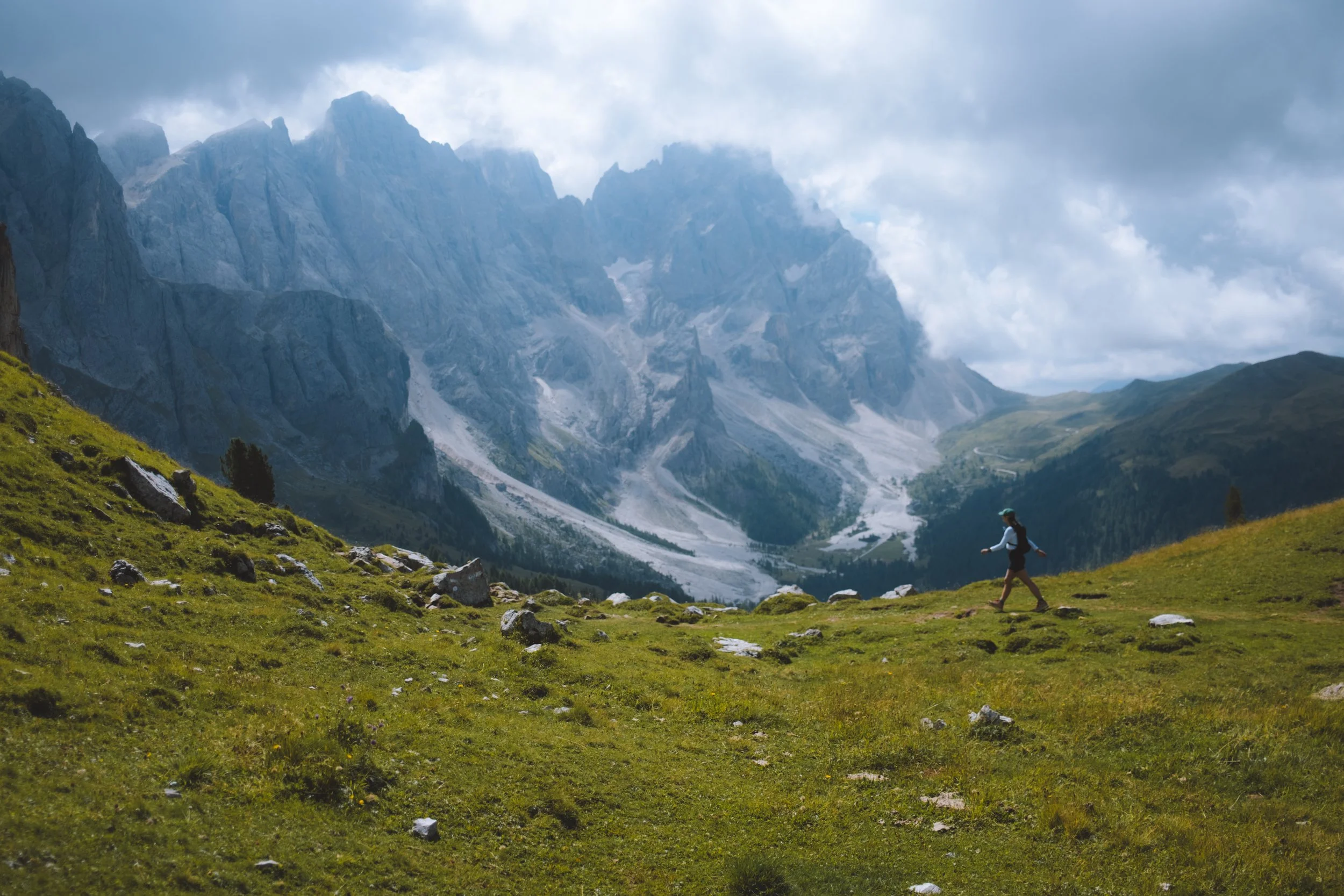
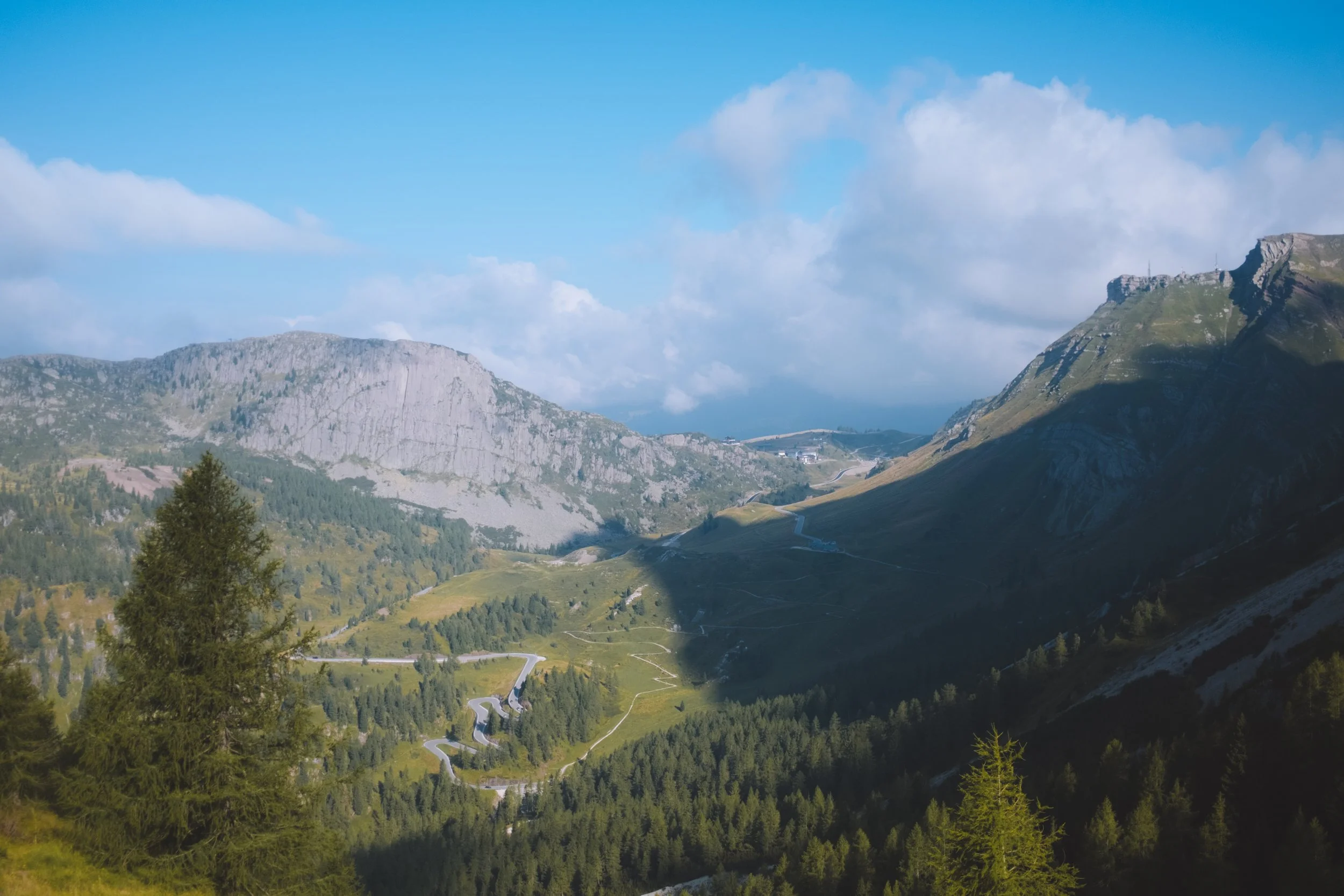
Last year I was invited by Dolomiti Superski to show Erna (my mom) so many of my favourite places in the Dolomites - and therein we created and completed the Tour d’Erna. This year, with my first ever big scary trail race approaching I reached out to Dolomiti Superski and asked if they had anything they thought would be a good fit. They suggested the Ronda - and I had some hesitancies. The entire circuit is spent in hotels deep in valley bottoms - instead of staying high in the alpine and being able to watch the sunrise and sunset from the most beautiful vantage points (while still in pyjamas) I would be hiking during the day and resting during the most beautiful times to take photos.
We compromised by tagging a hut onto each night of the “official” Ronda. And somehow it was the perfect trip. A few beautiful sunrises and sunsets - a luggage transfer between hotels so I was able to work and have all of my belongings everywhere. Afternoon cake and coffee and coca-colas. Options daily for each, moderate or challenging hikes. And a taste of regions I had mostly never visited - and those that I had, had only briefly sampled.
What is the Ronda?
For everything you should know before booking the Dolomites Ronda - and to learn about the difference between the Ronda 1 and 2 check out my intro to the Dolomites Ronda guide below.
Tour d'Erna Overview
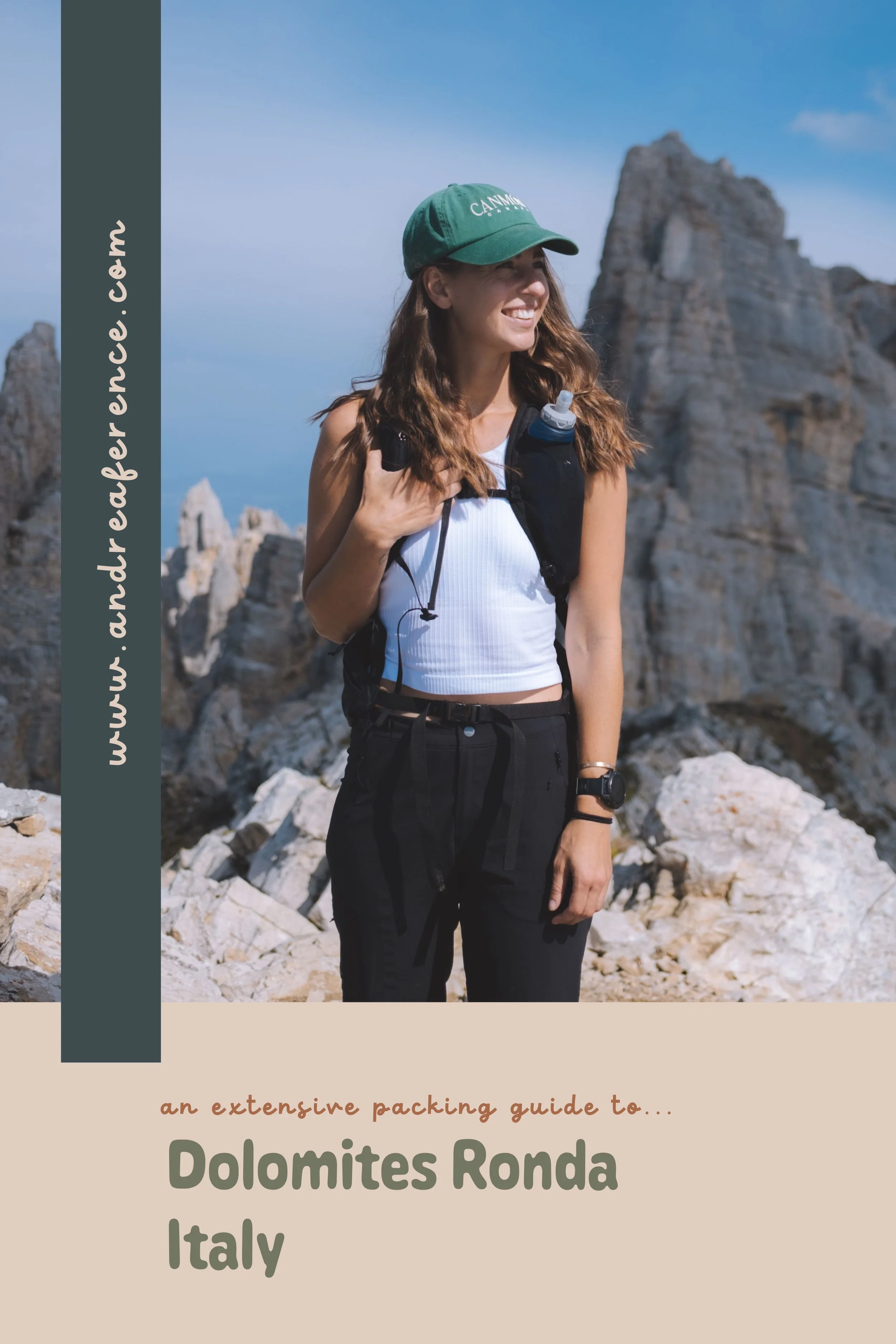
Packing
For my full Dolomites Ronda Packing Guide - click here.
My Dolomites Ronda Two
Why did I choose the Ronda 2 and not the Ronda 1
You might be asking this question right about now. And the reason is… that I had actually hiked all of the Ronda 1 piece by piece over the years. And if this had been my first trip the Dolomites that is likely what I would have picked. It is all of the hot spots and the views that you have seen a million times online that made you want to come to the Dolomites in the first place. It overlaps a lot with my Tour d’Erna. And since I had hiked all of the Ronda 1 (multiple times) I opt’ed for the Ronda 2 which was shockingly beautiful and most of the trails were less busy (which was nice during the Italian summer holiday when I was there) and there were only small sections that I had already hiked (one in the dark when I had food poisoning so it does not even count).
TLDR:
If you want to see the highlights of the Dolomites, it is your first time visiting and you don’t mind a busier trail : the Ronda 1
If you are looking to have a little less traffic on the trail (still busy by North American standards), have already visited before and looking for hidden gems : the Ronda 2
Dolomites Ronda 1
Dolomites Ronda 2
My route
Note that the distances and elevation gain/loss numbers given by the organizers of this hike along with all of the options can be found on there website here.
This page is my personal experience and the information is pulled from my watch data from my week spent in the Dolomites. I did the hike out of order starting with the final day and ending with the second to final day which does make it very slightly more complicated - I also was anxious about not having any sunrises or sunsets as most of the days begin with a lift assist (and the lifts do not open that early) so we added two huts to my trip (one at the start and one at the end) and indicated those side quests as “Day Zero” and “Bonus Day”. There are also days that I took a private taxi instead of public transportation which is noted but public transportation is available for the vast majority of this route and any mandatory private transportation is included in your booking of the Dolomites Ronda.
Now that we got all of that out of the way… onto the adventure!
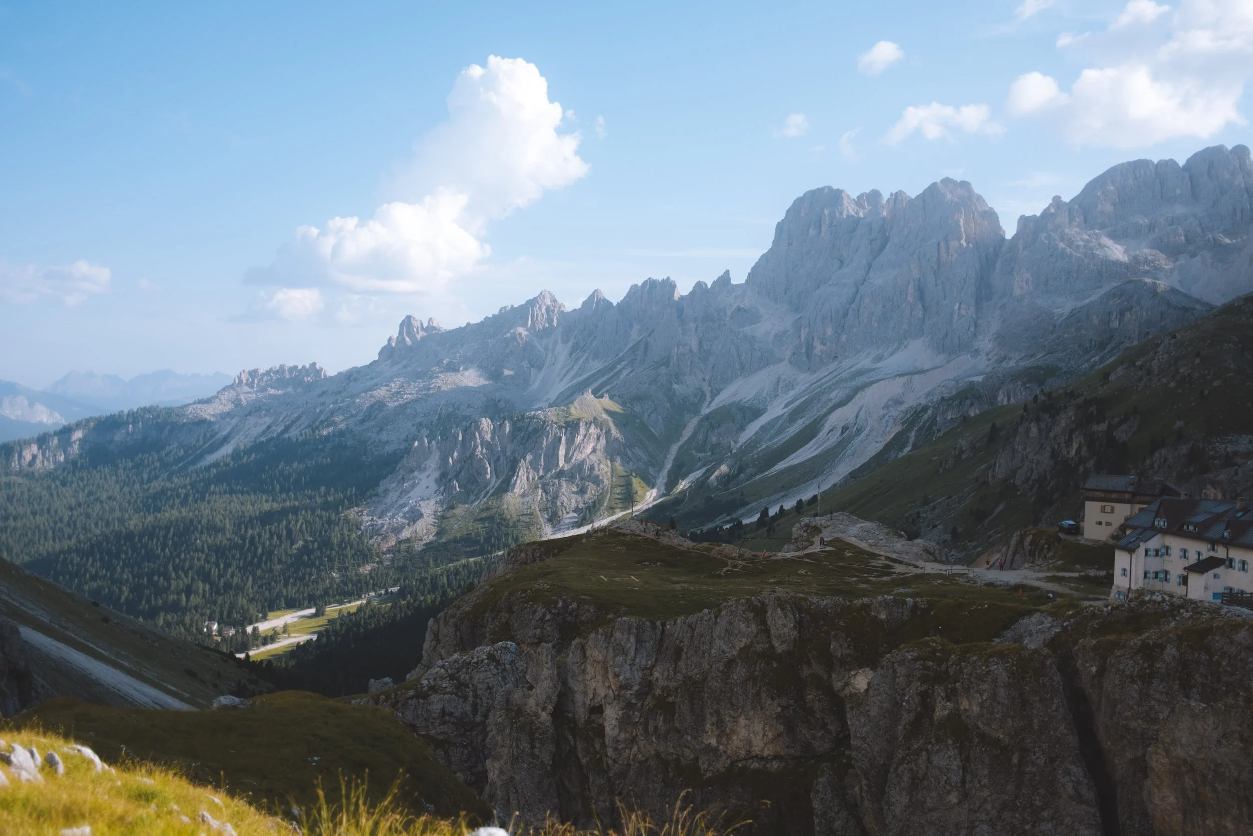
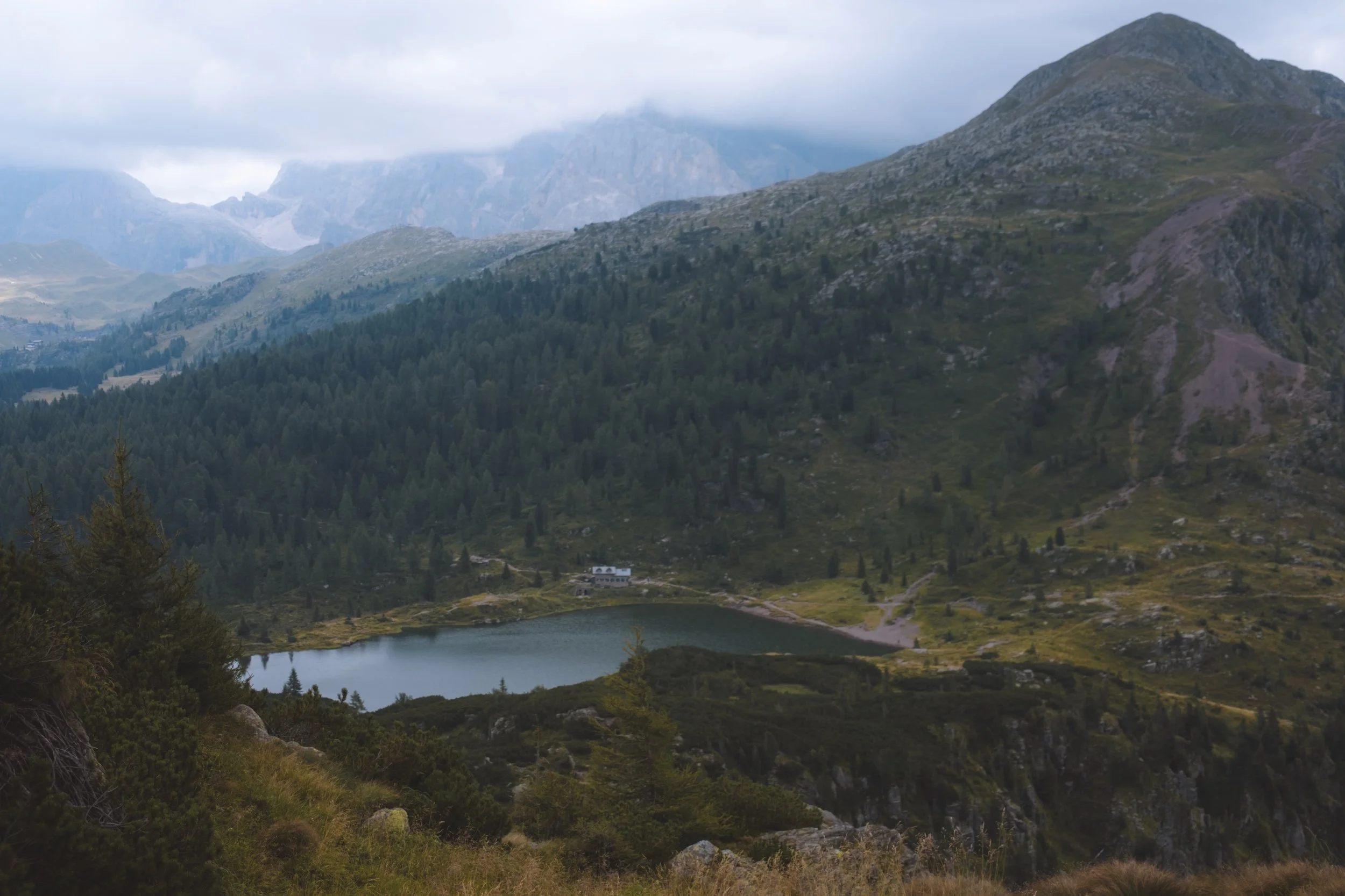
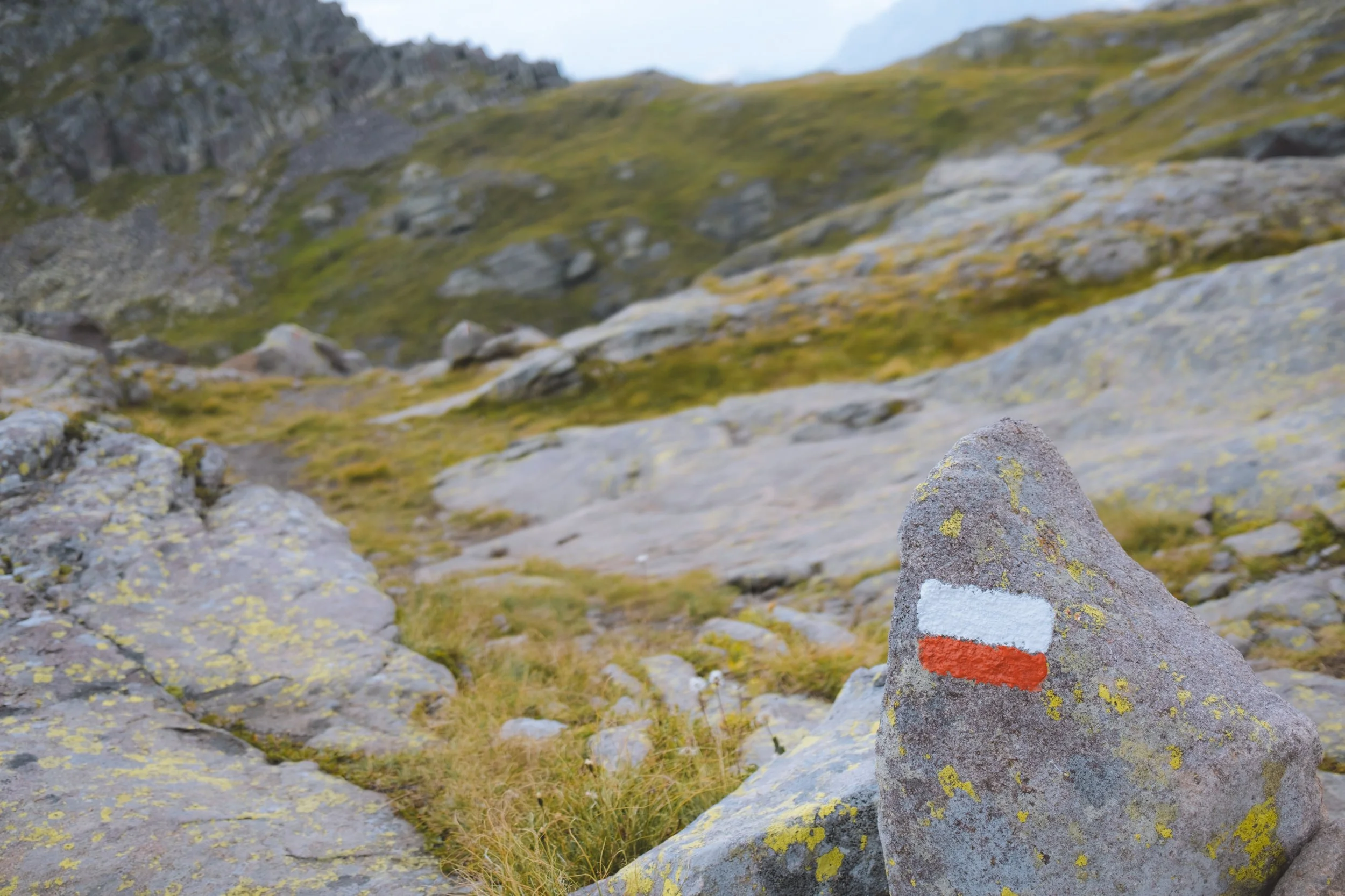
Map
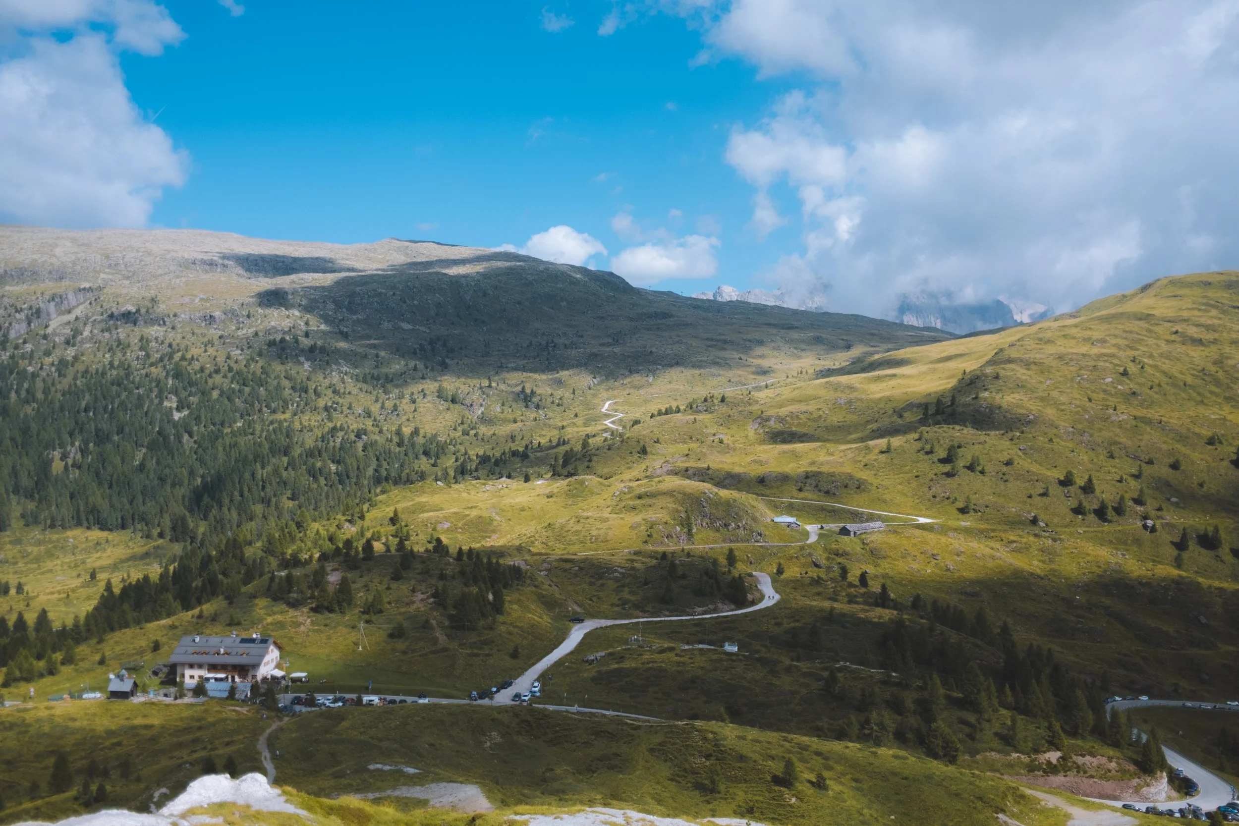
Click the below map for all of my stops and a few alternate suggestions. One day I will learn how to actually make function hiking maps but until that day… this is all I have.
Day zero
a trail running side quest to Rifugio Vajolet
starting point : Vigo di Fassa / Catinaccio Funivie
distance : 4.84km
elevation gain : 330m
elevation loss : 82m
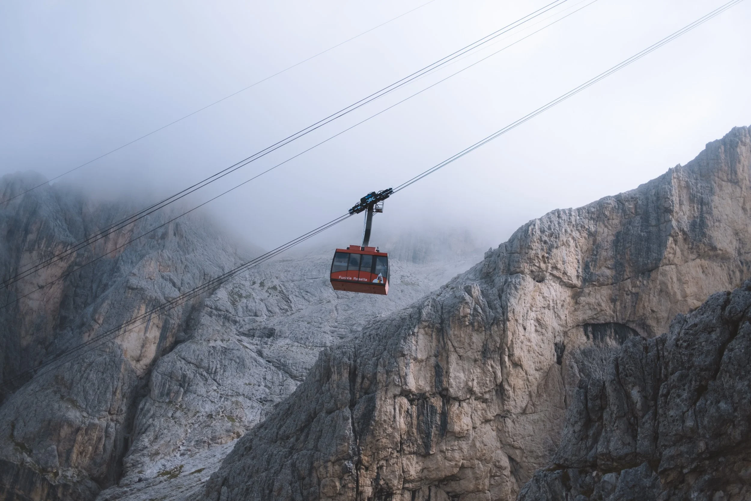
transport : Catinaccio Funivie (up)
daily trail time : 45min
ending point : Rifugio Vajolet
my thoughts
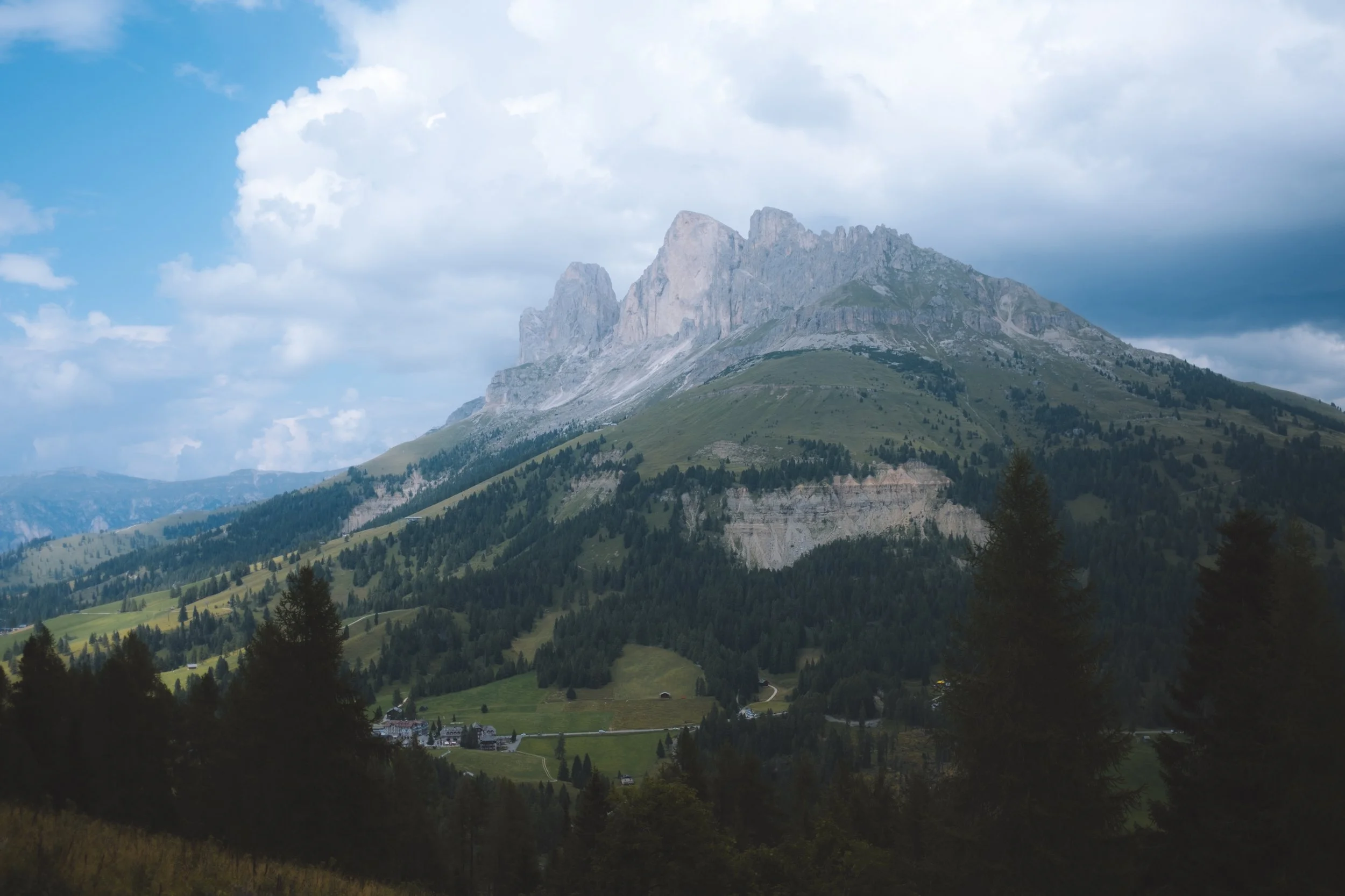
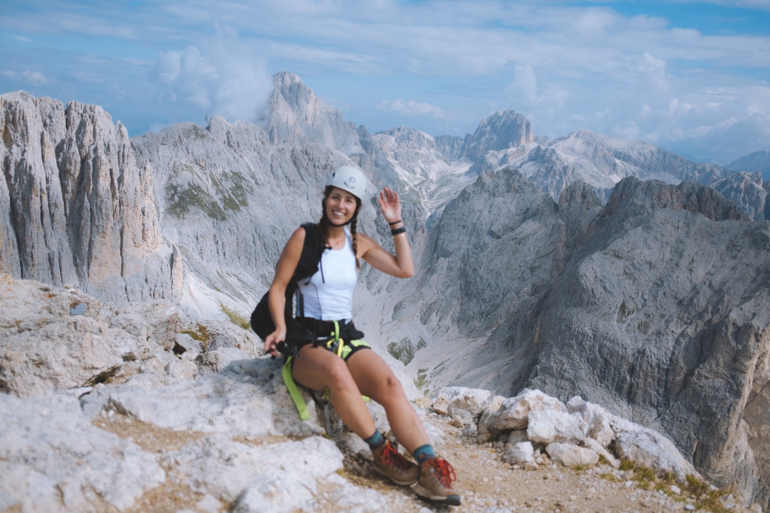
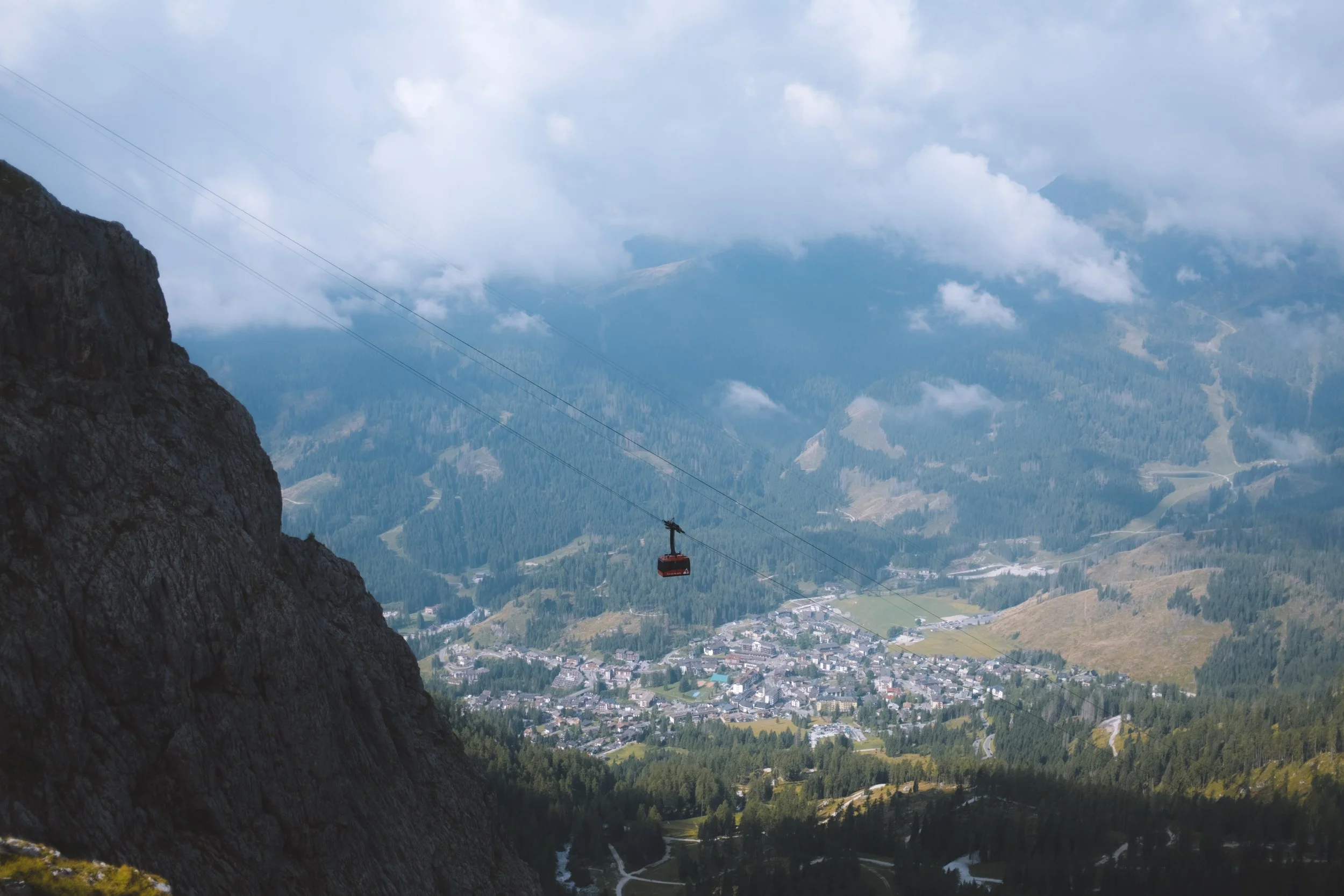
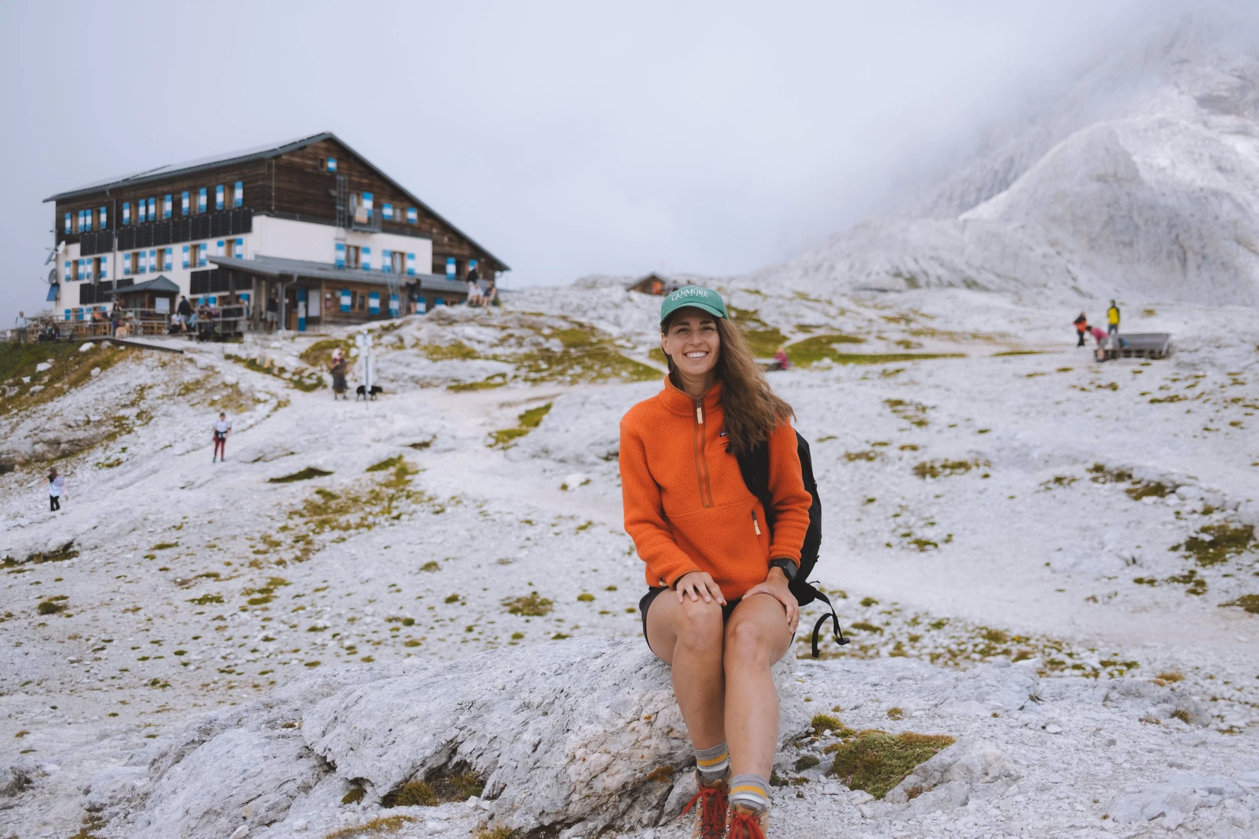
After a long flight and an even longer journey by land I was equally exhausted and elated. The cablecar up reminded me of how much I love the accessibility of hiking in Europe (note that this cable car is not included in the Dolomites Ronda pass as this is not part of the circuit). I opt’ed to trail run this ~5km to ensure my bag was light, test for a few longer fast packing trips on my list, and get a little fast movement in as I was to still be actively training for an upcoming trial race.
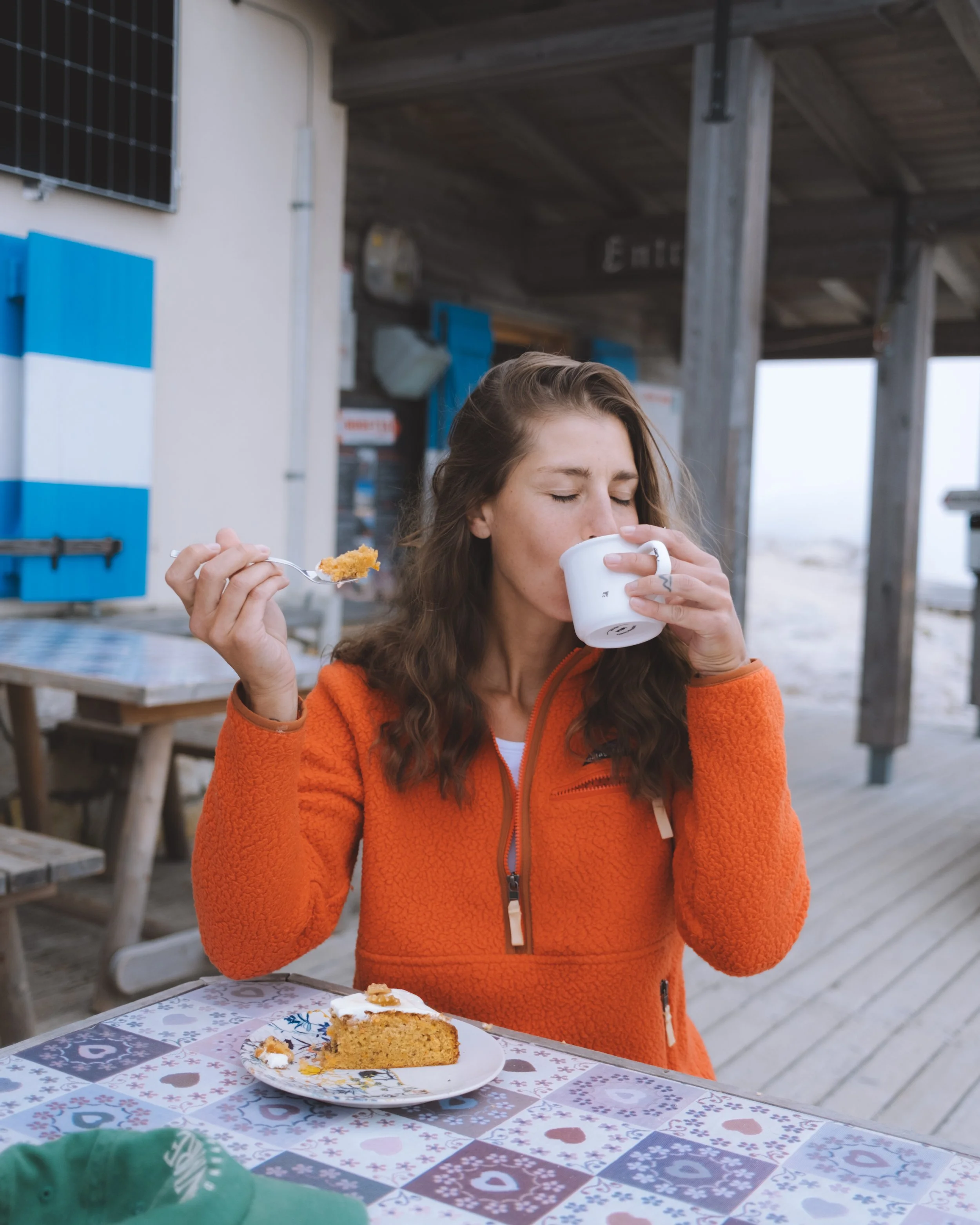
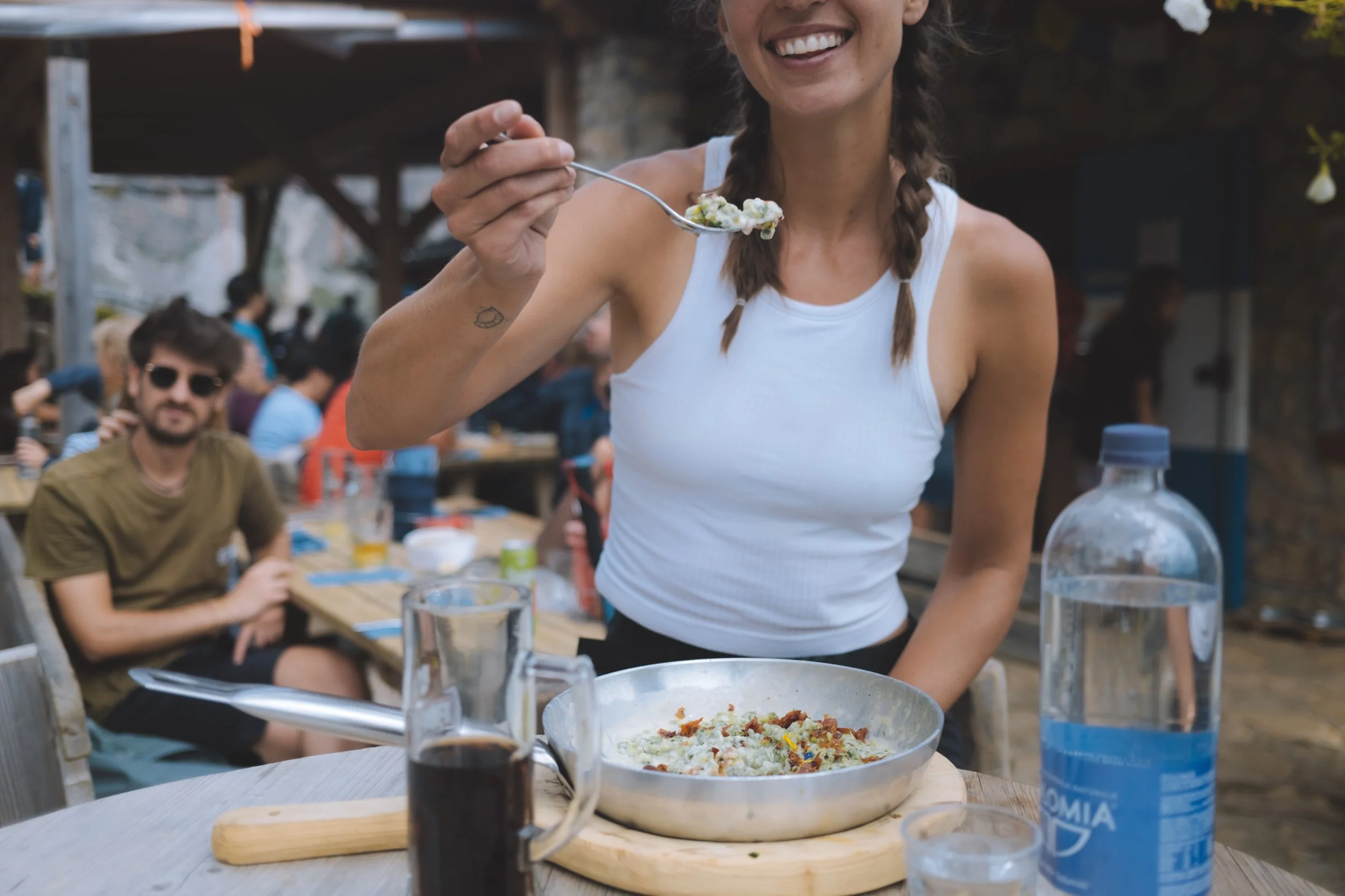
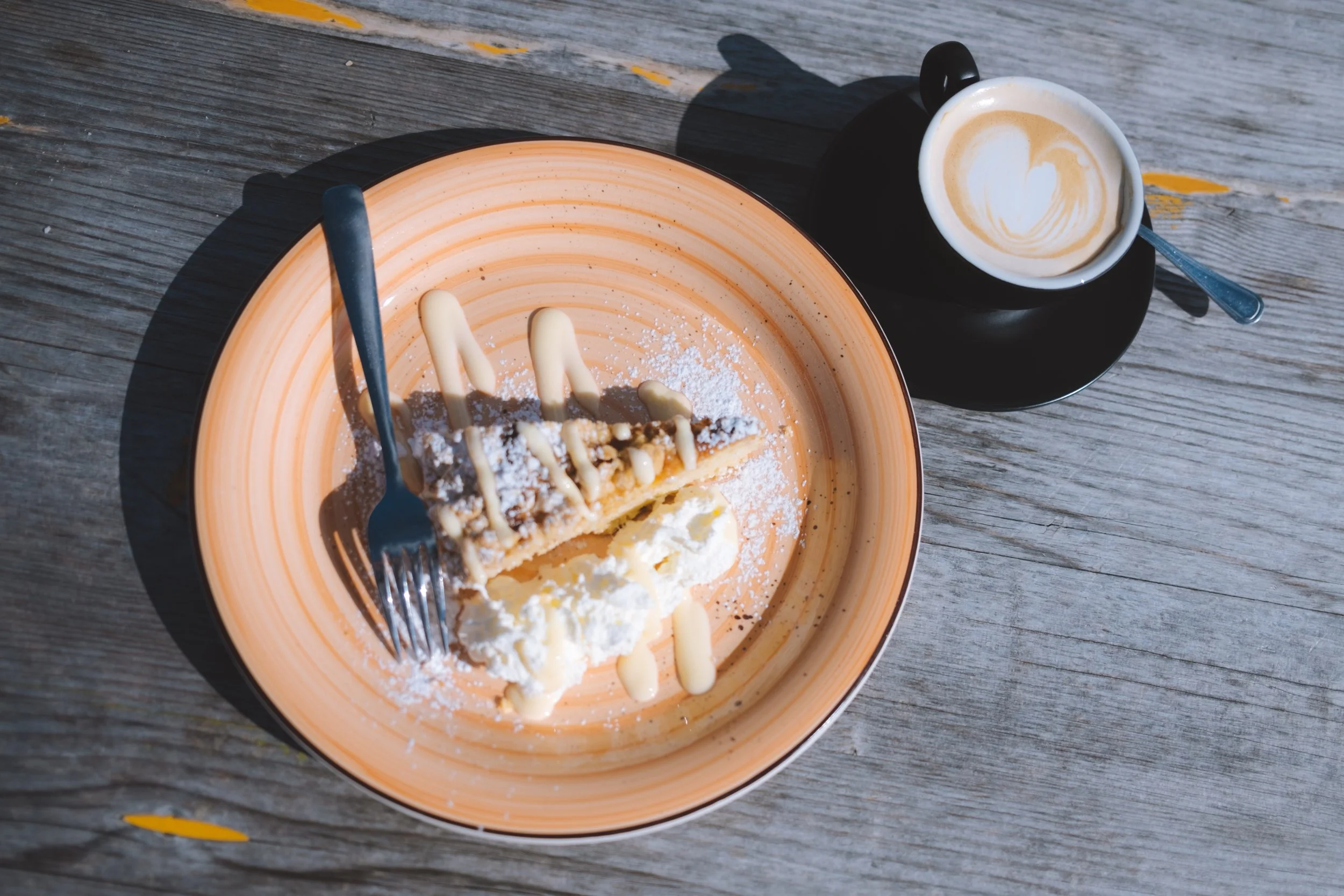
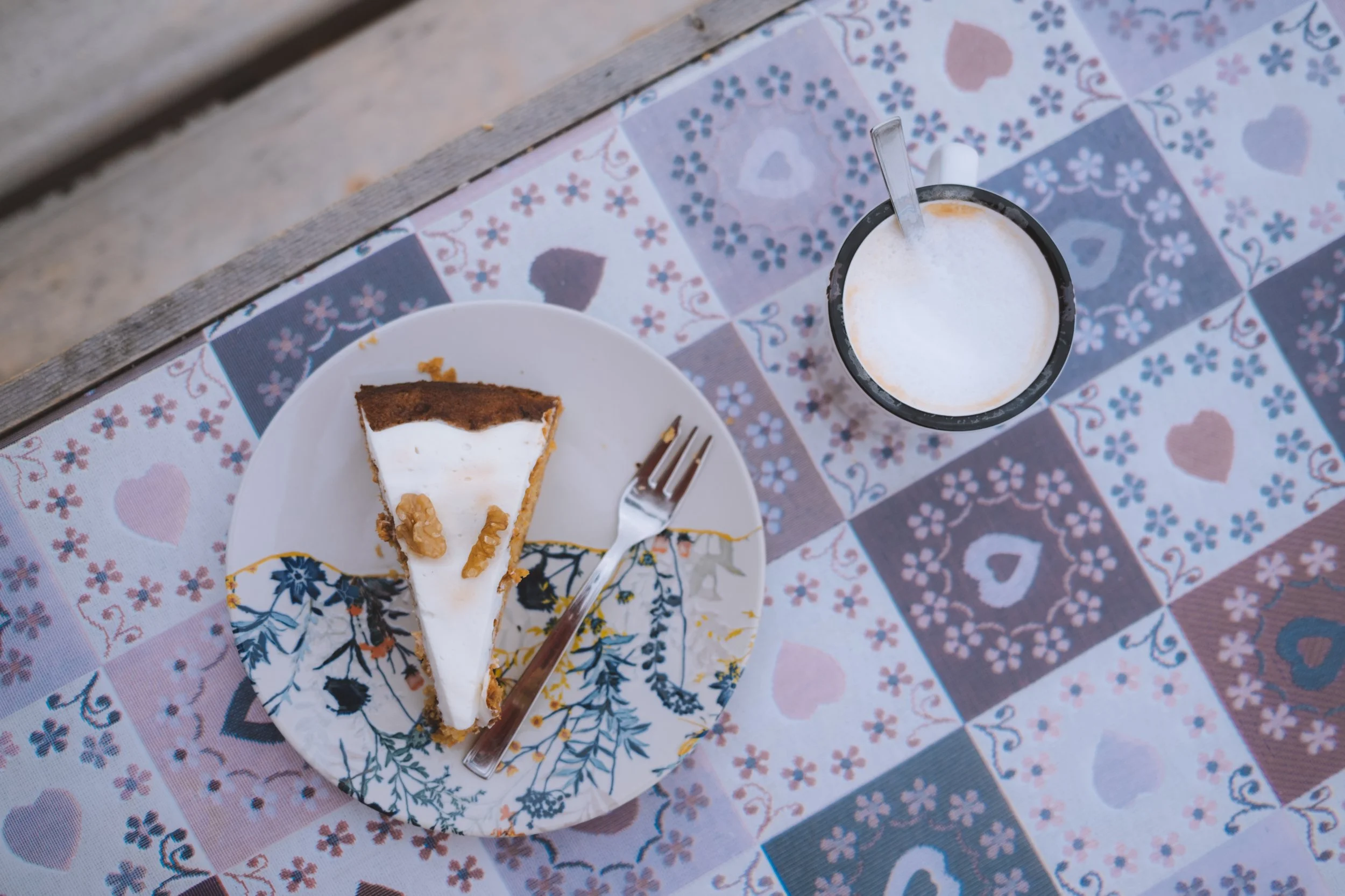
As I started my run a light rain began… and then quickly turned into a torrential downpour which abruptly ended when I reached Rifugio Vajolet - as I learned this was a very common afternoon occurrence. Almost like clock work. And a great time to have a piece of afternoon cake on a covered terrace.
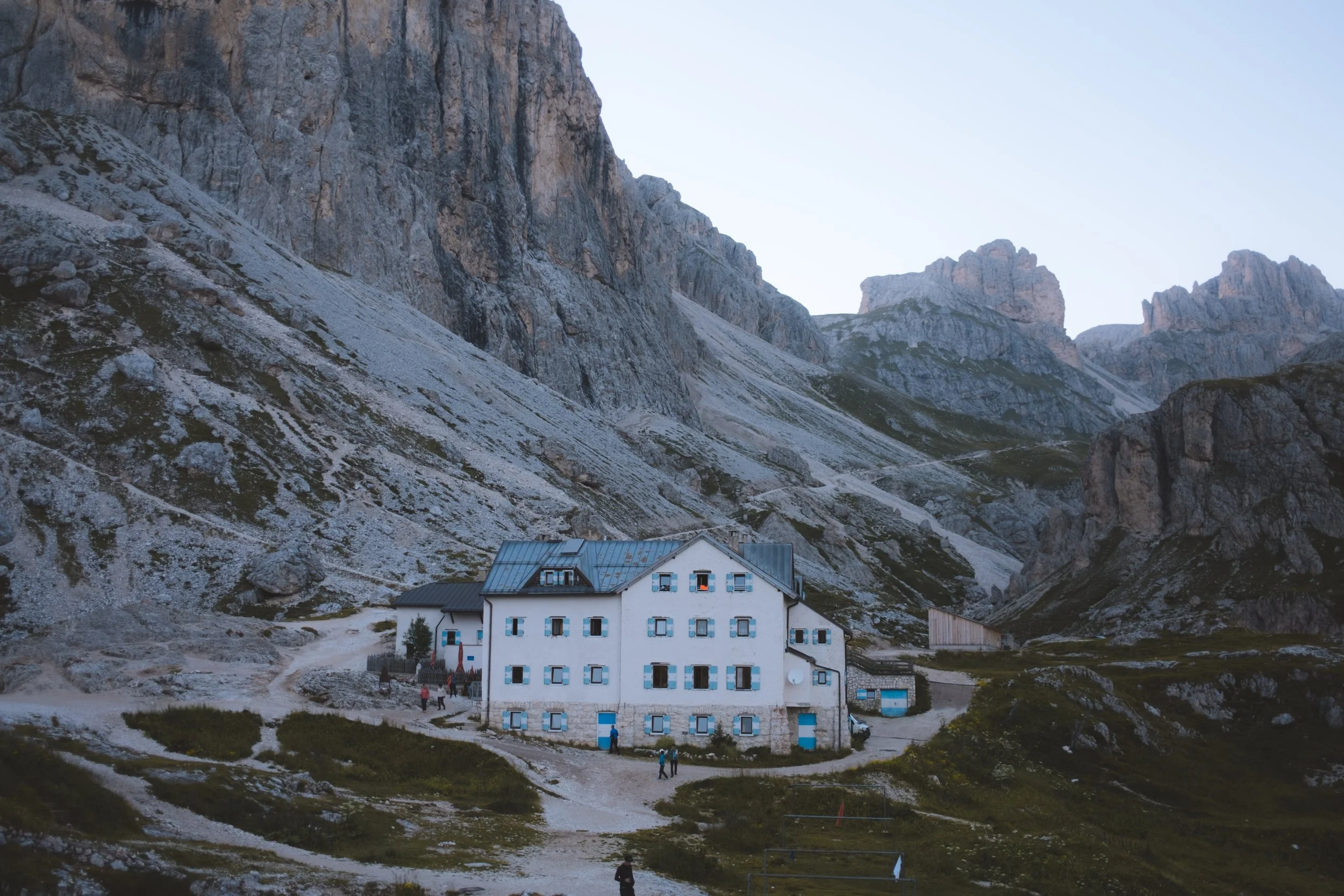
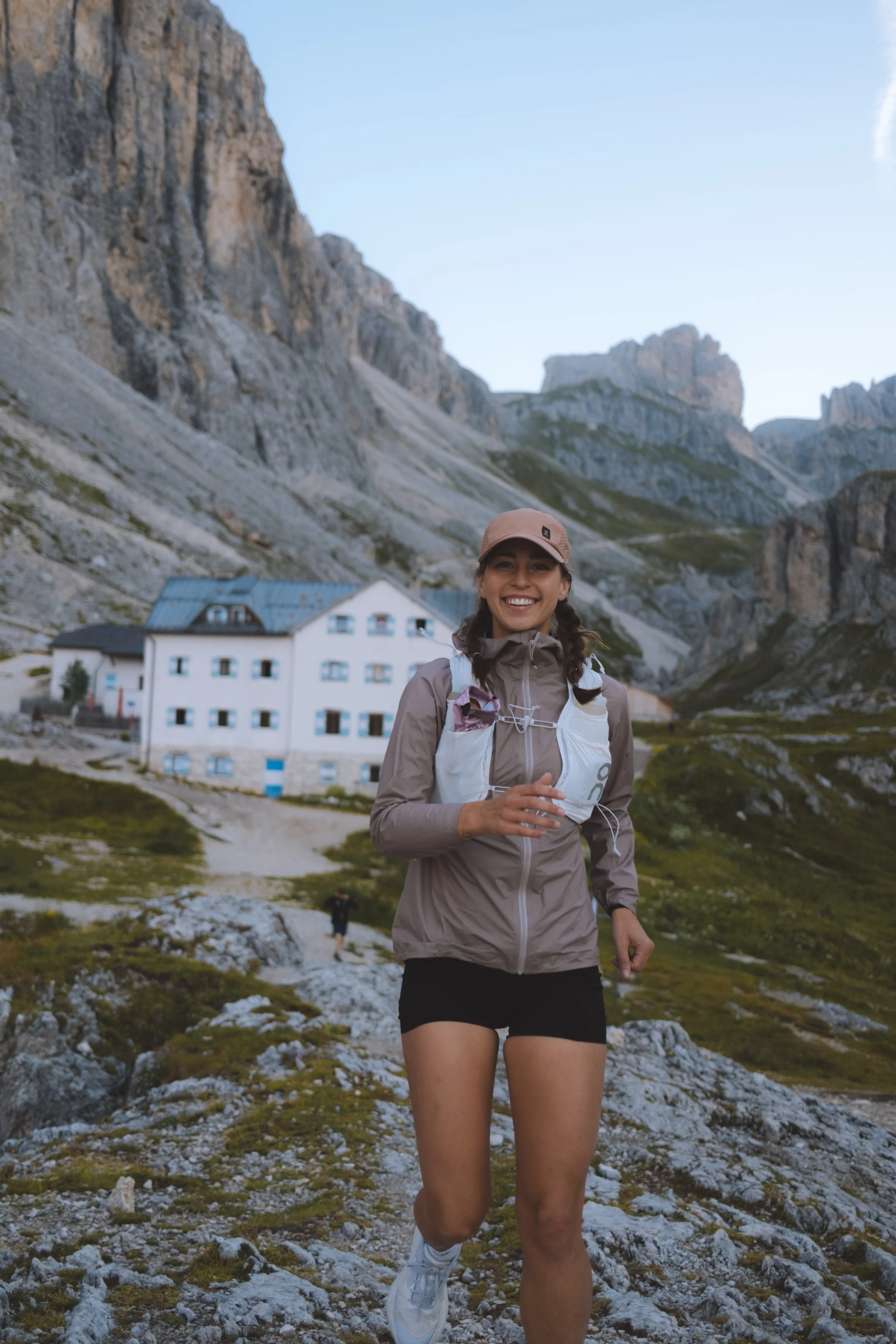
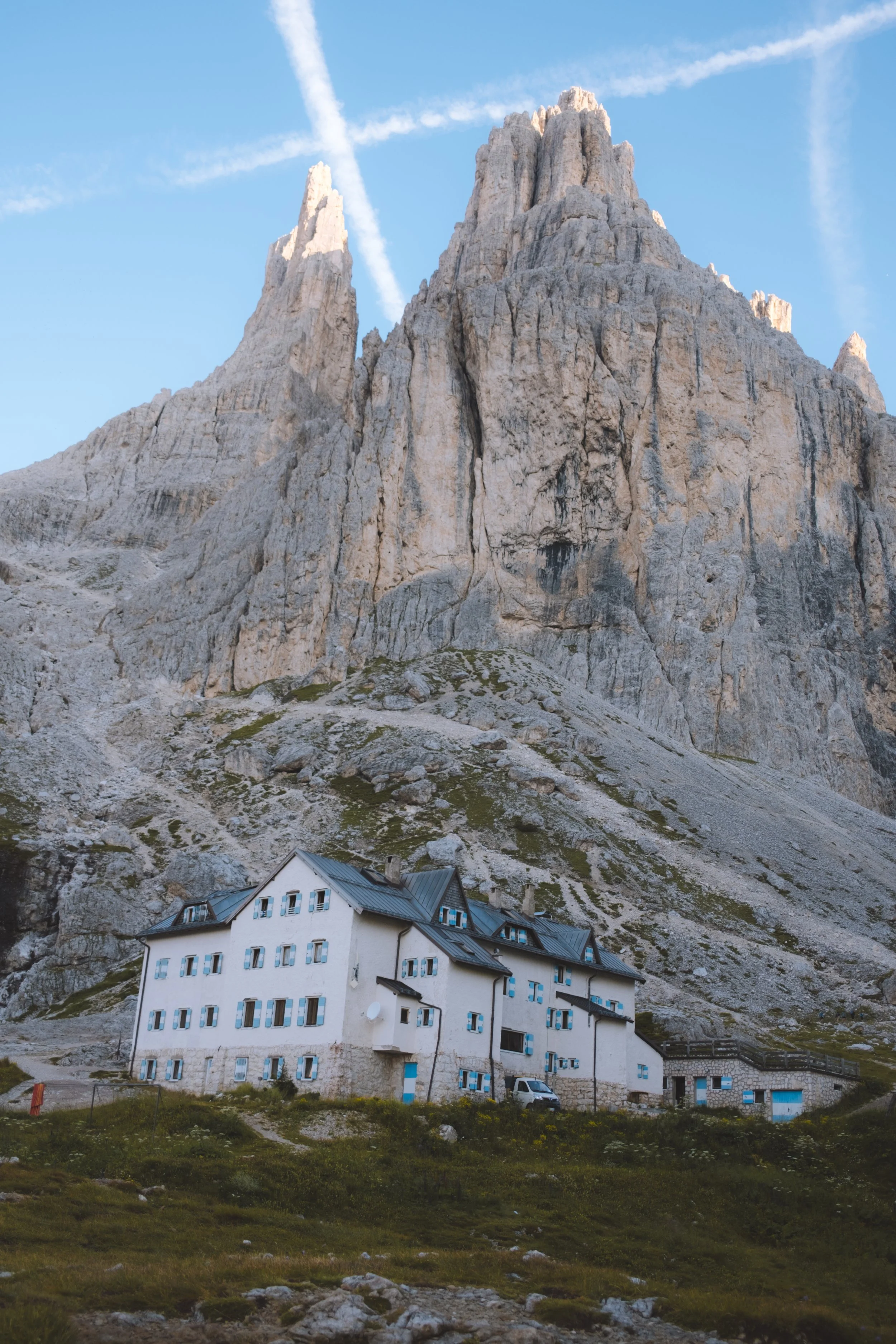
I arrived at the Rifugio Vajolet and was the last in my room which I shared with seven other hikers and was relegated to a top bunk under a sloped ceiling leaving ~2ft of headspace. That along with jet lag and some of the most prolific snoring I have experienced… made me very happy that the setup for the Dolomites Ronda is private hotel rooms instead of shared dormitory style. My advice : always try to arrive at or before check-in time to claim your bed.
The dinner was amazing and filled with Tirolian dishes that reminded me of my family in Austria. I shared a table with a German couple and three women from nearby Bolzano (one that followed me on instagram funnily enough). It was overall a wonderful evening in a truly magical place… with very little sleep.
Day 0.5
a trail running side quest from Rifugio Vajolet
starting point : Rifugio Vajolet
distance : 4.84km
elevation gain : 83m
elevation loss : 323m
transport : Catinaccio Funivie (down)
cake : Ciampedie refuge
daily trail time : 31min
ending point : Vigo di Fassa / Catinaccio Funivie
my thoughts
And now to undo my little side quest I had to make my way back to Vigo di Fassa. I packed up early and departed immediately after breakfast making it to Ciampedie refuge (cash only) just in time to accidentally steal a piece of cake and mid morning cappuccino. This was especially embarrassing as I ran into the owner of the cable car that morning and when I went back days later to remedy my accidental thieving and pay for my stolen goods… they remembered me in relation to him. I will blame it on my jet lag and lack of sleep - but mortifying nonetheless.
I am glad I went back to pay for it but will be honest that they did not find it at all amusing and I do not feel I can ever show my face there again.
After my cable car down I was picked up and quickly dropped off my bags at what would be my first hotel of the trip before rushing to the official start of the Dolomites Ronda 2.
Day one
The Dolomites Ronda day 5 (remember I did this out of order)
starting point : San Martino di Castrozza
distance : 13.47
elevation gain : 824 m
elevation loss : 1,141m
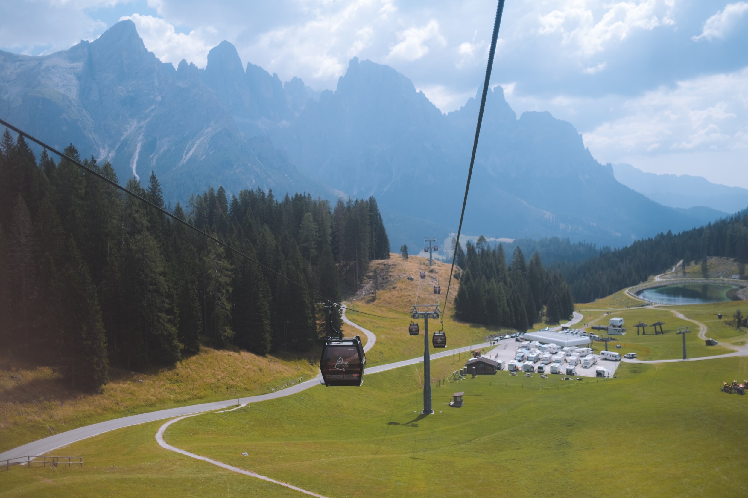
transport : Colbricon Express
lunch : refuge Laghi di Colbricon
daily trail time : 3:29:09
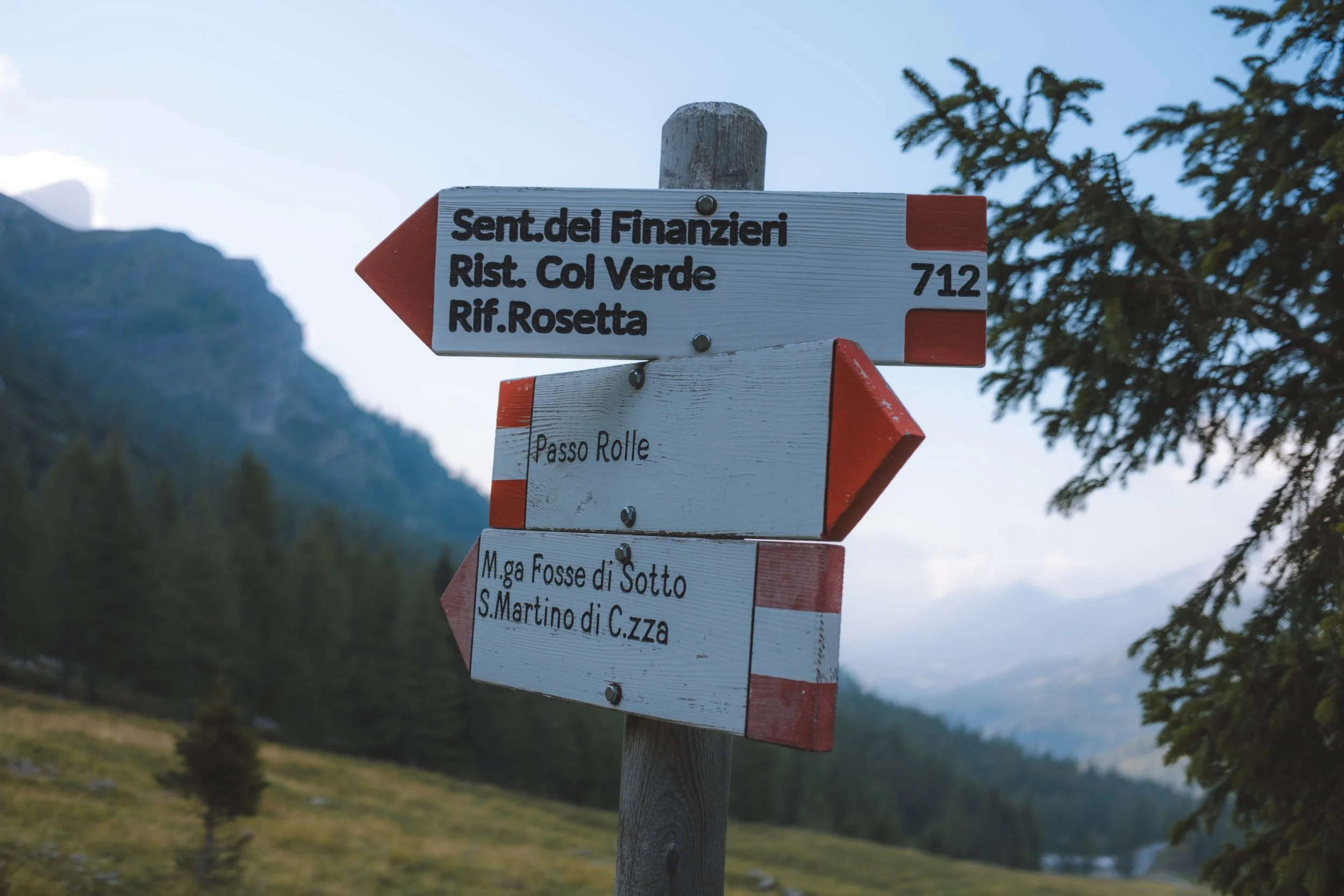
ending point : Passo Rolle
my thoughts
I learned a lot on my first day of the Dolomites Ronda - mostly that I need to check my ego and also check where all of the stops for food are. And also that I need to pack more emergency snacks on the trail just in case.
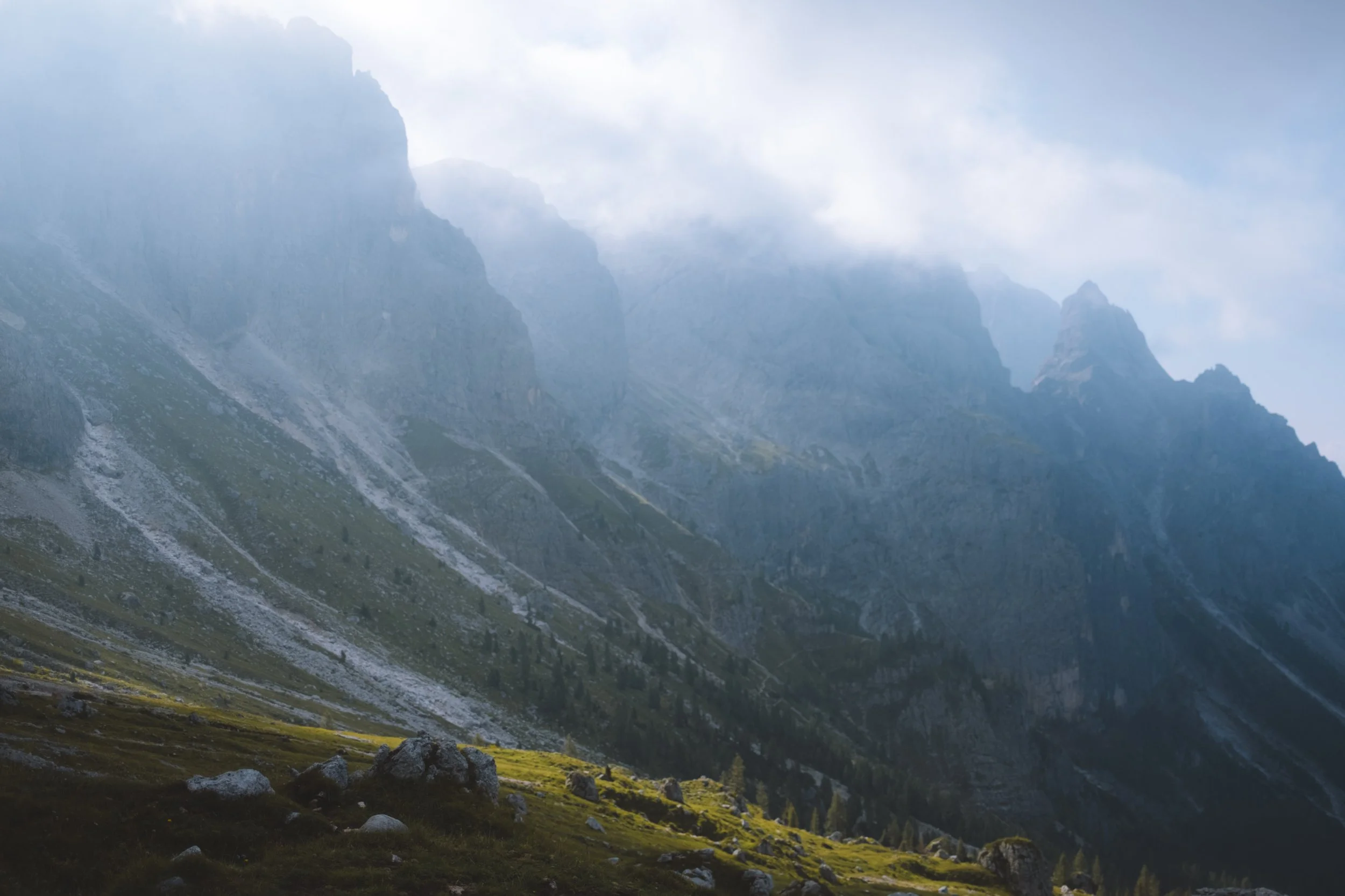
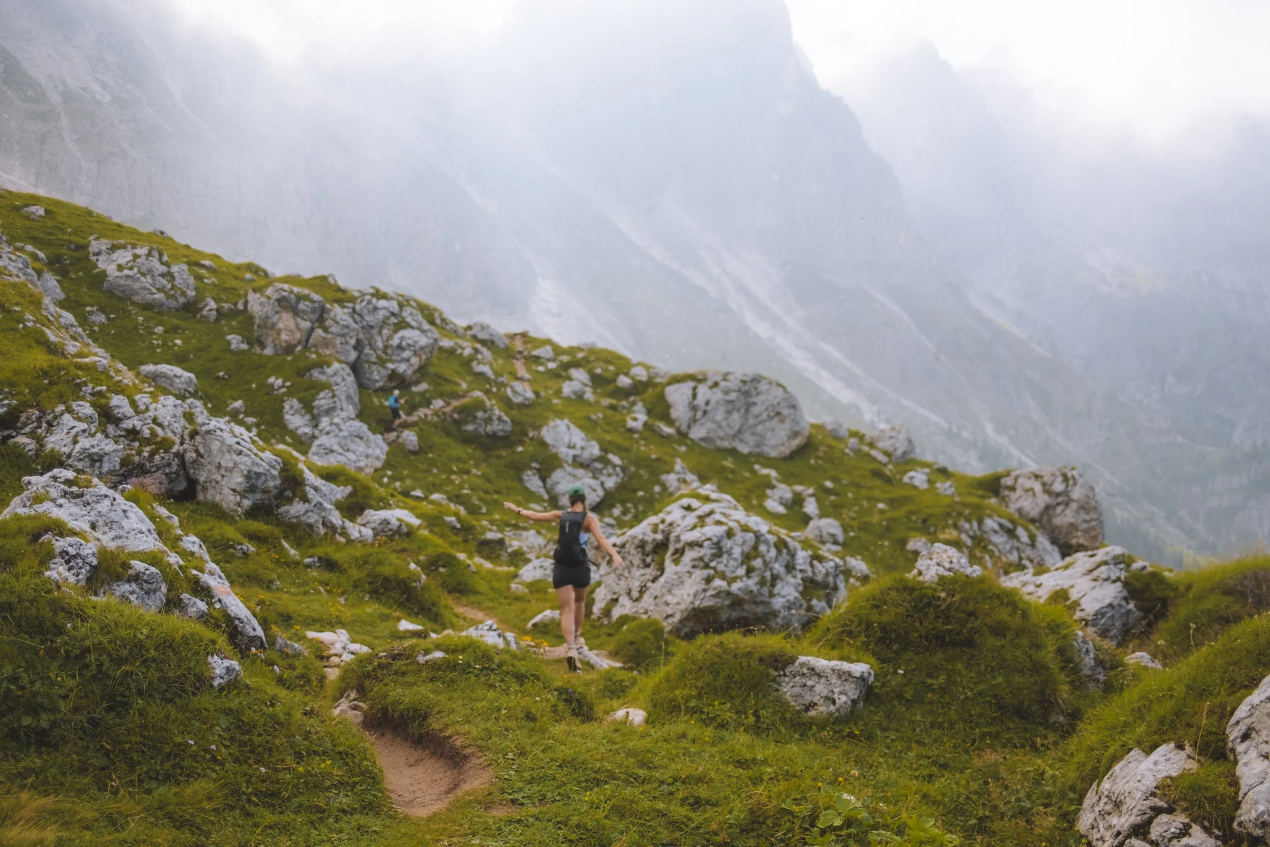
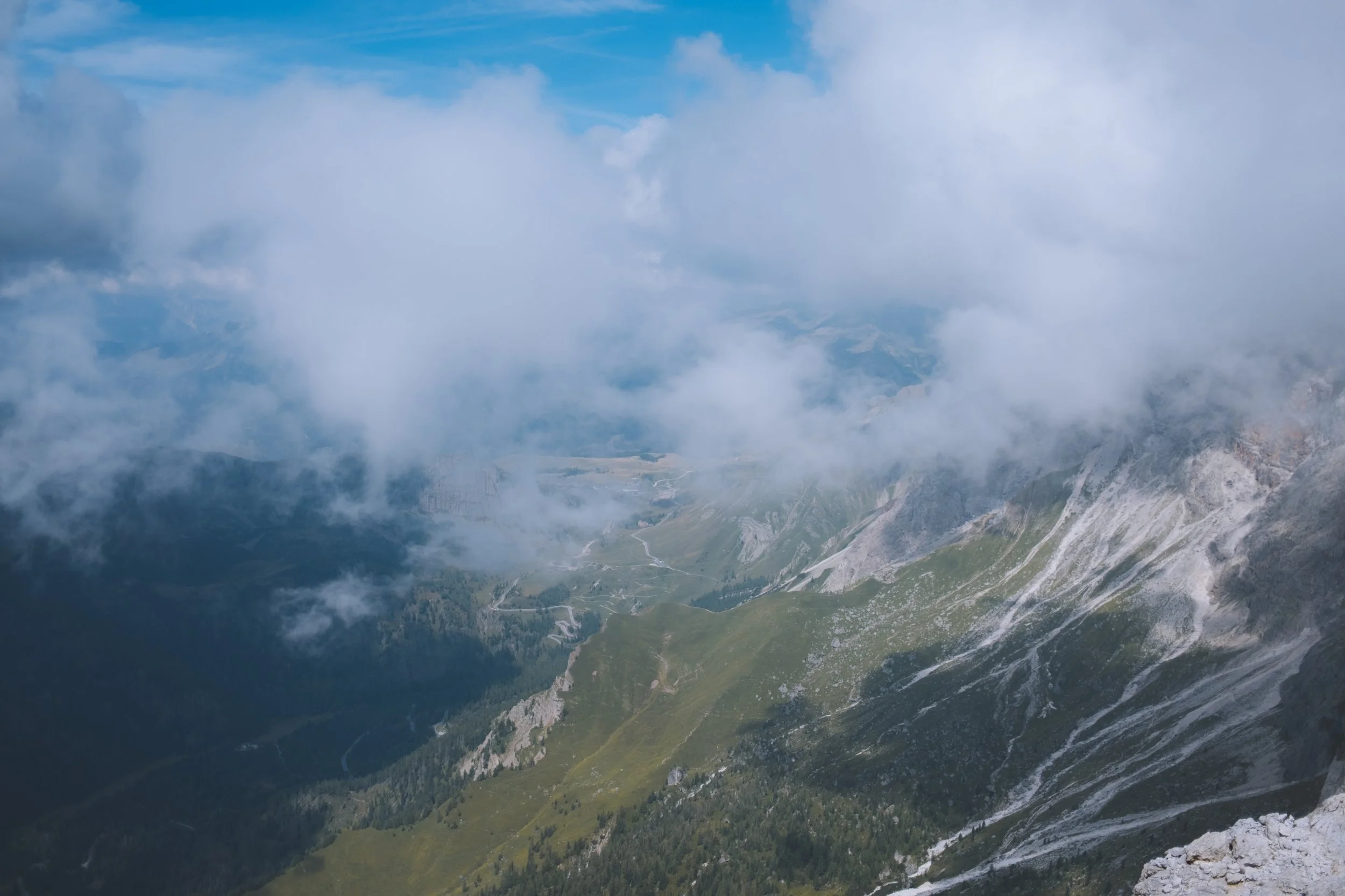
I started my day with the Colbricon Express and chose the challenging option. As I felt like I was already behind I decided to skip the first hut that offered food (“Punta Ces” mountain station) and push forward to my high point of the day. This was a mistake. But the time I reached the Sentiero Achille Gadler – Translagorai (which was absolutely beautiful by the way) I could hardly appreciate it because I was so hungry.
Beginning my descent to Passo del Colbricon and the Laghi di Colbricon, like clockwork, my afternoon storm rolled in - this time bringing lightening that was a little too close to comfort for me. At this point I made the mental note that morning hiking was in my personal best interest for the remainder of the trip.
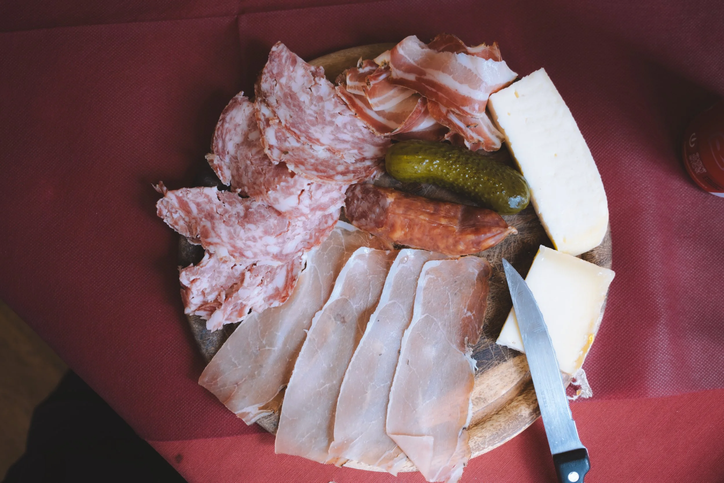
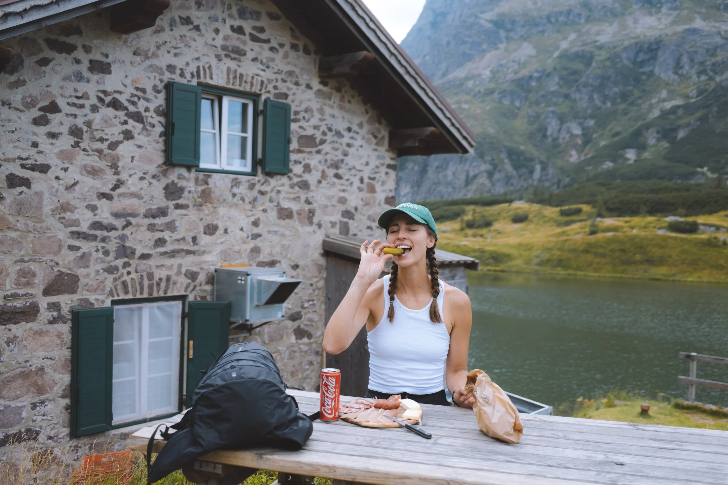
I made it down to Laghi di Colbricon and the rain let up, desperately stopping in the refuge just after 3pm I was told that lunch had stopped being served. I think the man working felt the desperation in my voice (or saw the tears welling in my eyes) and offered to make me a small cheese and meat plate. Unbeknown to him.. that is actually my all time favourite food. I sat outside by the lake and ate my girl lunch and can of coca-cola (European Andrea is really into a cheeky afternoon coke break).
After I was fed, I checked the Dolomites Ronda app and decided that I had no interest in finishing the challenging route and took the quick exit out the easy route to Paneveggio. I was quite exhausted at this point and decided to call for a private taxi - but there is public transportation that services this area. The challenging route ends at Passo Rolle (which we will visit later in this hike).
Typically this would be the end of the tour so from here you would have the option of spending the night at Passo Rolle or continuing on wherever your journey takes you for me, however, this was just the beginning.

Day two
The Dolomites Ronda day 1
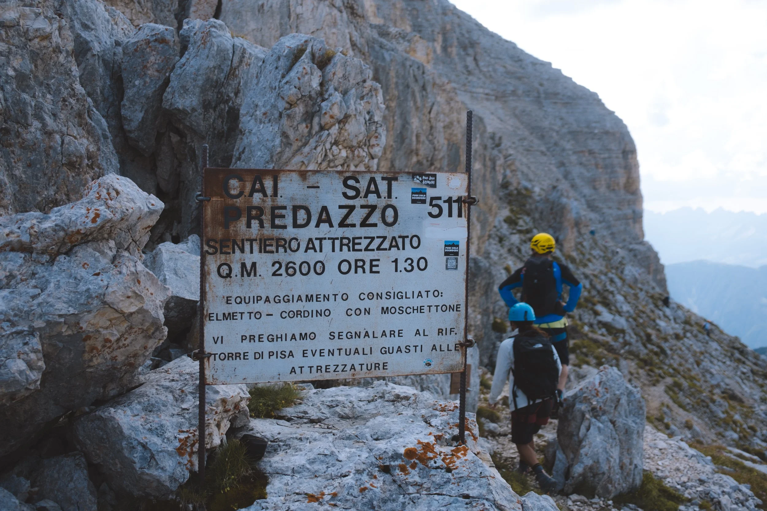
starting point : Predazzo
distance : 15.07km
elevation gain : 1,095m
elevation loss : 1,513m
transport : chairlift at Passo Feudo
daily trail time : 5:58:27
cake : Refuge Tower Of Pisa
lunch : packed snacks
ending point : Carezza

my thoughts
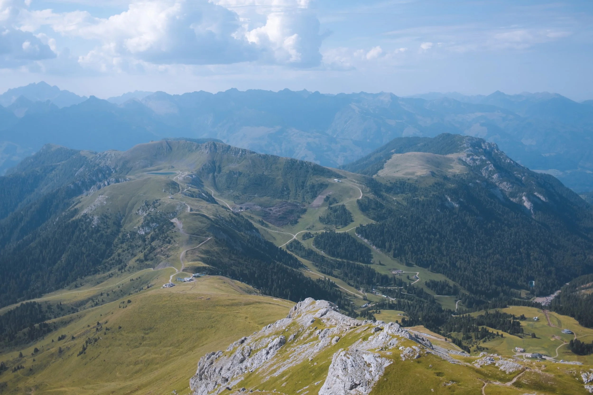
My second day on the Dolomites Ronda. Today began with a one minute walk from my hotel to the bus stop (note : download the bus app and make certain your tickets are loaded before leaving the hotel - the reception will help you with this) and a short bus ride to chairlift at Passo Feudo where all three options start their hike from.
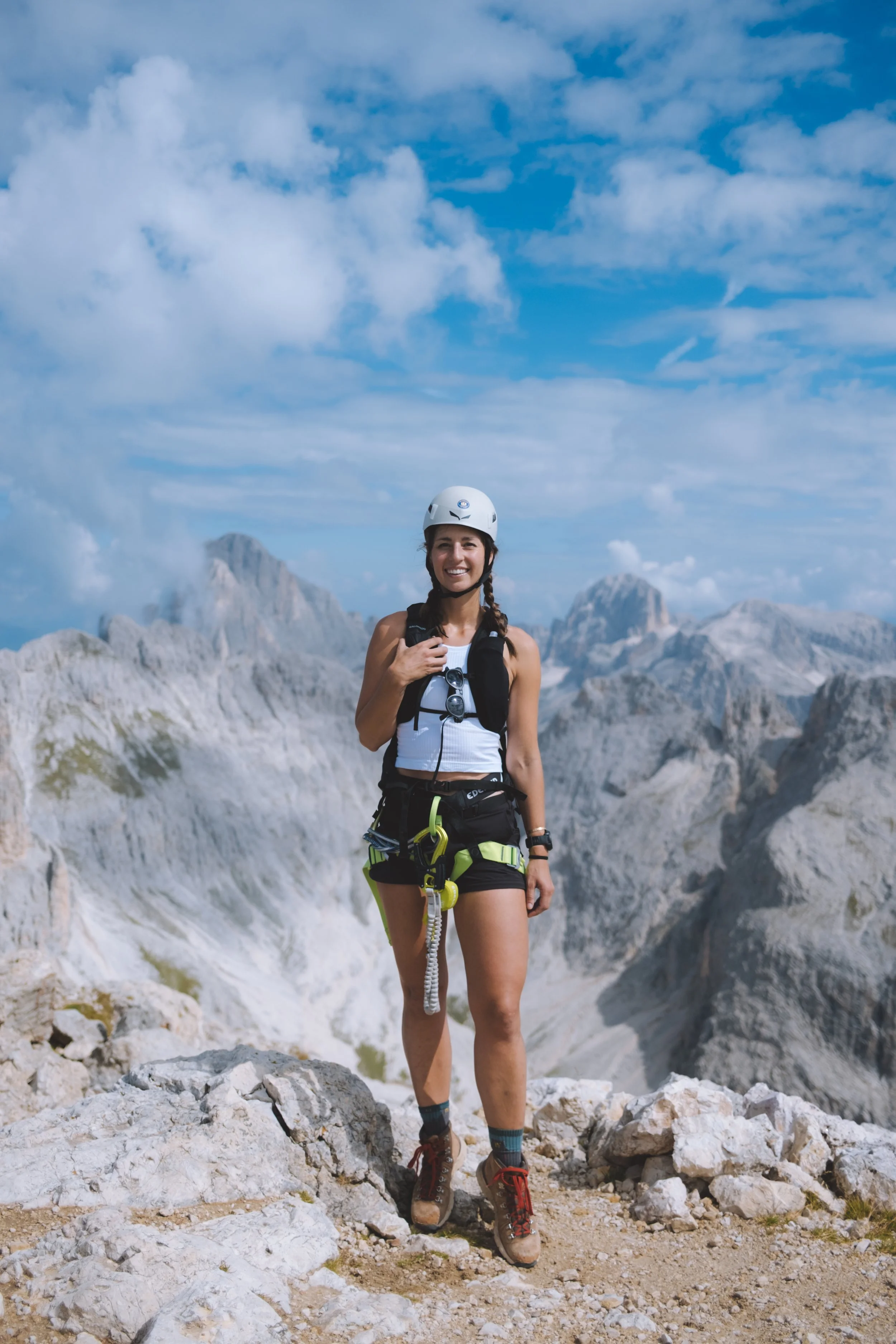
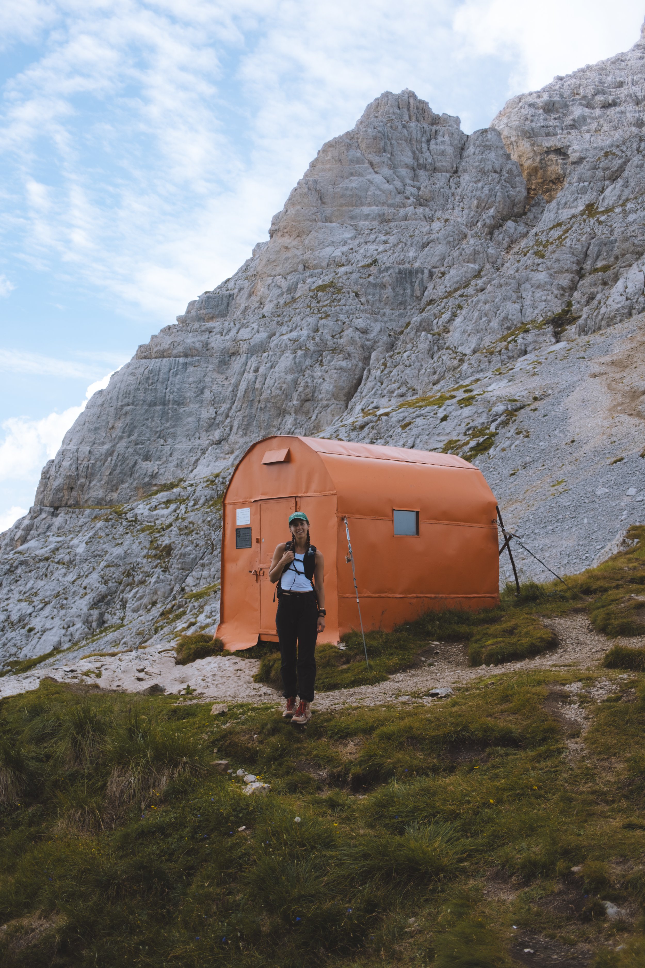
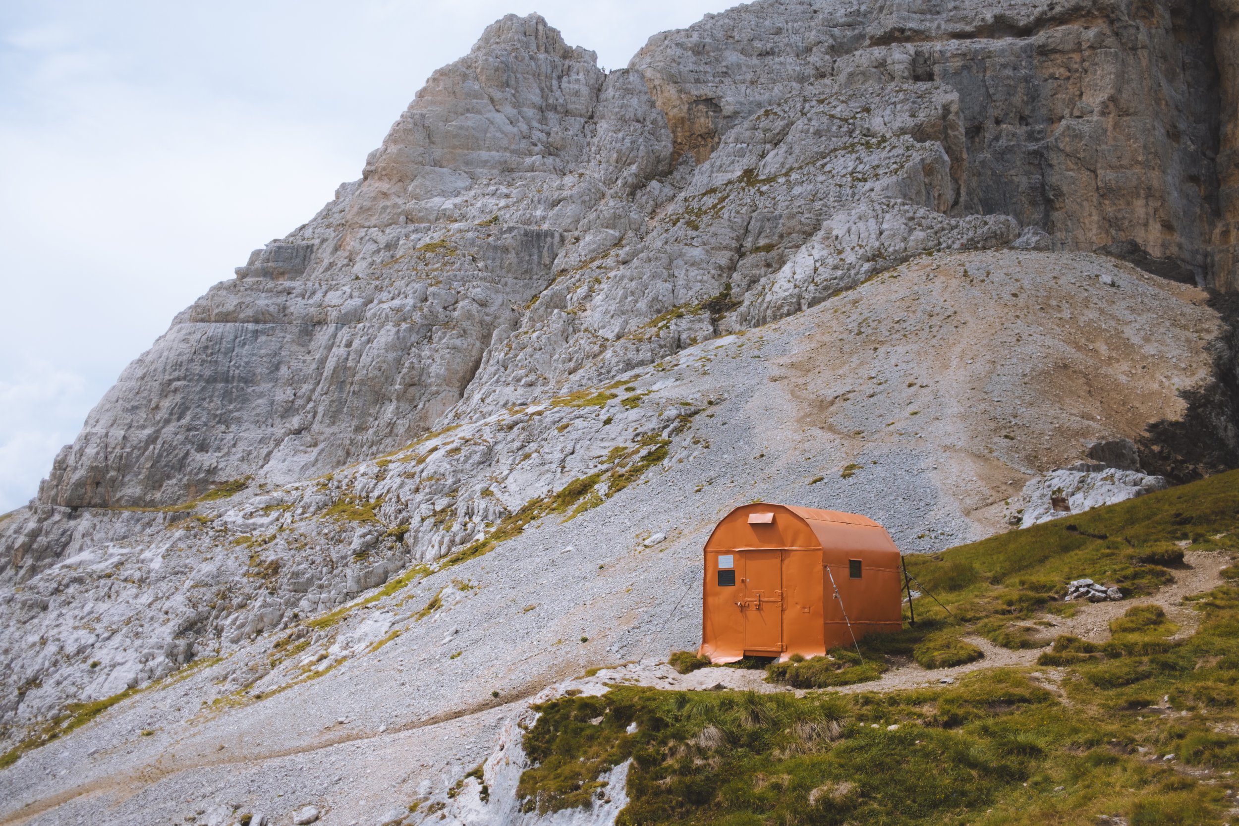
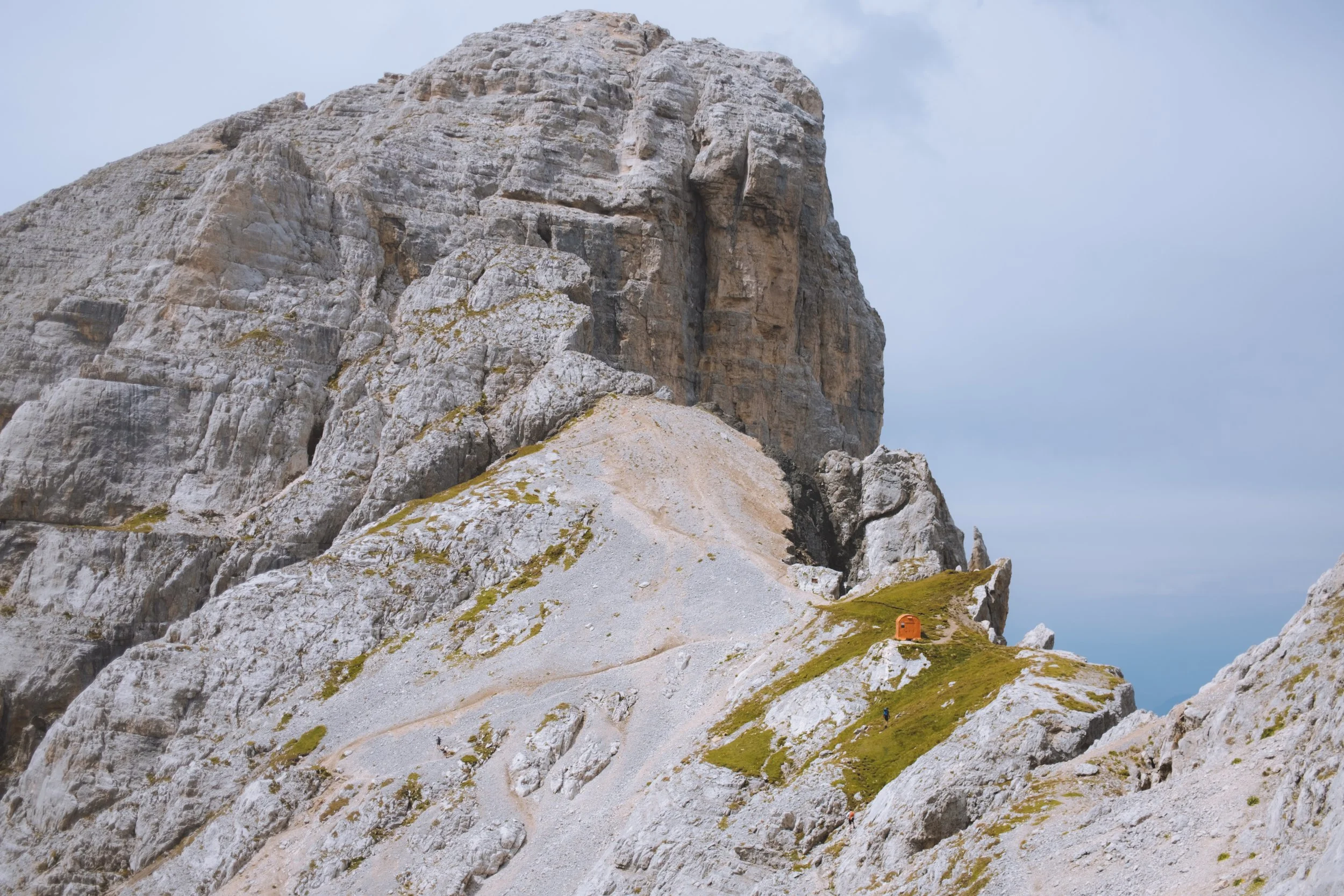
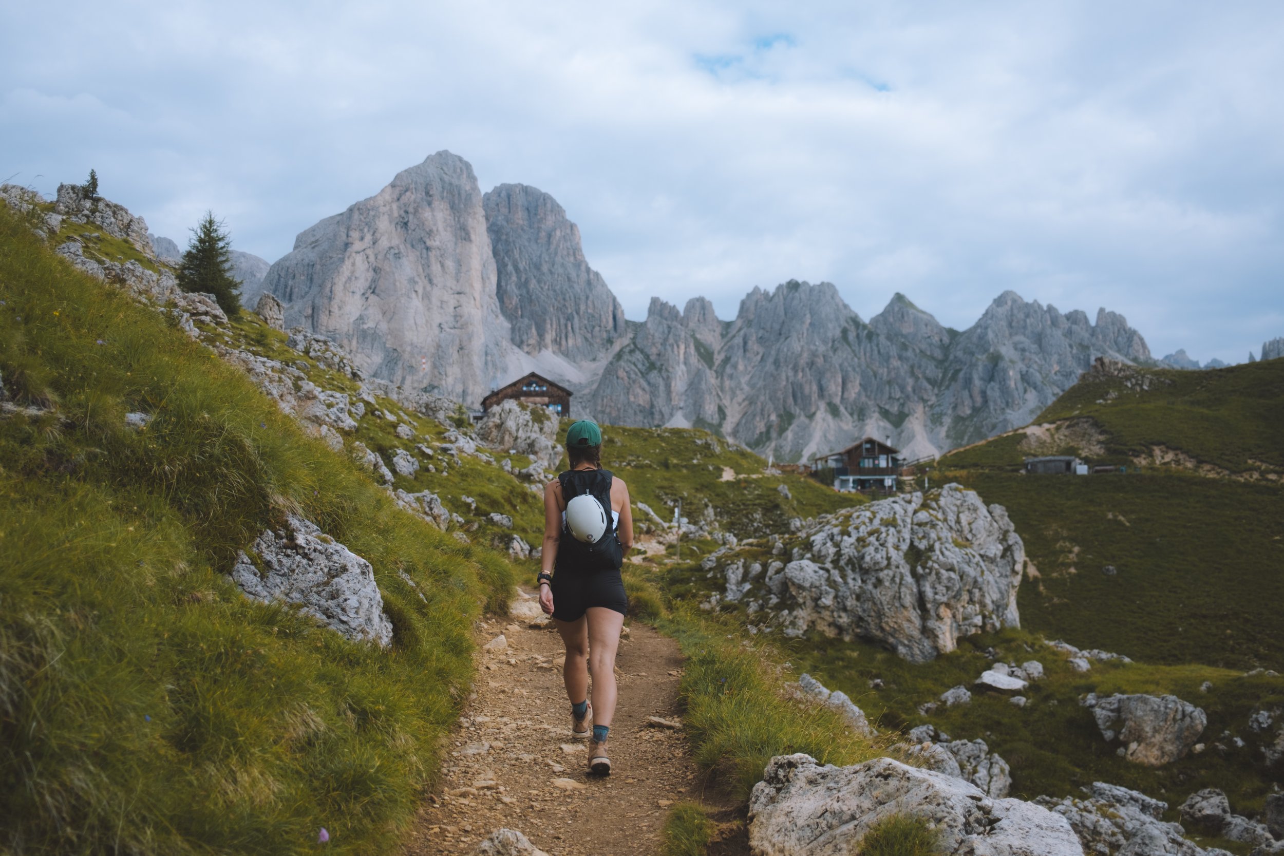
I, once again, felt the need to prove something and chose the challenging option. This was also my first day of not reading my daily description and being difficult. The challenging option for this day includes the Via Ferrata dei Campanili del Latemar. I did not realize this until I woke up in the morning and was eating breakfast. There was no time to get the mandatory equipment. I could have chosen one of the easier options which passes by a set of very cute huts but no… the challenging option featured the cuetest little orange Bivacco Mario Rigatti hut and I was determined to see it with my own eyes.
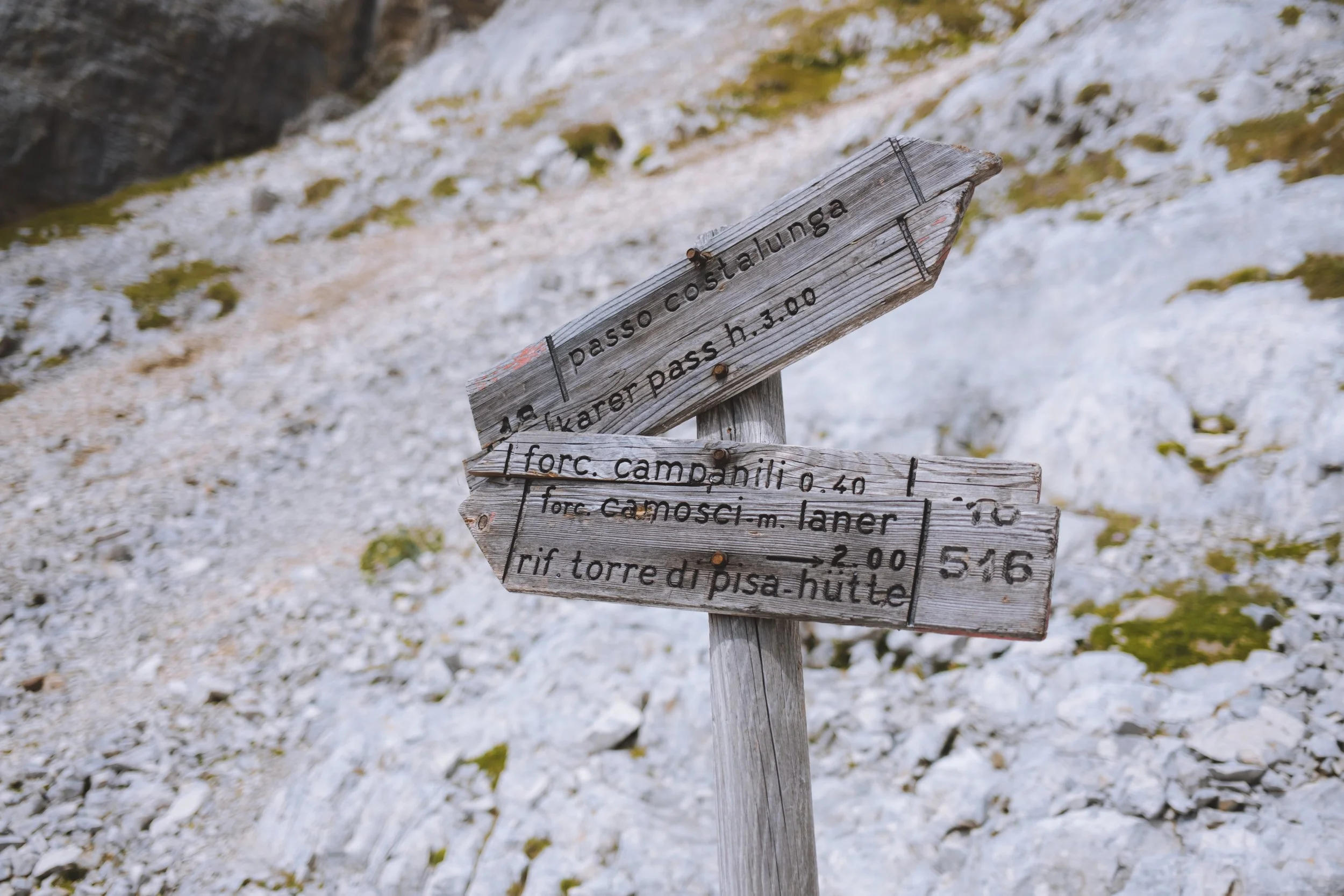
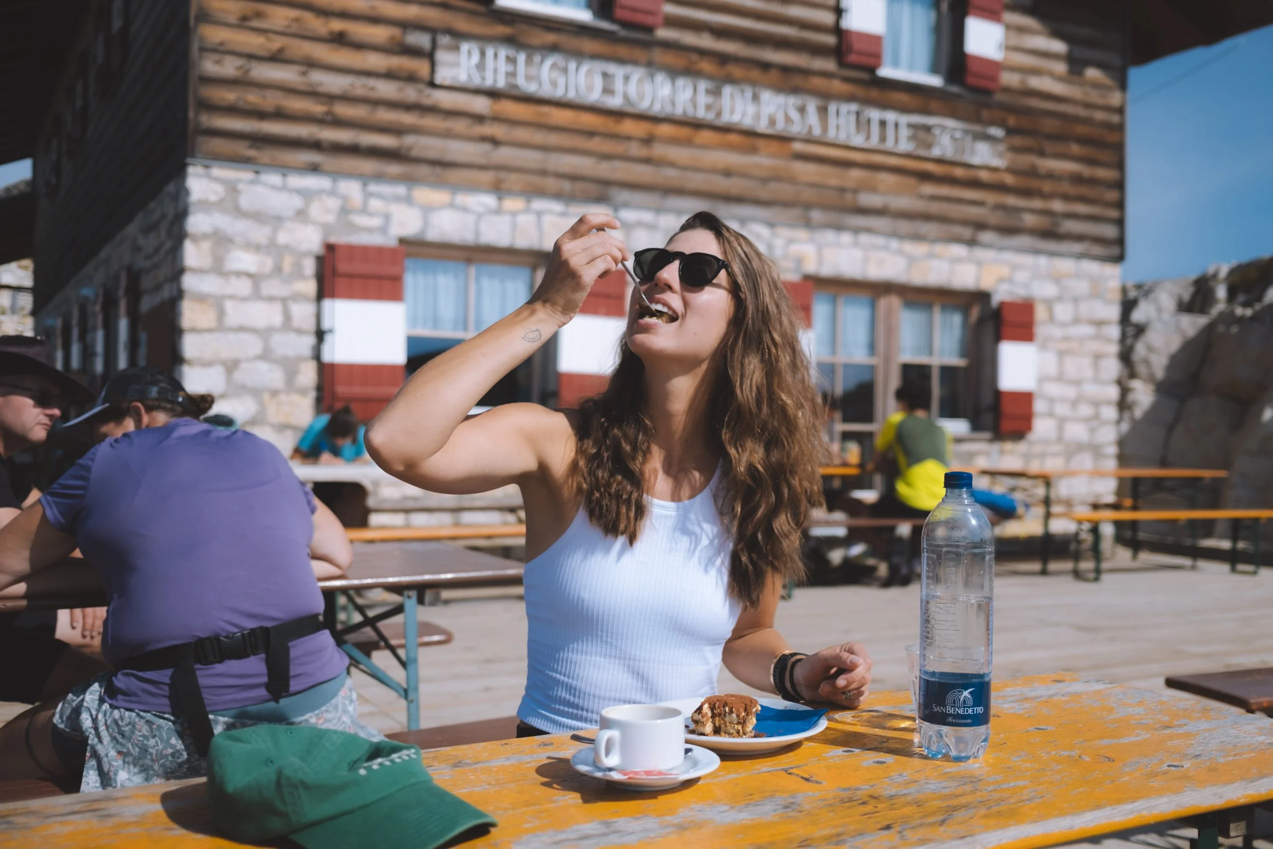
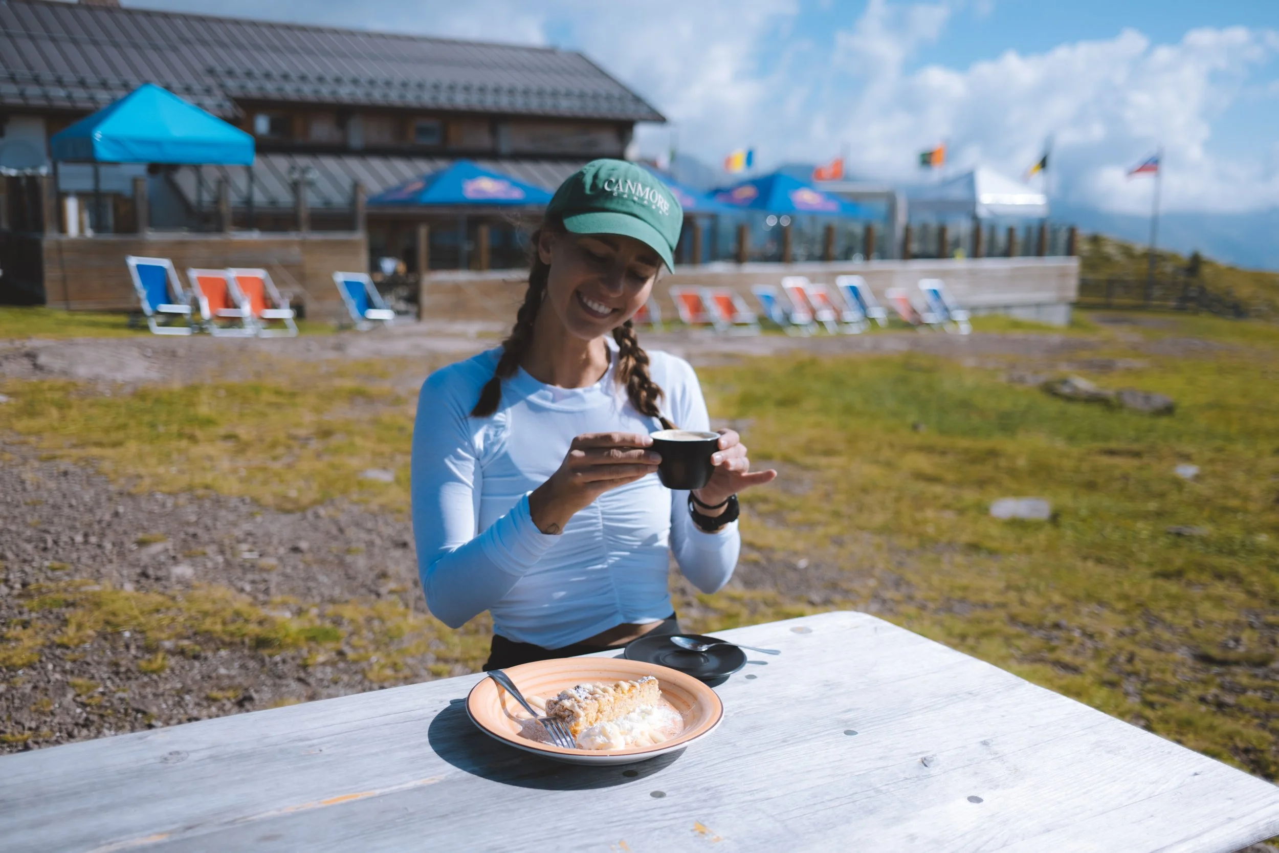
My first detour of the day was a small side quest to Refuge Tower Of Pisa - which I saw on the map and it looked beautiful. As I did in fact learn my lesson and well prepared with packed snacks galore for a day I knew may require a many hour backtracking detour because I am too stubborn… I stopped in for cake (tiramisu actually) and a coffee with an absolutely breathtaking view (do make this detour).
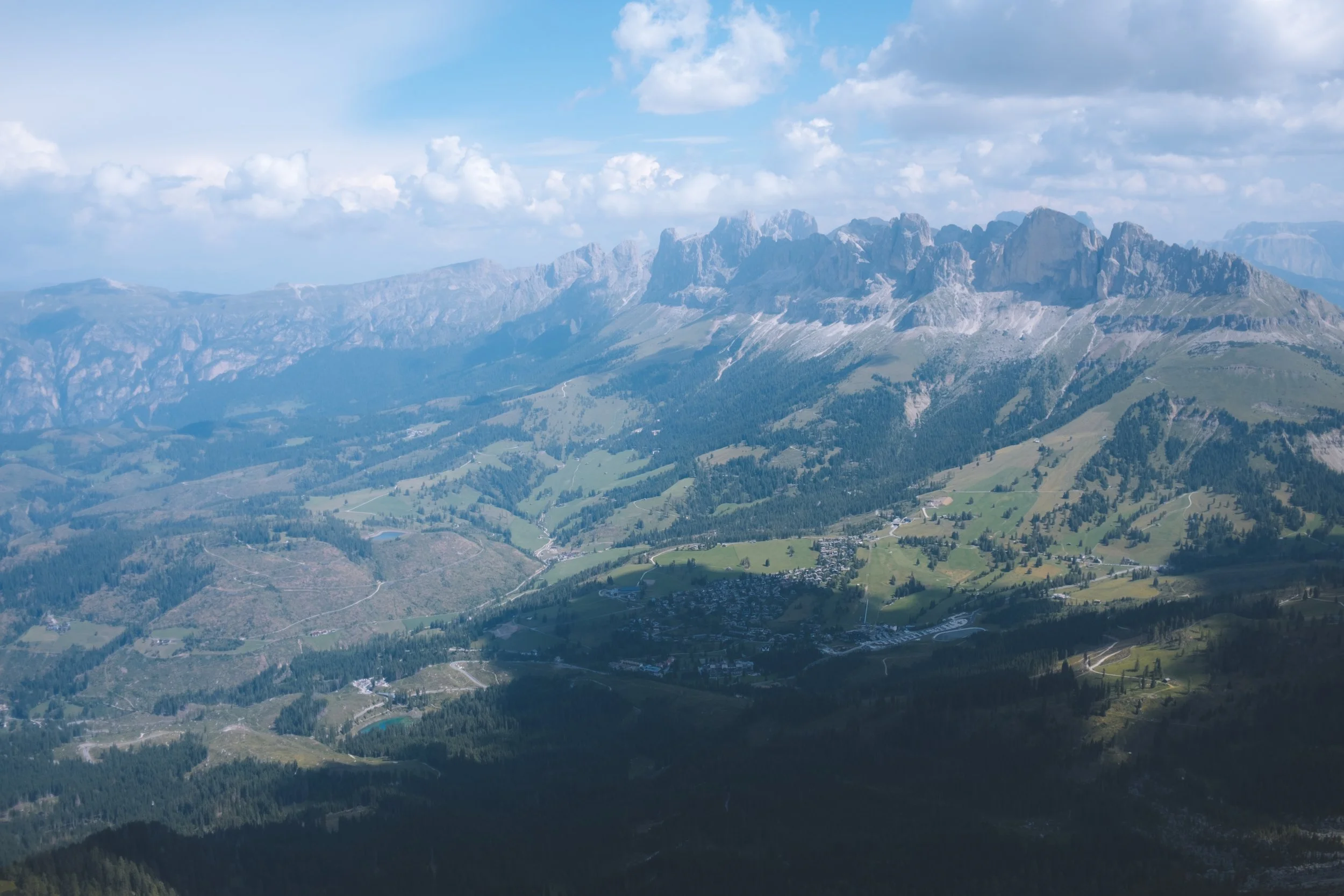
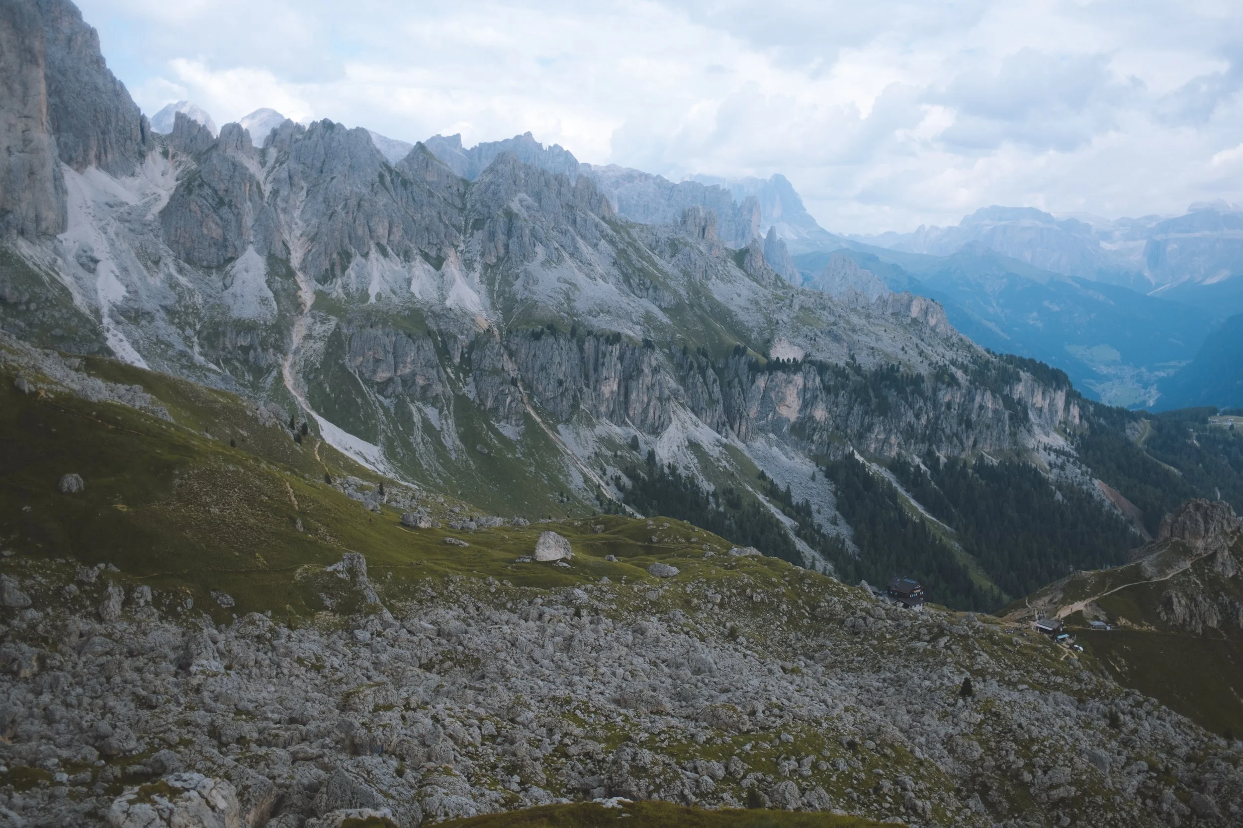
From there I did attempt to ask if it was possible to bypass the Via Ferrata dei Campanili del Latemar but… nobody understood what I was asking and I eventually gave up and decided that I was in need of an exploratory mission. I walked along the backside of the Gruppo del Latemar - an absolutely breathtaking landscape of white rock and meandered up the col to the entrance of the Via Ferrata dei Campanili del Latemar. It was extremely clear that without equipment this was not physically possible. Not just recommended but explicitly mandatory. And so if you cant go through it… maybe you can go around it. And that I did!
It was not as interesting or fun as the via ferrata would have been (I did not want to but did eventually look up photos - bring gear!) - and there were sections of extremely lose rock with some questionable no-fall zones. But a small path existed and I did eventually make it to the Bivacco Mario Rigatti hut - smug as a bug! It was so cute that it made the challenging journey worth it.
From there I continued up to the Pulpito di cima Pope - and then along the Ridgeline, down into the forest where I ended at the Sporthotel Passo Carezza - a very cool hotel that is actually owned by a former ski teammate of my ex boyfriend. What a small world! But if you do get the chose of hotels - request Sporthotel Passo Carezza - I am determined to go back in the winter. It also had the best cappuccino of my entire stay in europe.


Day three
The Dolomites Ronda day 2
starting point : Carezza
distance : 13.95km
elevation gain : 1,073m
elevation loss : 1,225m
transport : Paolina chairlift (up) Colbricon Express (down)
daily trail time : 6:23:13
cake : Ciampedie refuge
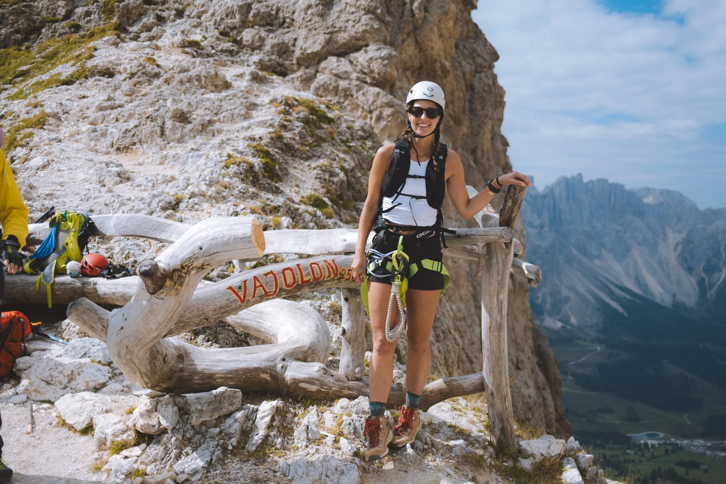
lunch : Roda di Vaèl hut
ending point : San Pellegrino (not the water)
my thoughts
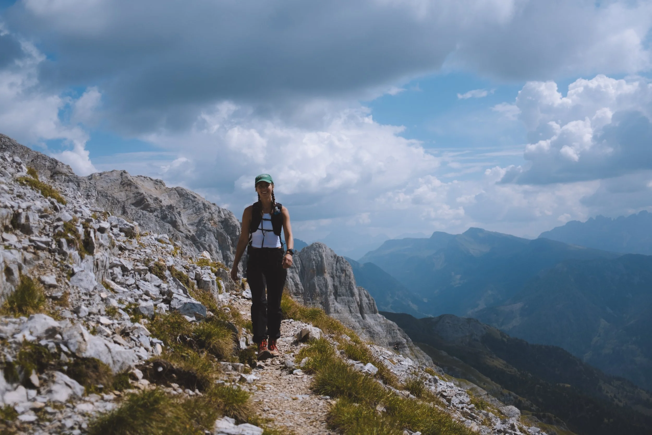
The lovely staff at Sporthotel Passo Carezza gave me a lift down to the starting point of my hike. They were also able to arrange Via Ferrata gear for me to rent (I don’t know if this is available to everyone or they made a big exception for me so please don’t quote me on this and bring your own gear as you will want it multiple days).
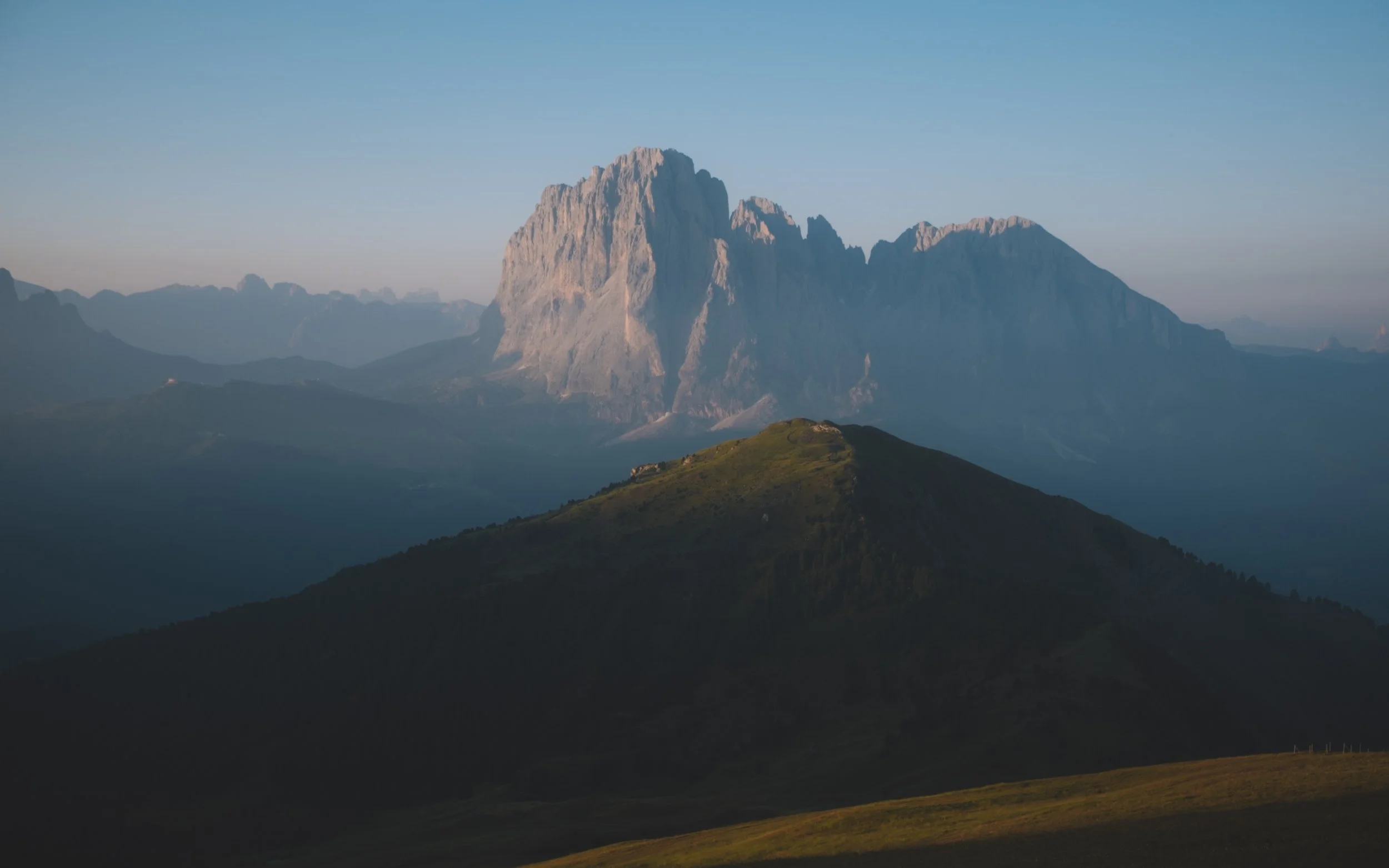
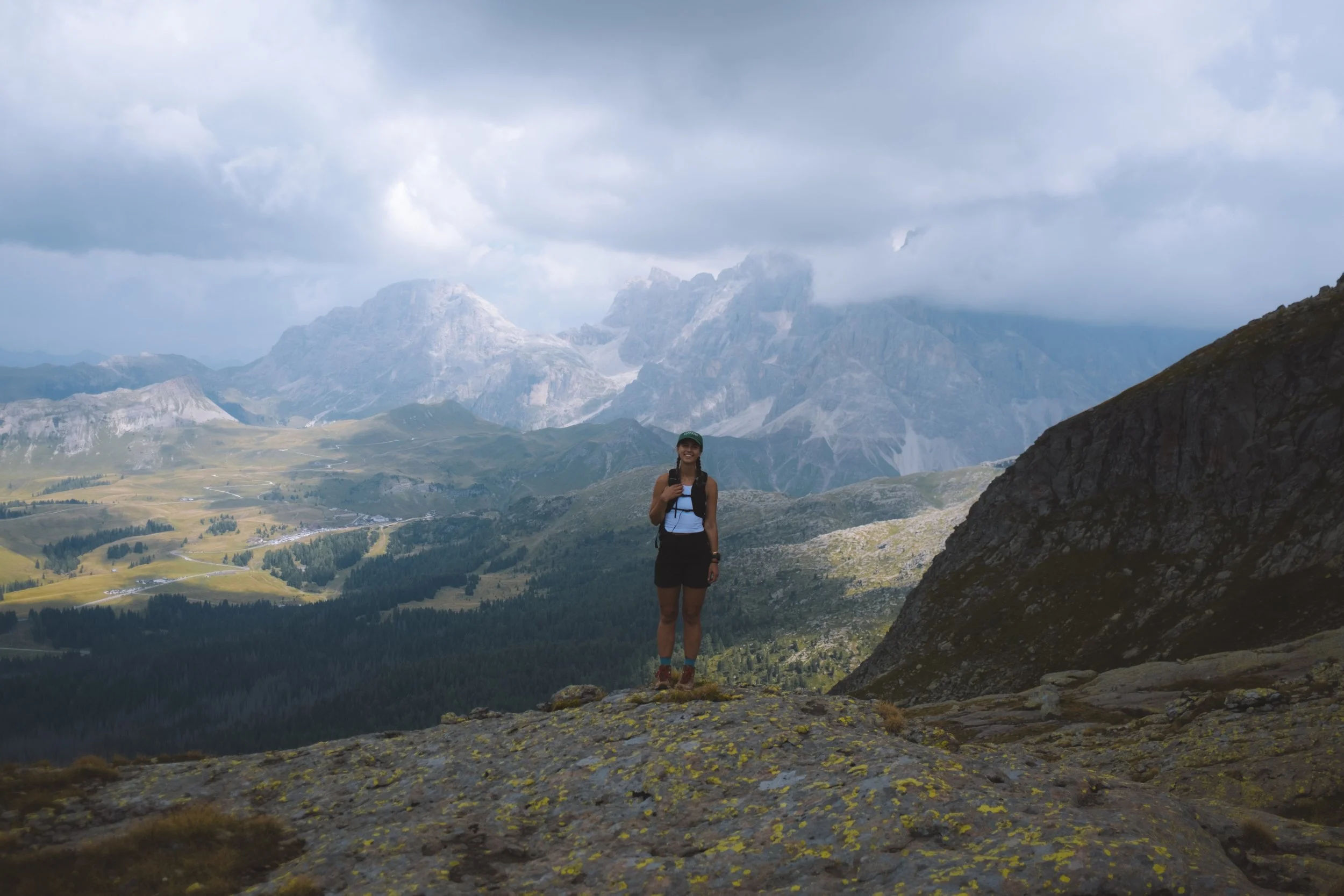
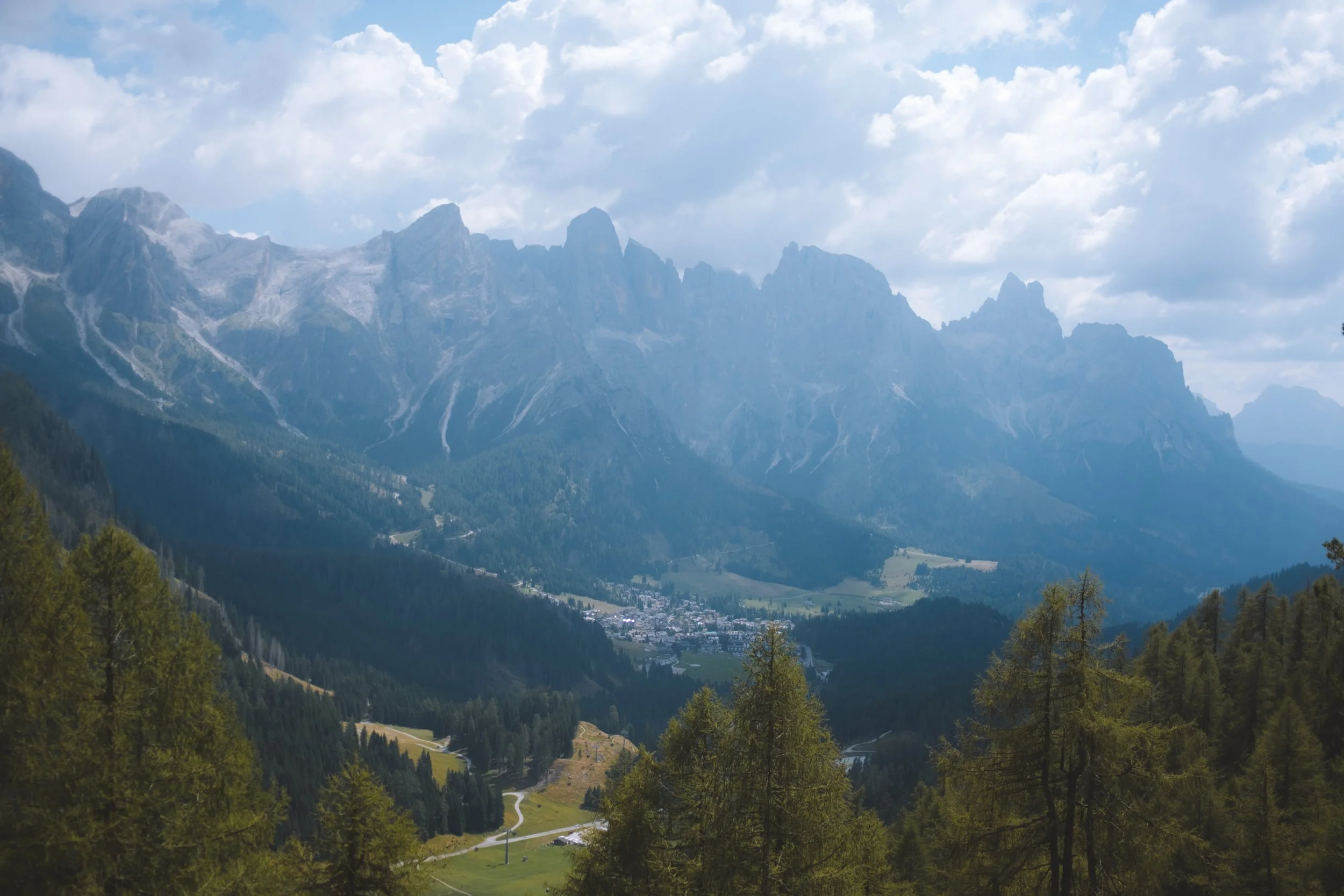
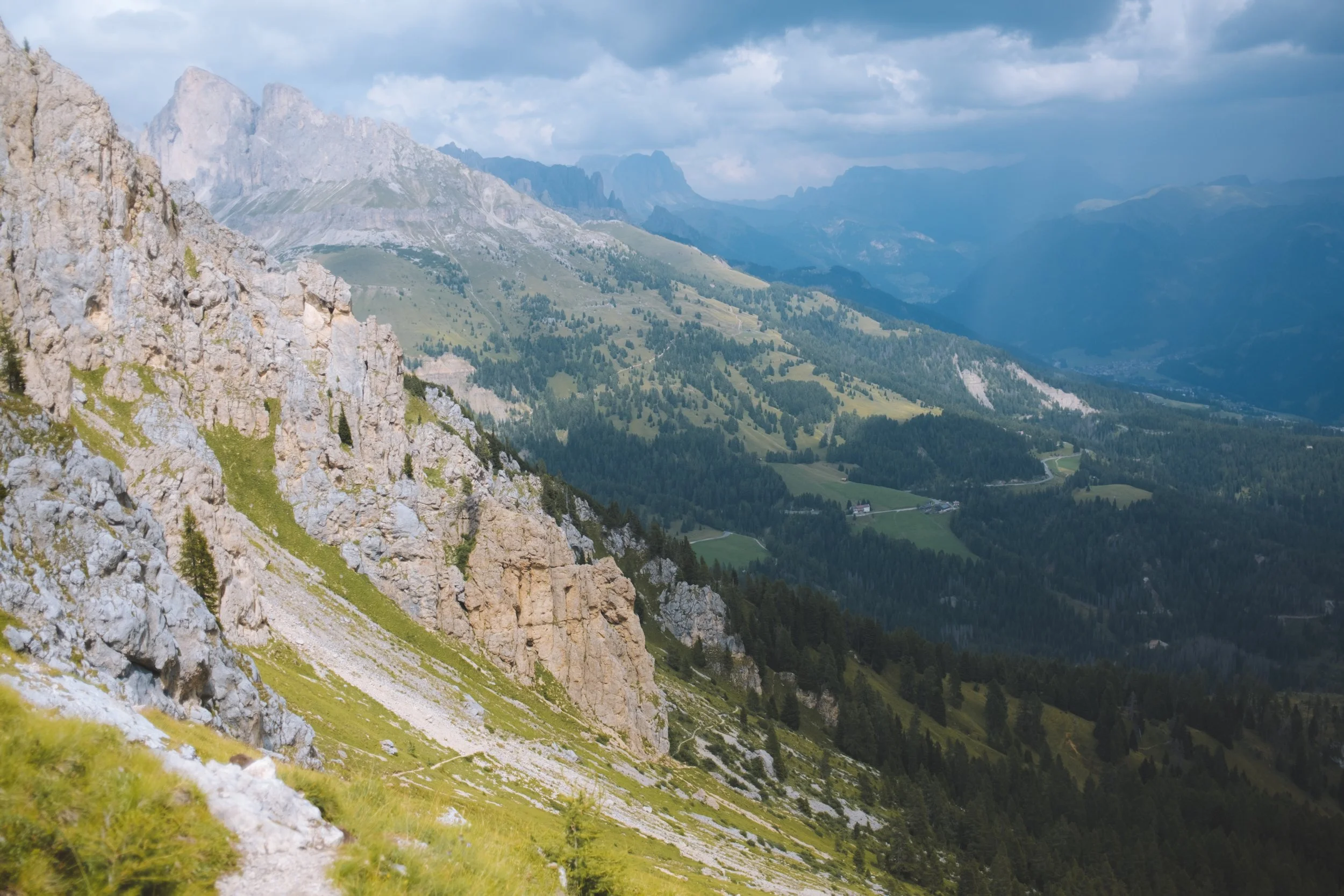
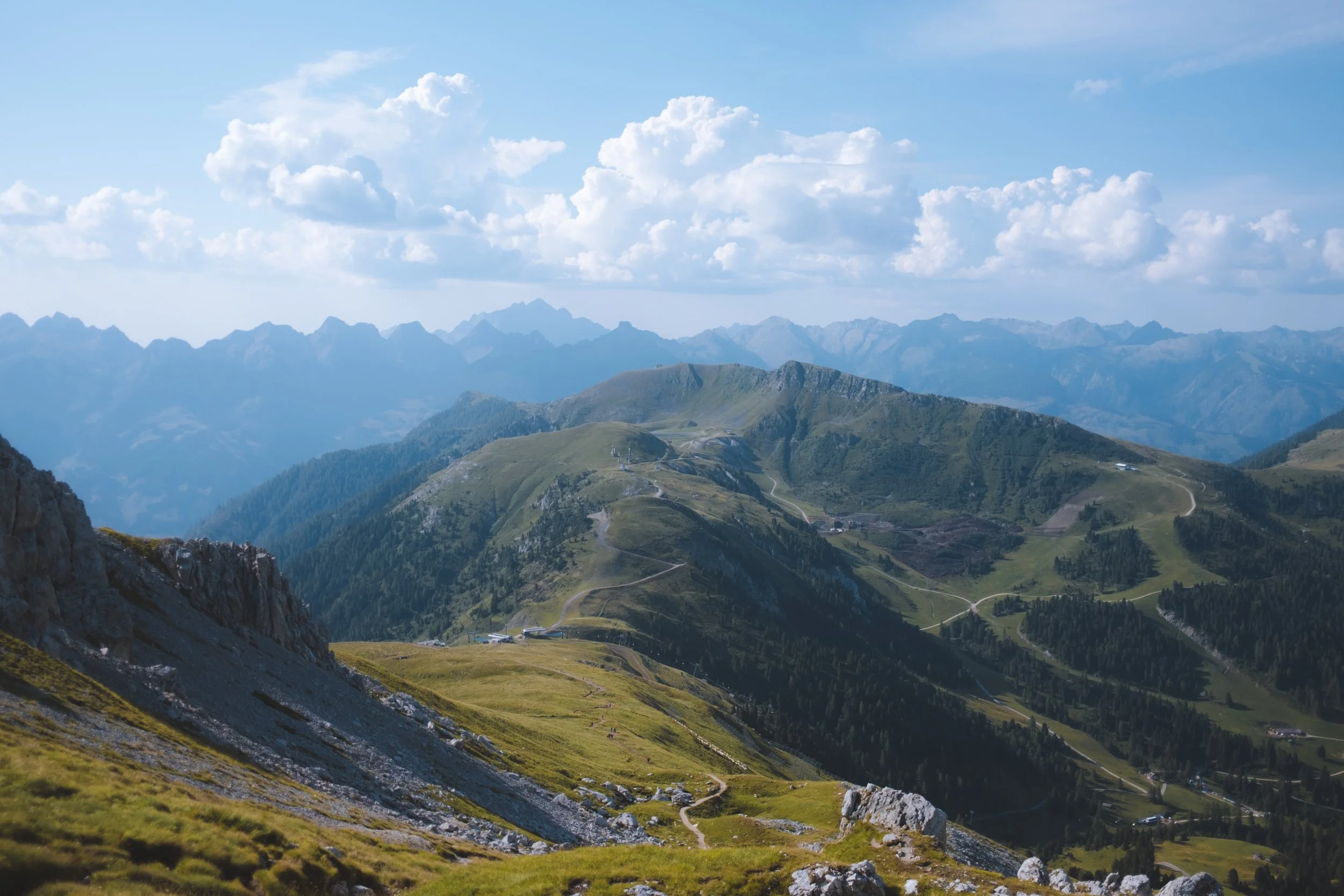
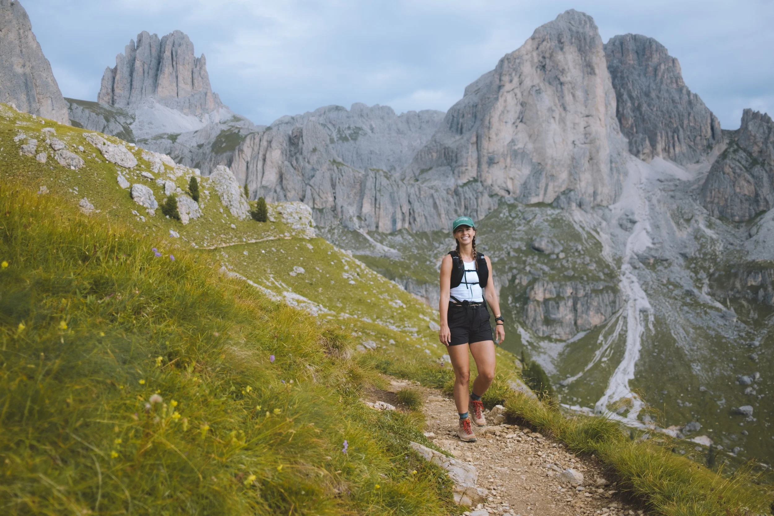
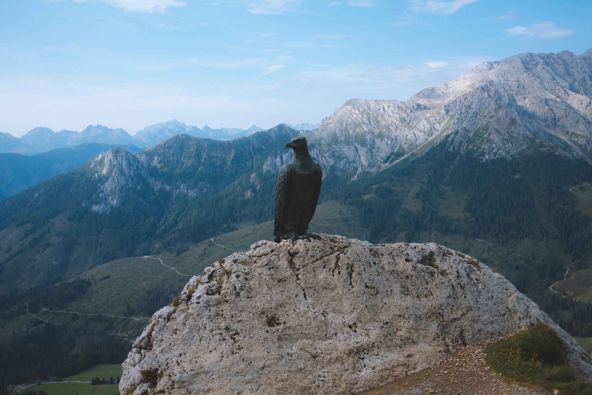
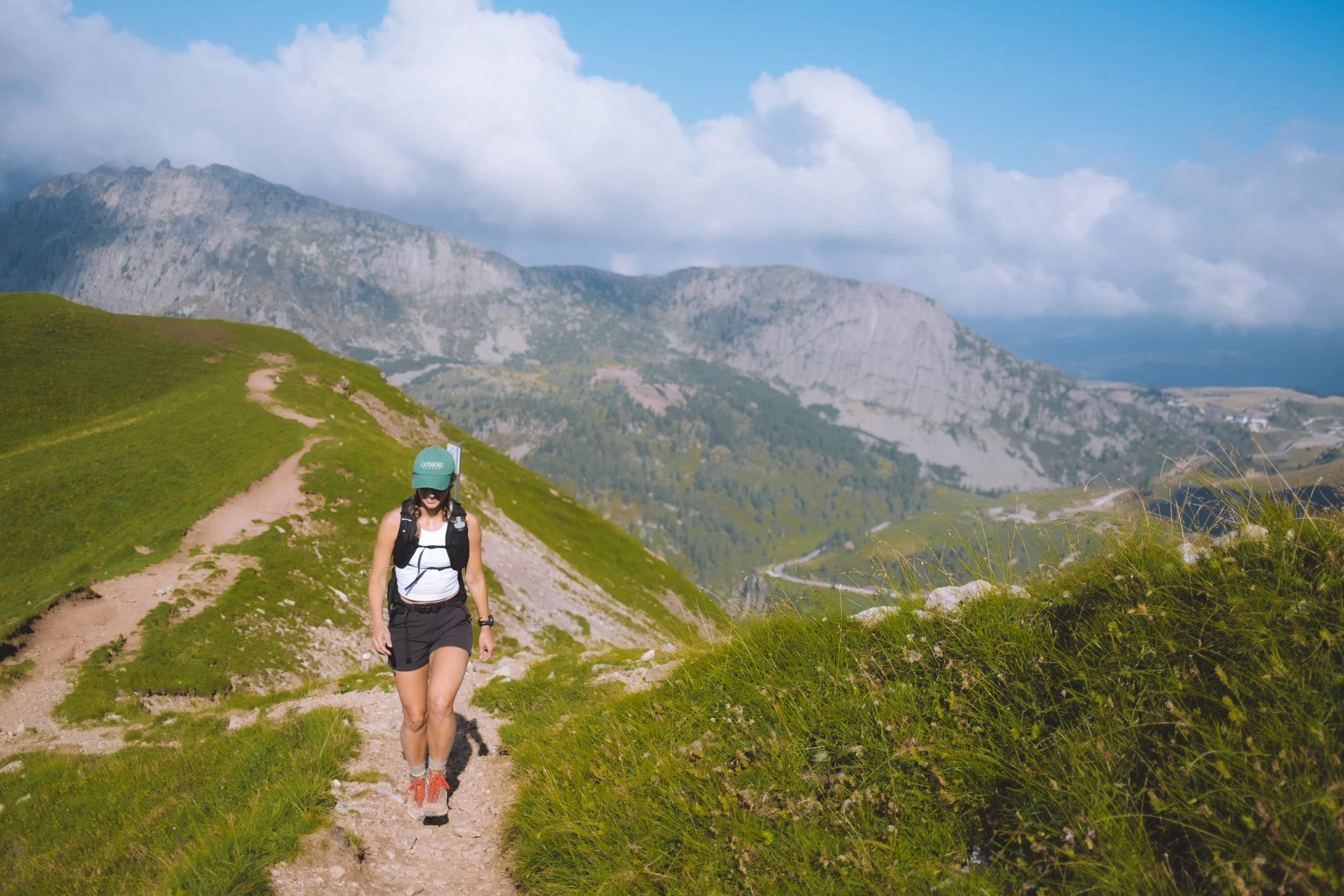
I, of course, chose the challenging option. From the top of the chairlift you meander up a gradual trail and pass the Christomannos monument - a 2.7-meter-tall bronze eagle commemorates the achievements of Austrian tourism pioneer Theodor Christomannos, who played a key role in the development of tourism in the region. It also looks over the hike from the previous day. That was one thing that I really enjoyed about this route. That you were able to start most days looking back at what you had completed the day before and end it looking at what was to come.
This route was fun in that it was a thru hike with a silly little loop in the middle where you will enter the Via Ferrata Roda de Vaèl - the first section to the summit was quite easy and could arguably be done without the gear (liability disclosure : don’t do this) - but from he summit you will have a down climb that I would personally not do without being tied in. After this small chimney section you have the option to either exit back to the Roda di Vaèl hut (this is the crossover of the loop and the main trail) or continue on to the second section of Via Ferrara. I chose the later. It was a lot of fun and in my opinion more exciting than the first half. The first half has a better view and the second half is more fun. So both very important.
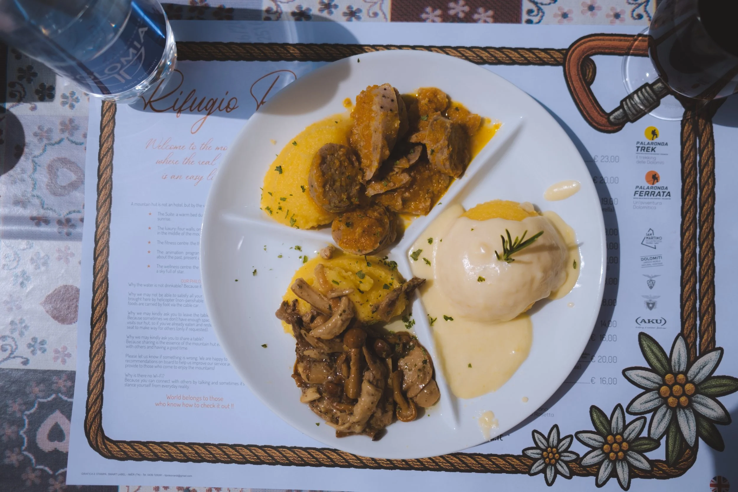
After I made it back to the Roda di Vaèl hut I sat down for an incredible wild mushroom polenta (and of course a cheeky coke) before continuing along the shoulder back toward…. Ciampedie refuge (remember from our warm up day where I became a thief!) I paid my debts and ate a piece of chocolate cake in the pouring rain before taking the Catinaccio Funivie to Vigo di Fassa where I was picked up by a car and taken to my next night’s accommodation.


Day four
The Dolomites Ronda day 3
starting point : San Pellegrino
distance : 25.56km
elevation gain : 1,228m
elevation loss : 1,765m
transport : Col Margherita cable car (up)
daily trail time : 7:07:08
cake : Rifugio Laresei
lunch : Baita Segantini
ending point : Passo Rolle/Valles

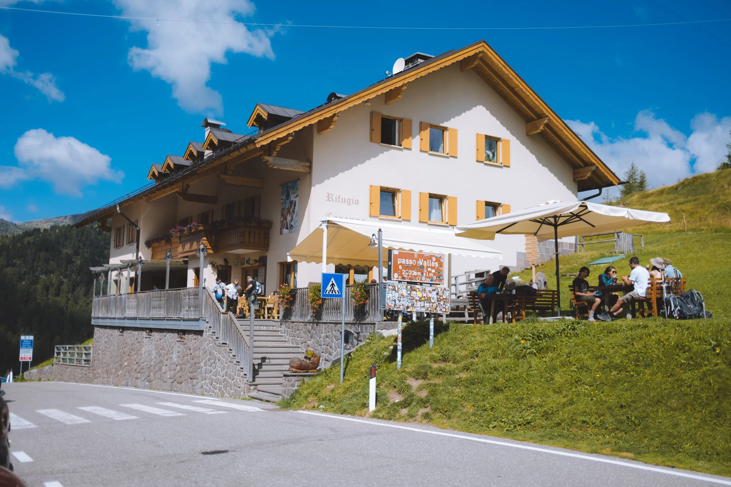
my thoughts
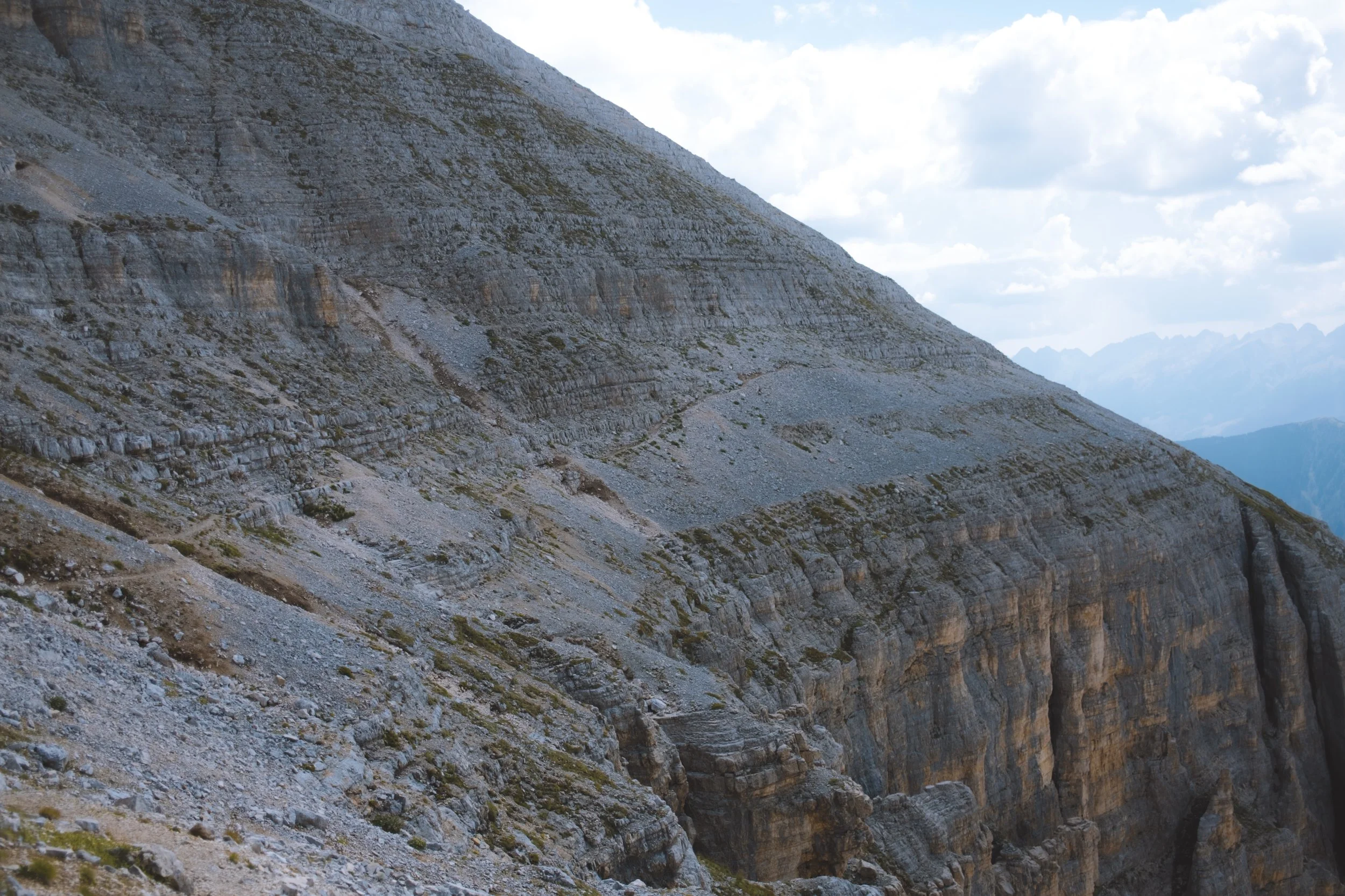
When will I ever learn? After a private transport ride to the Col Margherita cable car (make certain to get on the first cable car as this is a long day). I chose the challenging option once again. And even added on a small side quest.
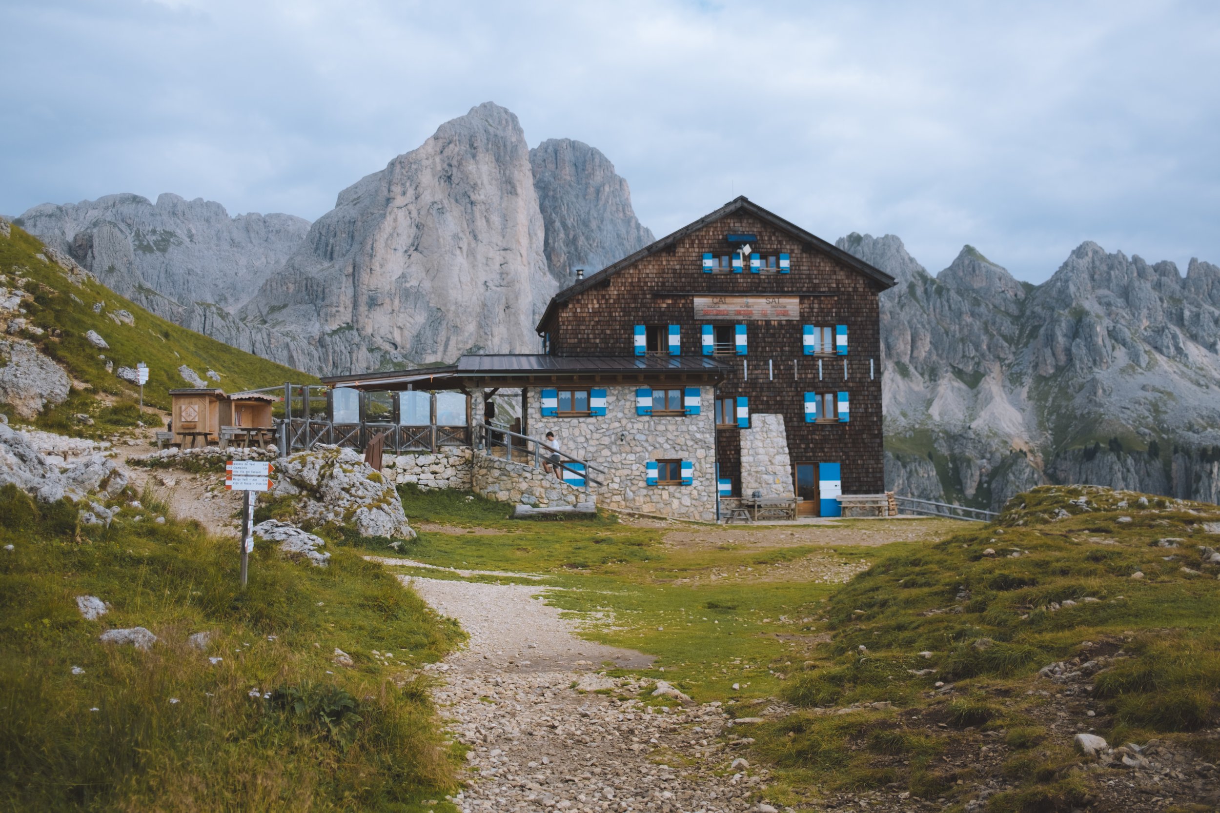
From the cable car I meandered down along the ski resort and saw in the distance a small hut - Rifugio Laresei - and enjoyed a piece of apricot cake looking over Lago di Cavia and the mountains that awaited me.
I then returned to the trail and made my way down to Passo Valles - and my biggest mistake of the day. The Rifugio Capanna Passo Valles was quite busy so I decided to continue hiking instead of stopping for lunch. Big mistake. BIG mistake.
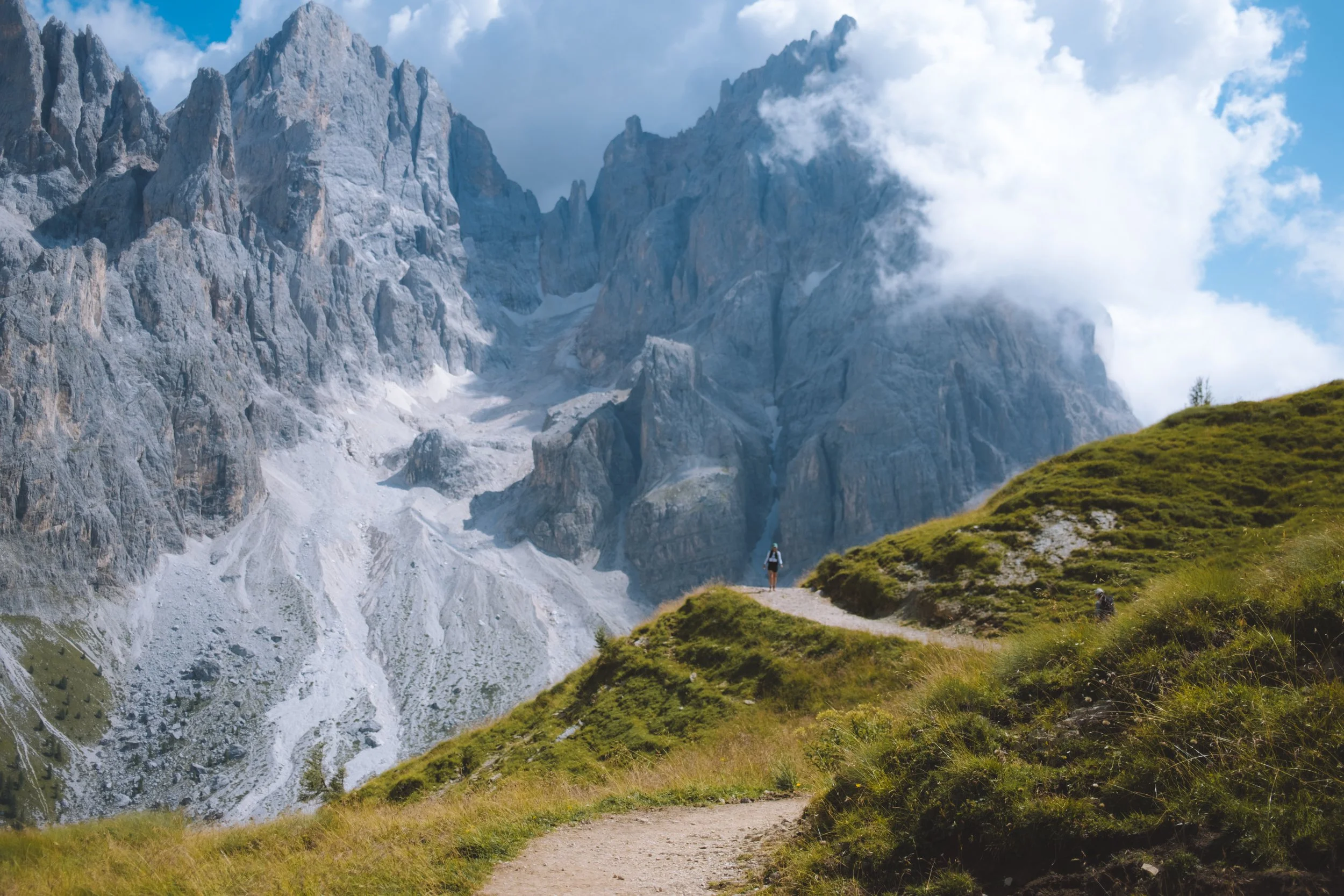
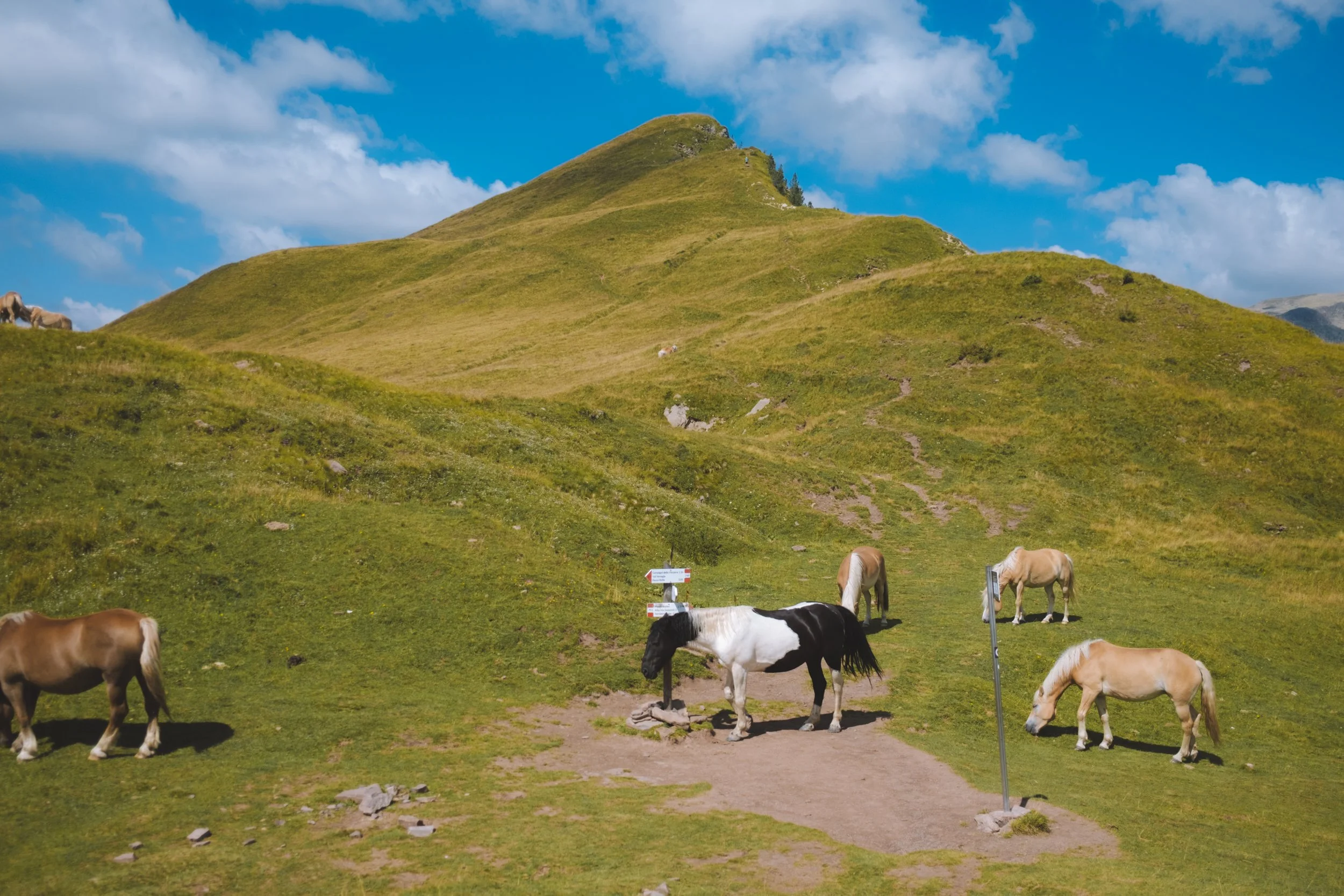
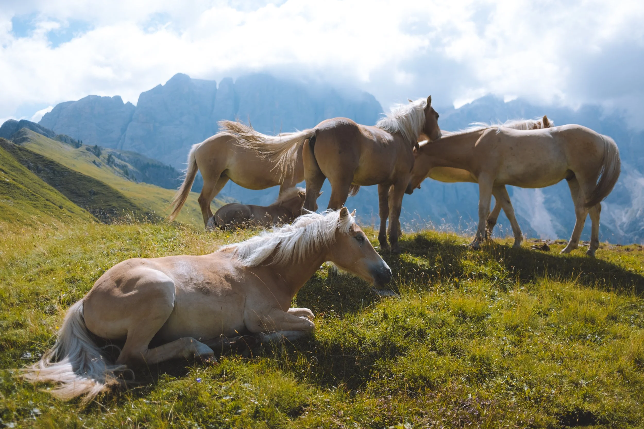
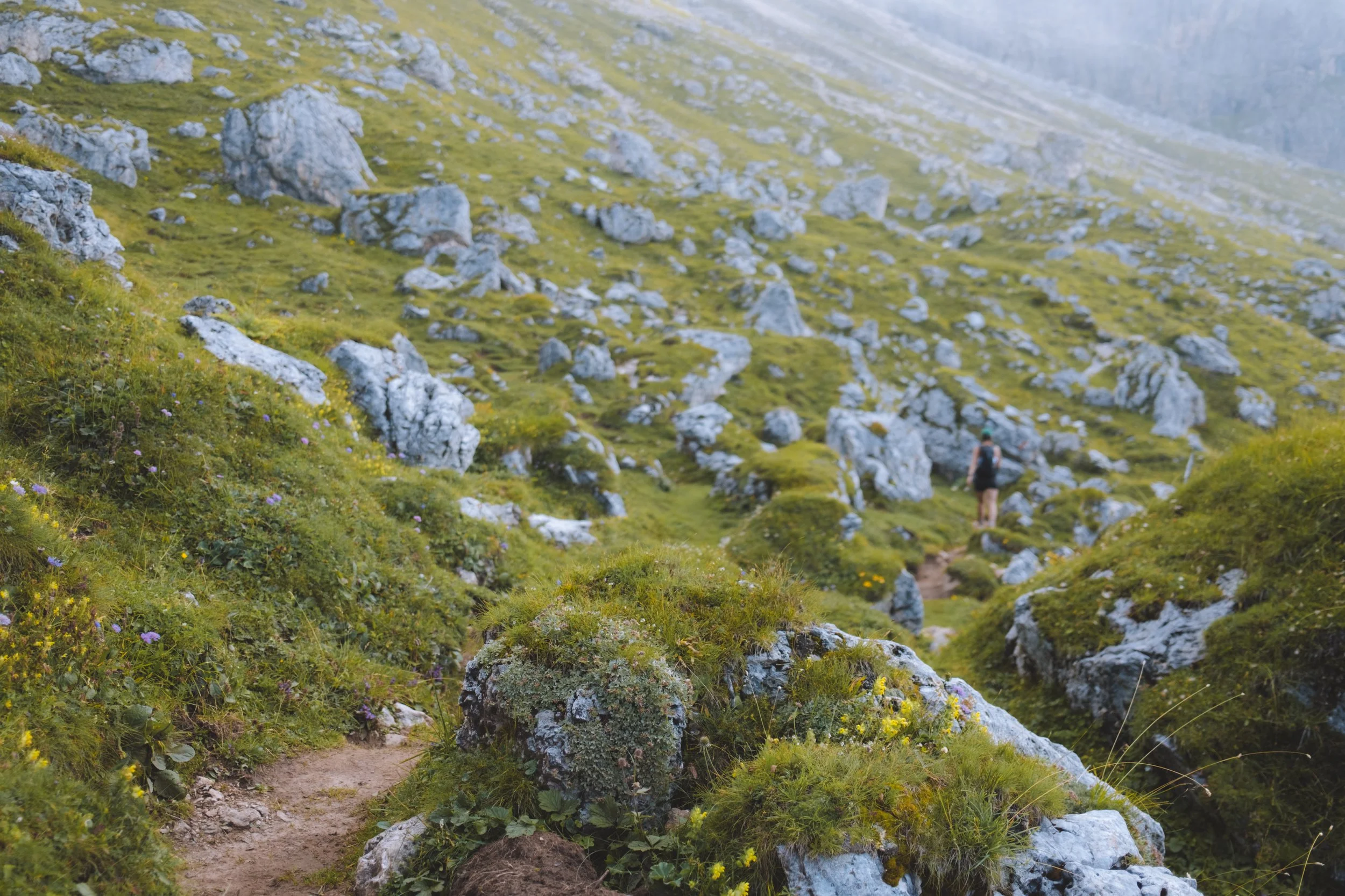
I pressed onwards up the slope to Forcella Venegia and a pass where I ws greeted by a group of wild horse - I did go up to the highpoint - Passo di Venegiotta - but honestly… I do not feel this was necessarily worth it and would likely opt to immediately descend to Val Venegia (the moderate option for this day).
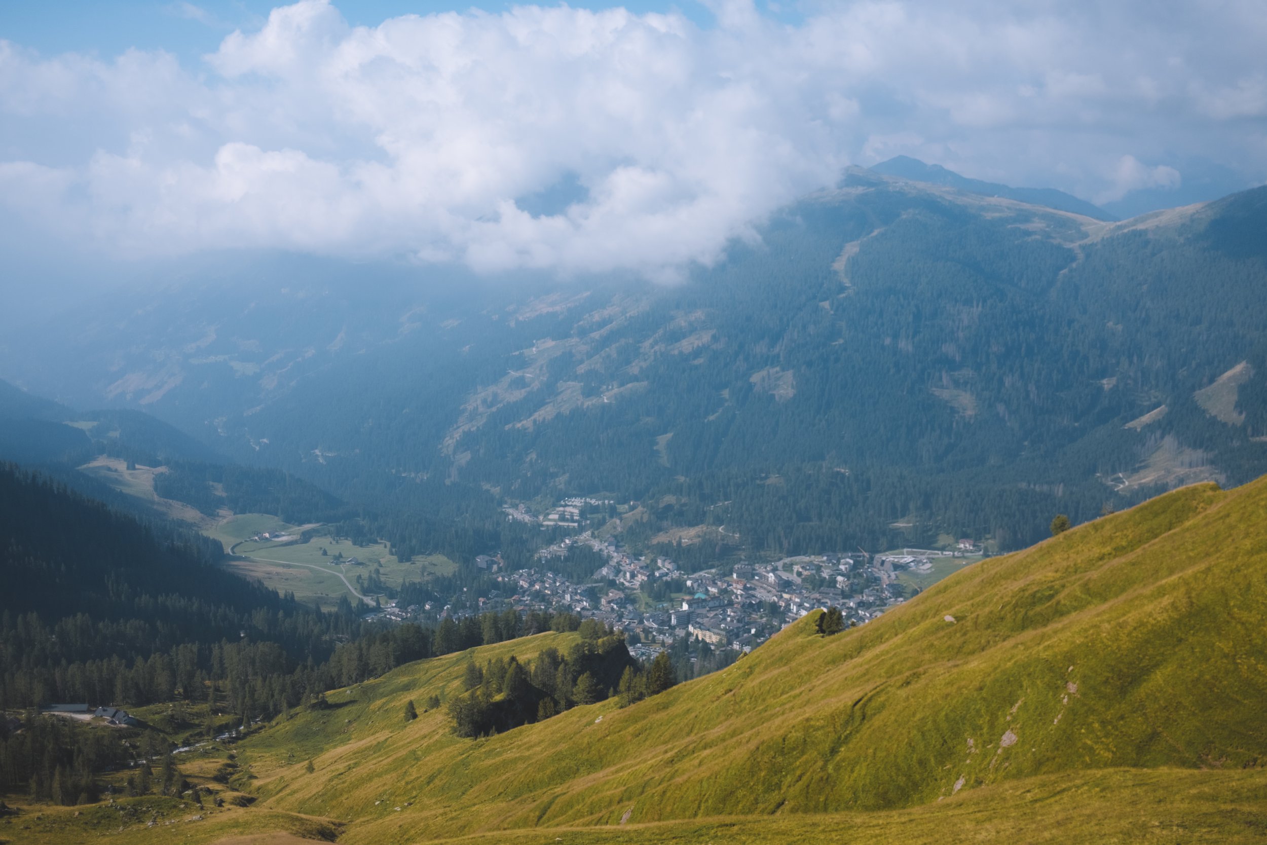
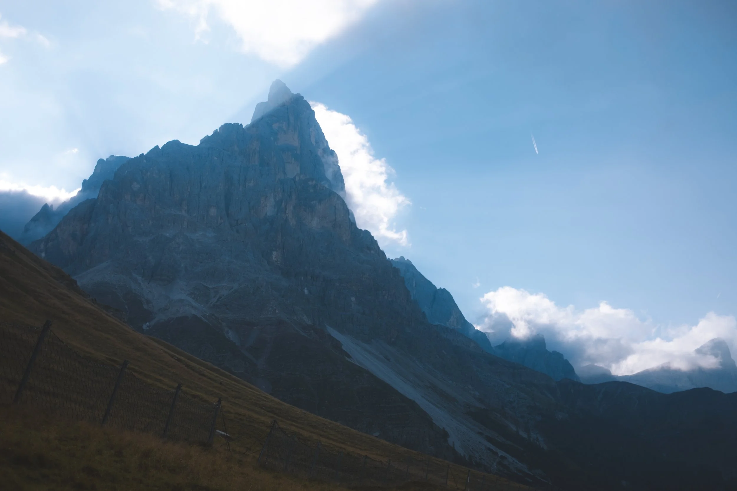
I did make it to the Baita Segantini and had a very late lunch (apparently with the entirety of Italy as this was extremely busy). And with this newly found energy I looped up to the peak of Castellazzo which I DO recommend making the detour for. It has incredible views overlooking the northern Pala mountain. From here you simply meander down to Passo Rolle (remember - I told you we would find our way back here).
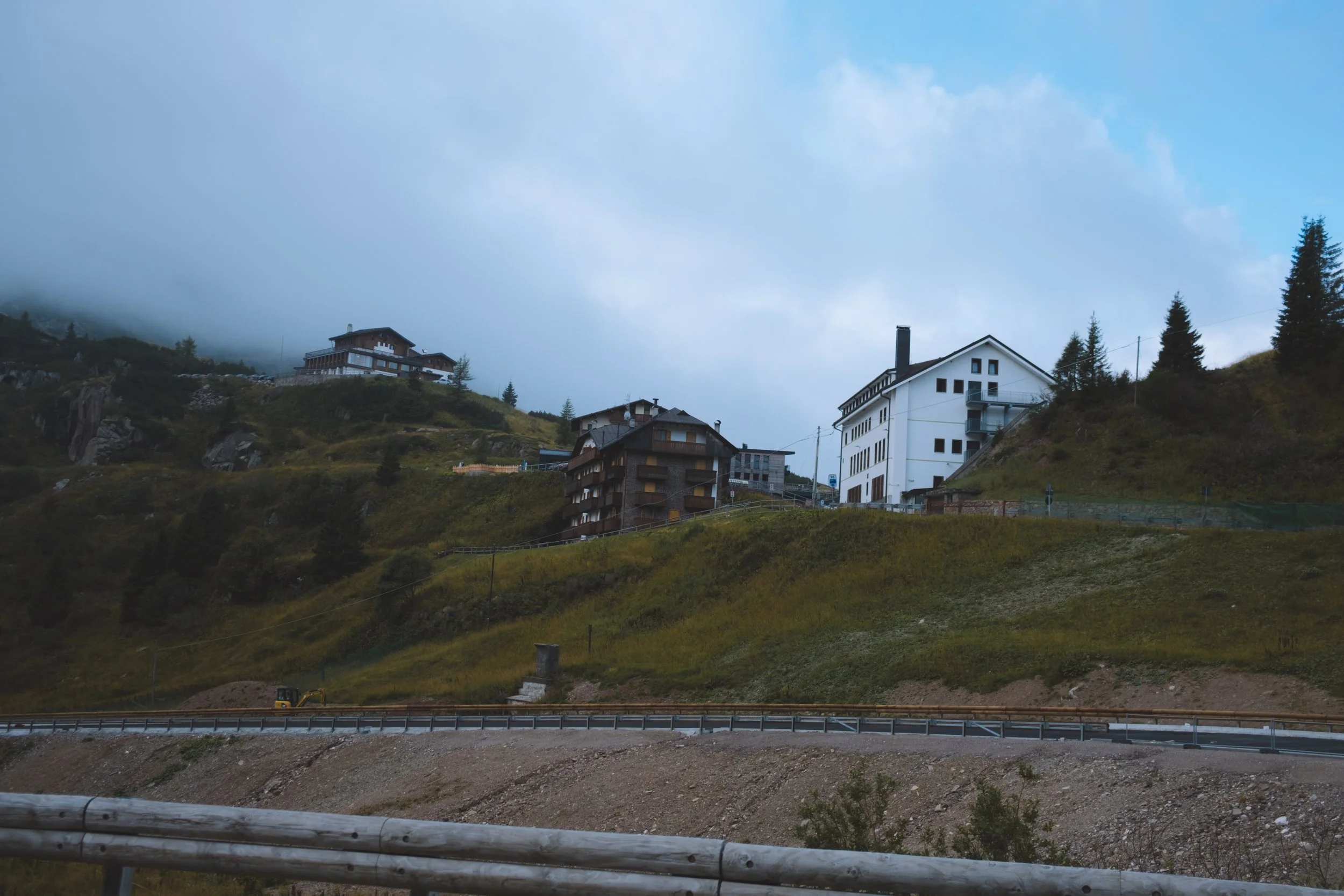
On this evening I stayed at the Albergo Vezzana hotel. And I have some notes. First : when booking ask if you can stay in the new rooms, this is what they advertise on their website and photos show up in google search. I stayed in an older room and it was fine… but not what I was expecting. ALSO - when you check in ask to be seated beside the windows for meals - and insist. I did this but they still sat me alone in a weird corner and my view for the evening was of the doors to the kitchen. It was extremely disappointing given the potential for the hotel I felt it let me down.

Day five
The Dolomites Ronda day 4
starting point : Passo Rolle/Valles
distance : 11.34m
elevation gain : 1,006m
elevation loss : 396m
transport : none
daily hike time : 4:36:49
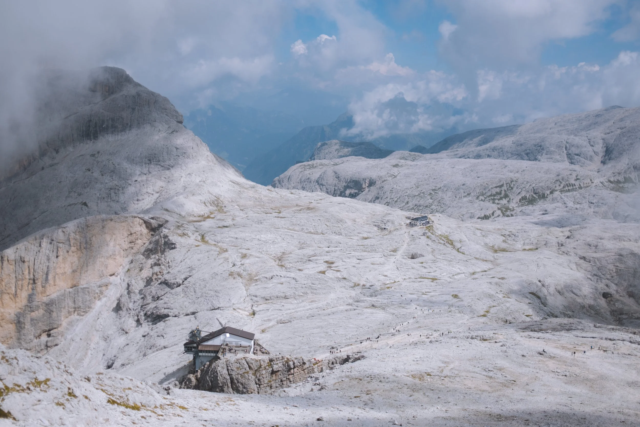
lunch : Rifugio Rosetta
ending point : Rifugio Rosetta
my thoughts
Our final day and on this day I did start hiking from my hotel and was able to get an earlier start. Unfortunately… the way that the trail orients it would have likely been better to sleep in and have a slow morning. Especially as I was cutting this day short so my path ended up being the moderate option as I had booked into a hut for my bonus evening.
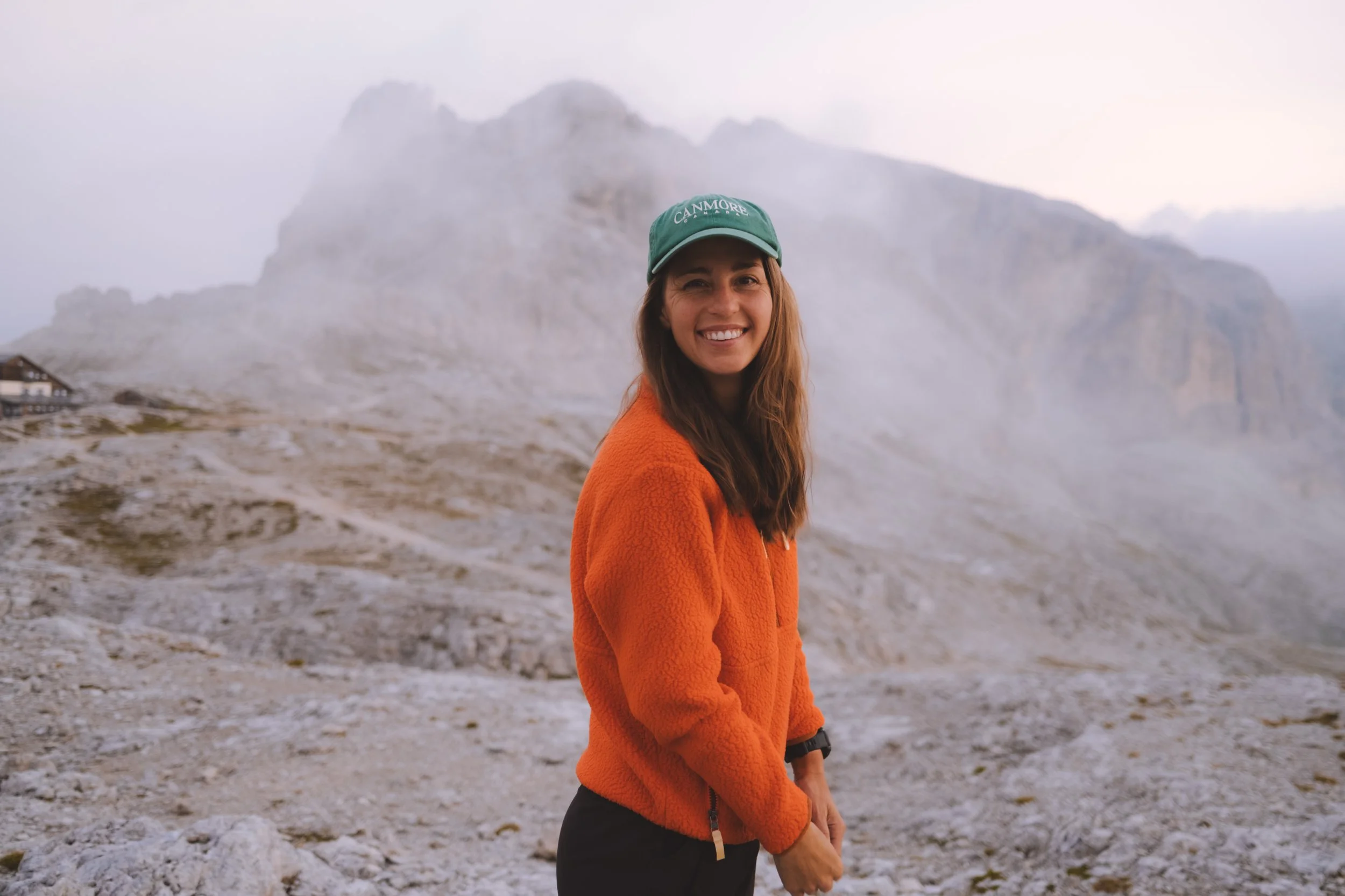
This trail beings at Passo Rolle and essentially meanders up hugging the shoulder with amazing views of the San Martino valley and the Lagorai mountains before a steep set of switchbacks bring you to Rosetta Pass. The highlight of the day is the summit of the Cima Rosetta - which allegedly has beautiful expansive views… but I was stuck in a cloud. Oh well, that is just the way the cookie crumbles sometimes! I spent the afternoon on the patio of the Rifugio Rosetta before settling in for the night.
This time I was ready and ended up in a non bunk bed in a room with 5 other people. The last couple to arrive did try to con their way out of the top bunks with short ceilings to no avail. Stand your ground! This hut has wifi for purchase but only in the eventings and it is $$$. Dinner was good, nothing exceptional and there was only one person who snored in our room. So I count that as a win!


Bonus Day
A night at Rifugio Rosetta
starting point : Rifugio Rosetta
distance : 0.54 km
elevation gain : 44m
elevation loss : 8m
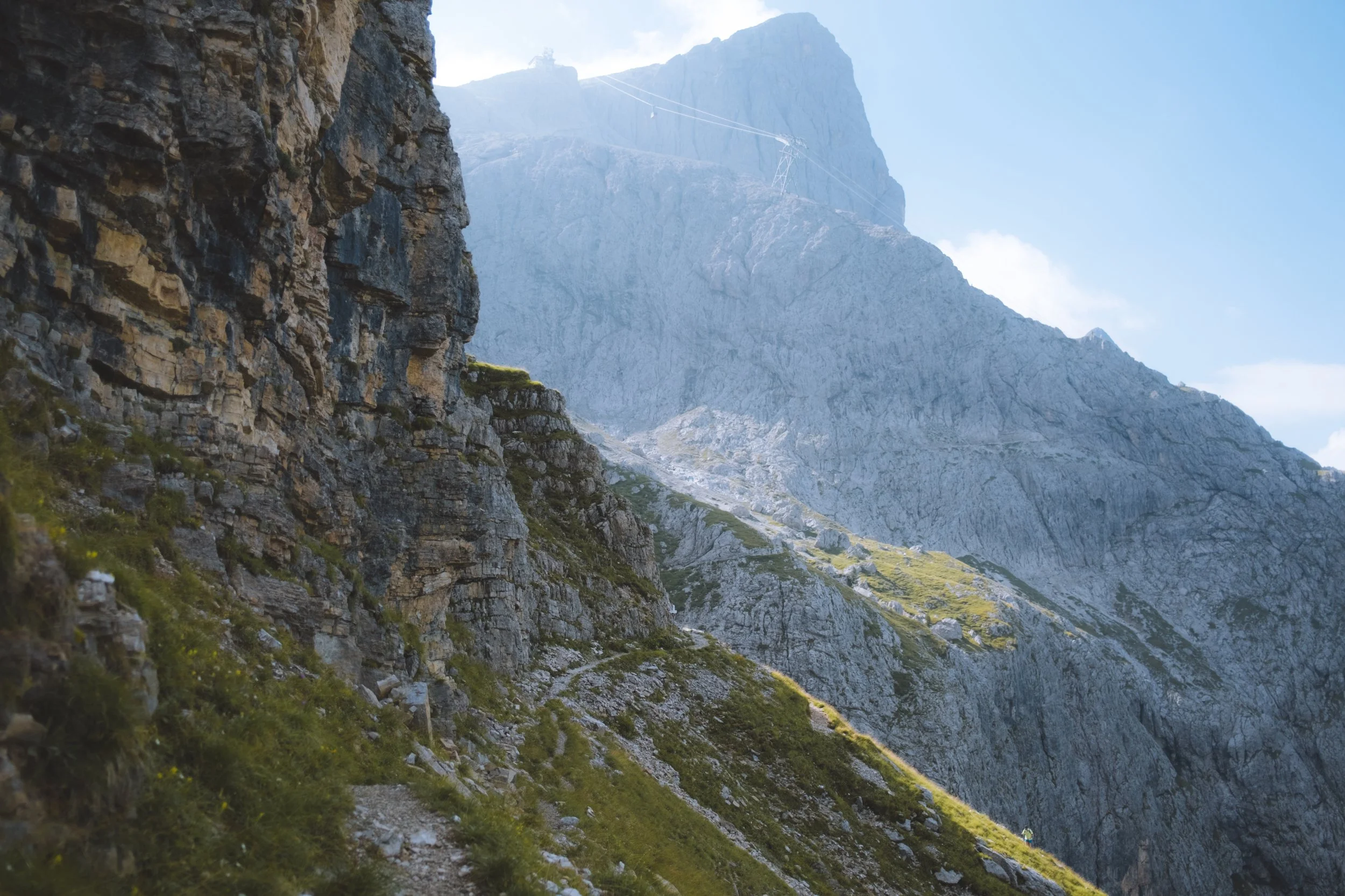
transport : Colverde - Funivia Rosetta (down)
daily hike time : 00:08:23
ending point : San Martino di Castrozza
my thoughts
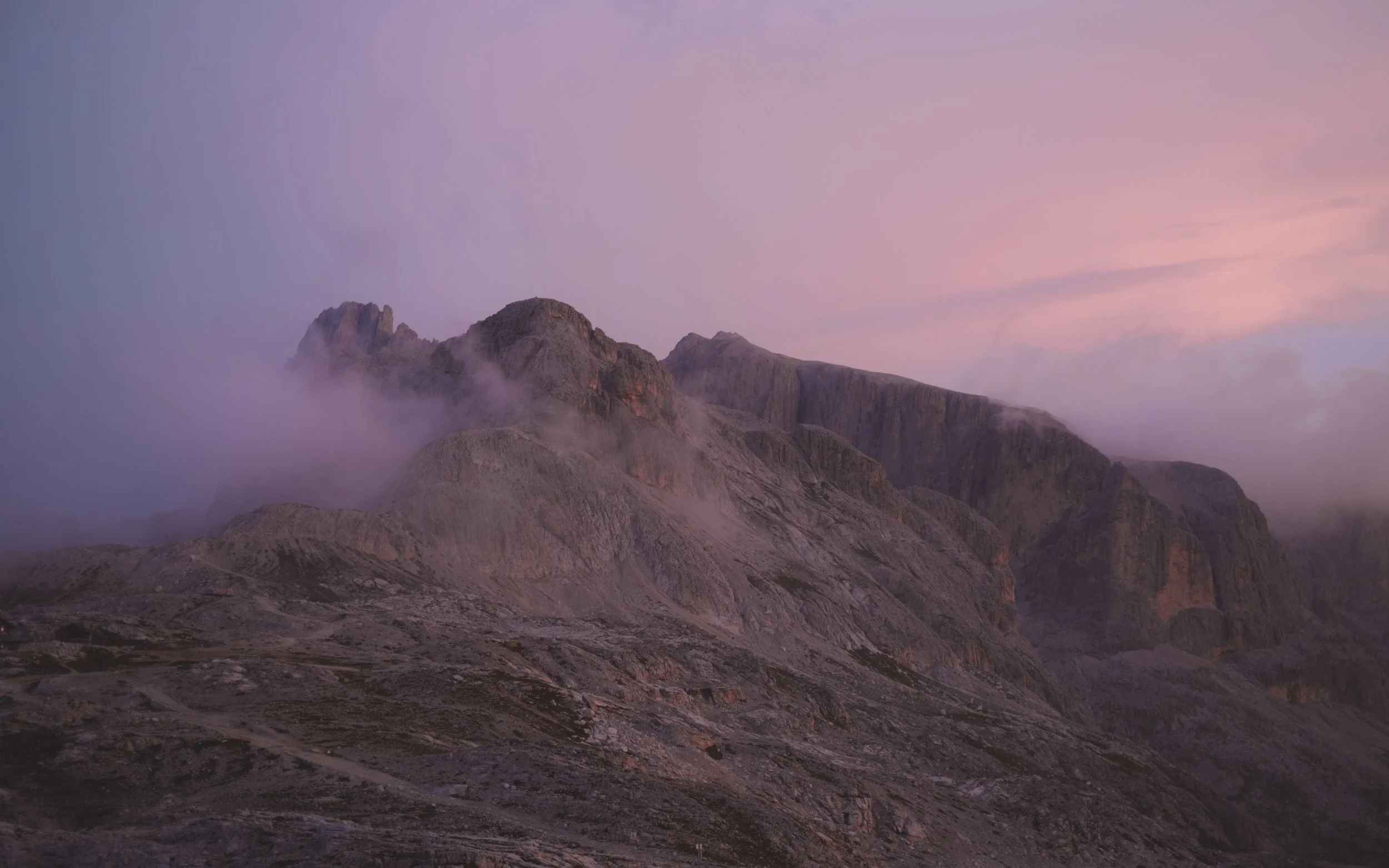
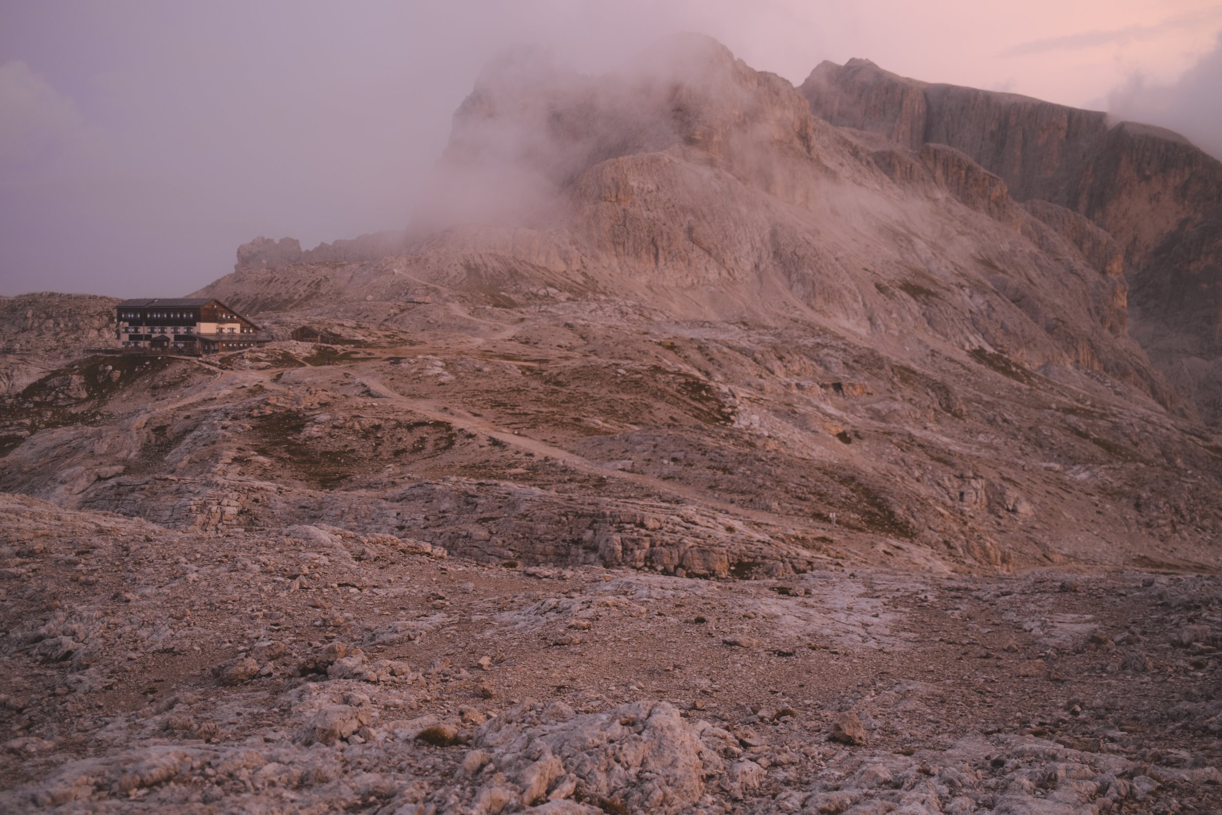
A classic hut breakfast of bread and butter and jam. It reminded me of the days on the Haute Route. I don’t like cereal or super sweet foods in the morning so I spent that entire trip praying that there would be cheese or eggs and more often than not accepting my breakfasts of buttered bread and mediocre coffee. I did, however, splurge on this final morning and when they finally fired up the espresso machine I ordered a cup. It was… the best that you could find on that mountain top. Which is all I will say.
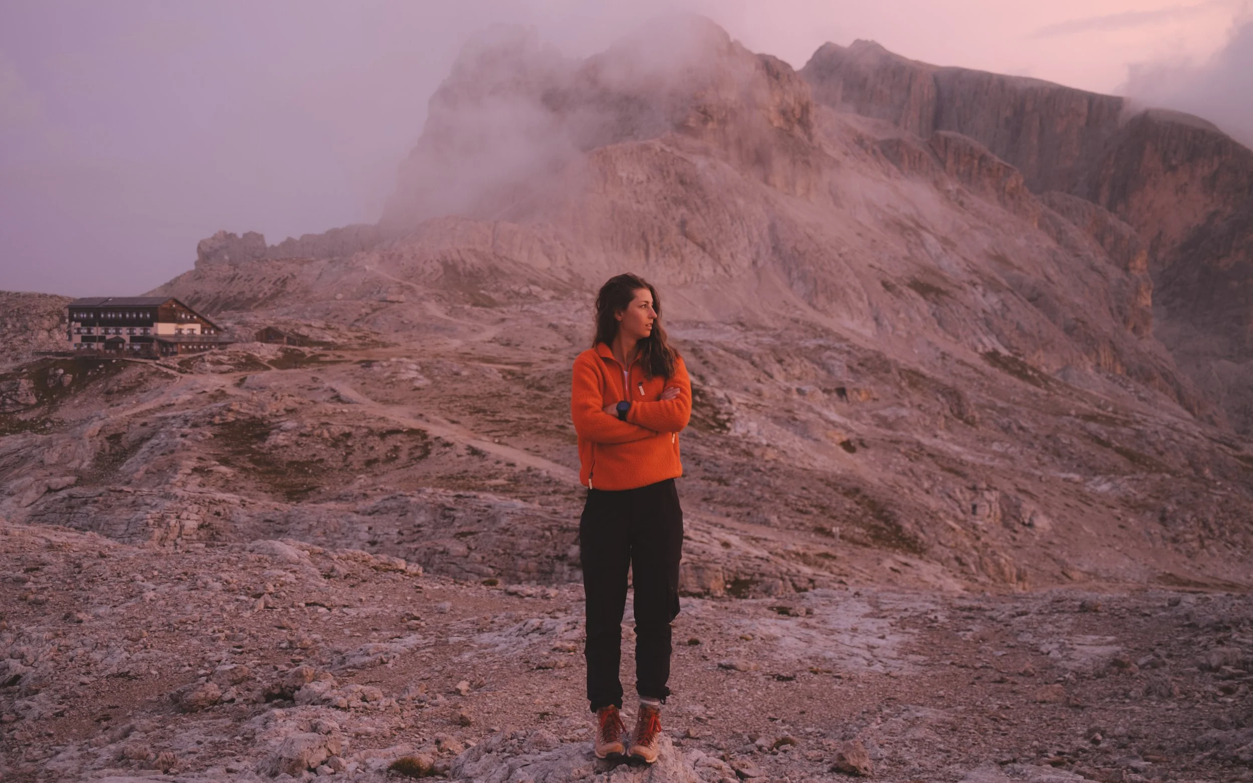
The sunrise was still foggy but at the last second turned the entire sky pink and purple and I took a handful of very swollen morning eyed photos before packing up my bag and making my way toward the cable car - I had a long trip back to Austria to make it in time for lunch (spoiler : I did not). On my way to the cable car it began to rain… and rain and rain and rain.
I collected my luggage from the bottom of the cable car station and lugged them around town to the bus stop. The bus arrived and then immediately broke down. This is when I should have cut my losses and called an uber. I did not. I got on a second bus that would still get me to the train but take twice as long.
Upon arriving at the train station (finally) I watched as all of the tickers turned form scheduled times to cancelled. there was a train derailment. Allegedly there were busses that would act in place of the train but I had not the time and took the most expensive uber of all time (the same as my original uber would have been 6 hours prior) and did eventually make it to Bolzano where I boarded my train to Innsbruck. I was only an hour late… for dinner.
final thoughts
I had a lot of hesitancy (read : ego) with staying in hotels instead of huts for this trip. I think it made me feel less like myself. Less roughing it, less rugged. I had fresh clean sheets and unlimited hot water. There was nobody snoring next to me - I did not risk drawing the short straw and sleeping in a hot cramped upper bunk. And not just the comfort that made me feel like I was a fraud, not a real outdoorsy girl… but I felt like my job, to capture this experience, would be hindered as my hiking and my time spent in the most beautiful places would be in the harsh mid day light.
And I loved it. I loved being able to truly rest and recharge. I enjoyed the slower pace - the lack or urgency. The mid afternoon stops for snacks and small naps in meadowy fields. Maybe this is me getting older, losing my edge. But (aside for my inability to use public transportation) this trip was different in a really great way. There was no stress of planning or anxiety around making sure I was where I needed to be. But I also was not in a group, there was no guide. I had an app with a single choice to make easy, medium, difficult and was on my way. Ideally making it to the hotel before dinner.
This hike is great for families, it is great for groups of friends but it is also perfect for people, like me, who really need a little alone time on the trail. To sort out their thoughts and re-centre.
As much as I wish I could say that I chose to hike the Dolomites Ronda, it seems to have chosen me.
Also! My full GPS tracks are available by following me on Strava (you can find each day by looking at August 14-20, 2025).
*Please note that some of the links above are affiliate links, and I may earn a small commission on any purchase made - at no additional cost to you. As always, all ideas and opinions expressed in this post are entirely my own. Thank you for your support!
Like this post? Pin it for later and share it with others!


